|
|
Little Rock National Airport - Adams Field Airport |
Little Rock National Airport
Adams Field |
 |
 |
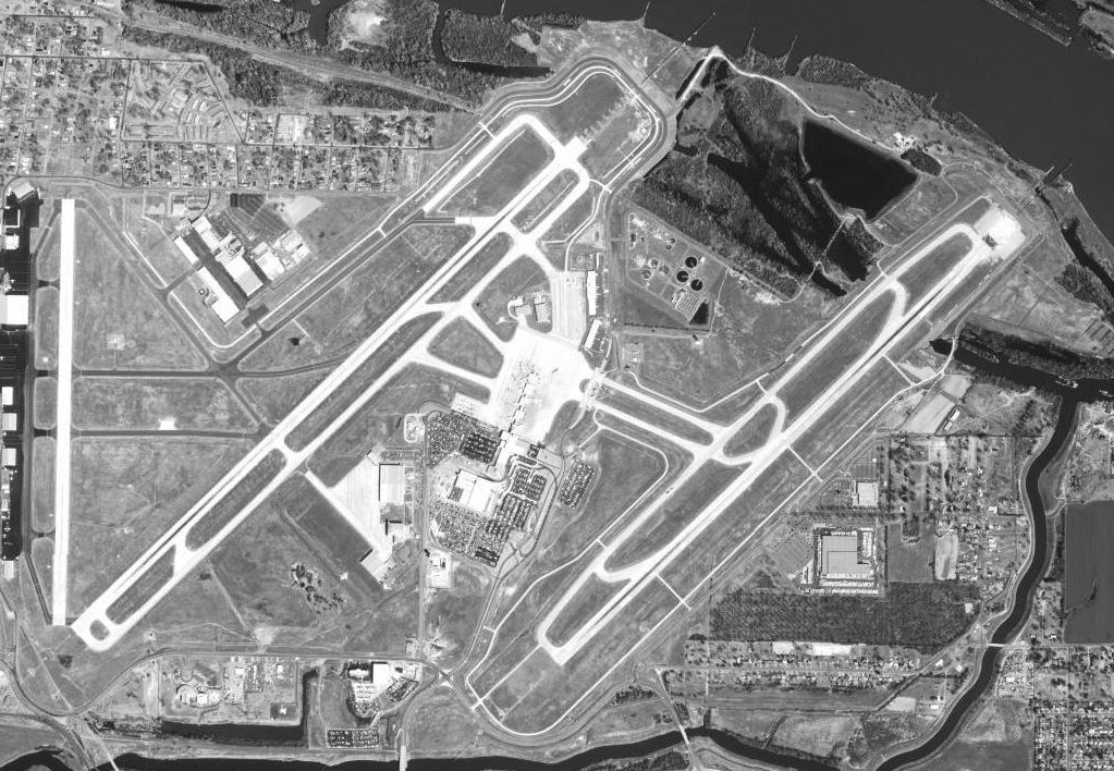
| Aerial photo as of March 25, 2001 |
| IATA: LIT – ICAO: KLIT – FAA LID: LIT
Location of the Little Rock National Airport
|
| Summary |
| Airport type |
Public |
| Owner |
City of Little Rock |
| Serves |
Little Rock, Arkansas |
| Elevation AMSL |
262 ft / 80 m |
| Coordinates |
34°43′46″N 092°13′28″W / 34.72944°N 92.22444°W / 34.72944; -92.22444 |
| Website |
www.fly-lit.com |
| Runways |
| Direction |
Length |
Surface |
| ft |
m |
| 4L/22R |
8,273 |
2,522 |
Concrete |
| 4R/22L |
8,250 |
2,515 |
Concrete |
| 18/36 |
5,124 |
1,562 |
Concrete |
| Helipads |
| Number |
Length |
Surface |
| ft |
m |
| H1 |
50 |
15 |
Concrete |
| Statistics (2005) |
| Aircraft operations |
167,880 |
| Based aircraft |
152 |
| Source: Federal Aviation Administration |
Little Rock National Airport (IATA: LIT, ICAO: KLIT, FAA LID: LIT), officially Little Rock National Airport/Adams Field, is located 2 miles (3 km) east of the central business district of Little Rock, a city in Pulaski County, Arkansas, United States. It is Arkansas' largest commercial service airport, serving more than 2.1 million passengers in the year measured from March 2009 through February 2010. The airport attracts passengers from a large part of Arkansas as well as a number of surrounding states.
Although the airport does not have direct international passenger flights, there are more than 150 flight arrivals and departures at Little Rock each day, with non-stop jet service to 18 national/international gateway cities.
The regional jet made its first appearance at Little Rock National in 1997, with three daily flights by Delta Connection carrier, Comair, to Cincinnati. Comair has now been joined by other Delta Connection carriers as well as American Eagle, Continental Express, United Express, and US Airways Express in operating the regional jet at Little Rock. HistoryAdams Field is named after Captain George Geyer Adams, 154th Observation Squadron, Arkansas National Guard, who was killed in the line of duty on September 4, 1937.
American Airlines was the first airline to serve Little Rock when it first landed at Adams Field in June 1931.
During World War II the airfield was used by the United States Army Air Force Third Air Force for antisubmarine patrols and training.
In 1972, the airport unveiled its current 12-gate terminal.
On June 1, 1999, American Airlines Flight 1420 crashed upon landing at Little Rock National Airport on a flight from Dallas/Fort Worth International Airport, killing the pilot and 10 passengers.
In August 2008 the airport announced that it had approved a plan to renovate the terminal over a 15-year period. The central component of the plan would be to expand the terminal from 12 to 17 gates.
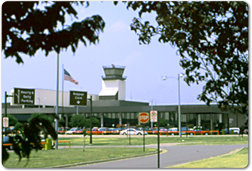
Facilities and Aircraft
 | |
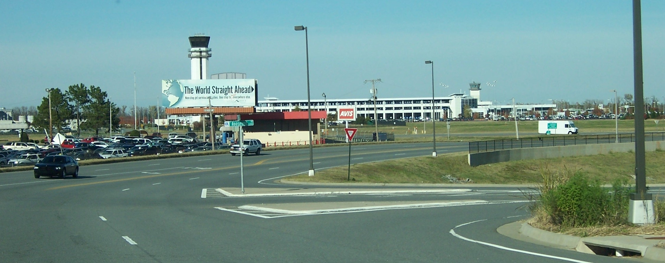
The airport, from an approach road |
Adams Field covers an area of 2,000 acres (809 ha) which contains three runways and one helipad.
For the 12-month period ending December 31, 2005, the airport had 167,880 aircraft operations, an average of 459 per day: 42% general aviation, 23% air taxi, 15% scheduled commercial and 20% military. At that time there were 152 aircraft based at this airport: 45% single-engine, 32% multi-engine, 22% jet and 1% helicopter.
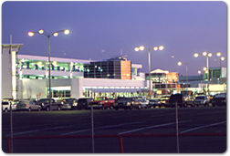
Terminal
 | |
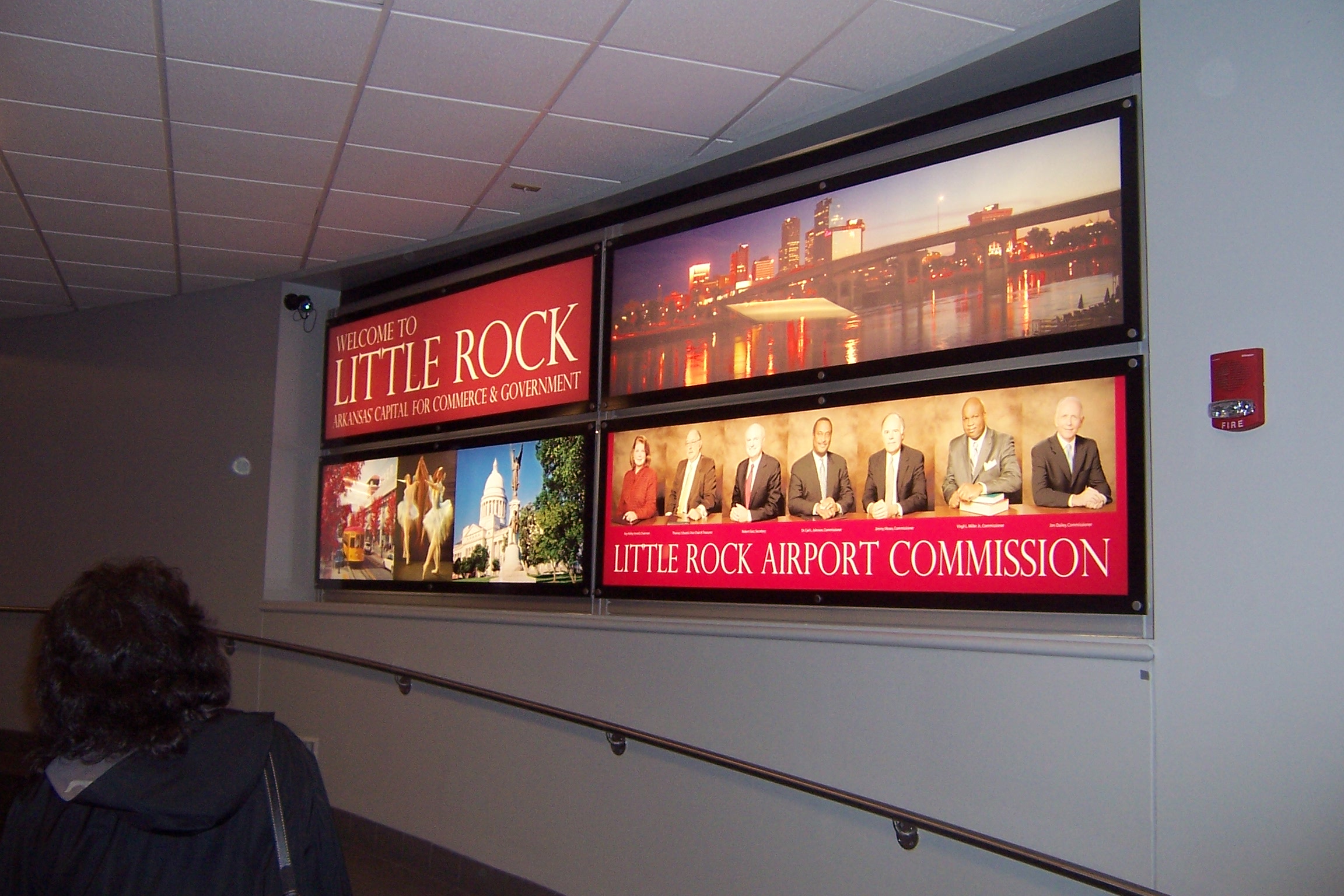
Welcoming sign at terminal |
The airport has a single, elongated terminal building with 12 gates. Six gates are located along the length of the terminal (three on either side) and a circular area at the end has six more gates.
The terminal handles more passenger traffic than it was originally designed for. Nineteen planes are berthed every night, and the circular area - where Southwest Airlines, the airport's largest carrier, controls three gates - is especially vulnerable to crowds and long lines. The new terminal will have 17 gates.
Public transportation to and from the airport is provided by Central Arkansas Transit Authority (CATA) bus #12.[1]
Passenger Airlines and Destinations
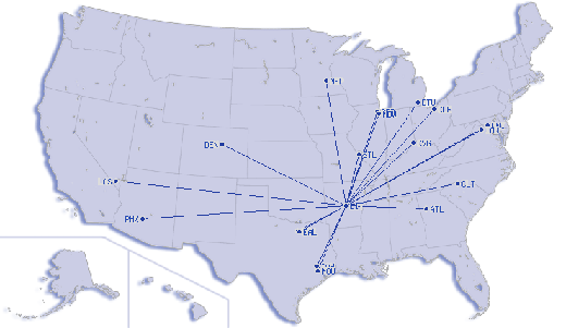 |
Destinations served from Little Rock National Airport
(as of August 2008)
|
| Airlines |
Destinations |
| American Eagle |
Chicago-O'Hare, Dallas/Fort Worth |
| Continental Express operated by ExpressJet Airlines |
Houston-Intercontinental, Newark |
| Delta Air Lines |
Atlanta, Memphis |
| Delta Connection operated by Atlantic Southeast Airlines |
Atlanta |
| Delta Connection operated by Comair |
Detroit |
| Delta Connection operated by Chautauqua Airlines |
Cincinnati/Northern Kentucky |
| Delta Connection operated by Pinnacle Airlines |
Memphis |
| Southwest Airlines |
Baltimore, Chicago-Midway, Dallas-Love, Houston-Hobby, Las Vegas, Phoenix, St. Louis |
| United Express operated by SkyWest Airlines |
Chicago-O'Hare, Denver |
| US Airways Express operated by PSA Airlines |
Charlotte |
Cargo Airlines
- DHL
- UPS Airlines
- FedEx Express
The above content comes from Wikipedia and is published under free licenses – click here to read more.
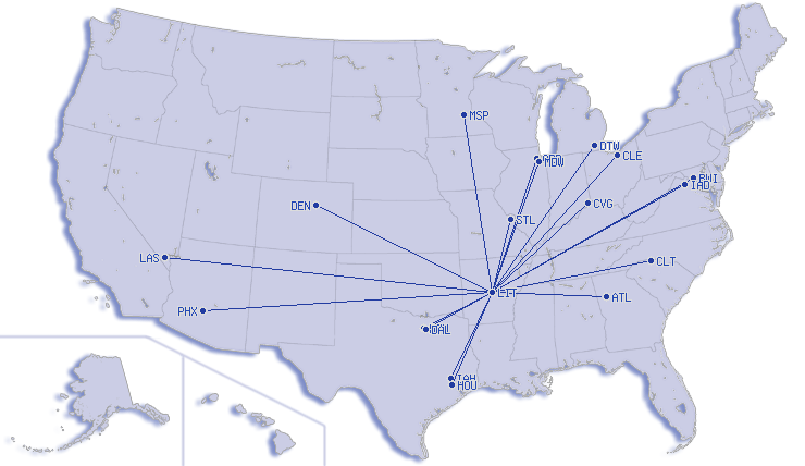
Little Rock National Airport (LIT) is Arkansas' largest commercial
service airport, serving about 2.1 million passengers annually. The airport
attracts passengers from a large part of Arkansas as well as a number of
surrounding states.
 There
are more than 150 flight arrivals and departures at Little Rock each day,
with non-stop jet service to 18 national/international gateway cities,
making Little Rock truly one stop away from the world. There
are more than 150 flight arrivals and departures at Little Rock each day,
with non-stop jet service to 18 national/international gateway cities,
making Little Rock truly one stop away from the world.
Little Rock National is served by American Eagle, Continental Express,
Delta, Delta Connection, Frontier, Northwest, Northwest Airlink, Southwest
and US Airways Express.
The Little Rock airport, officially designated Adams Field, has offered
commercial air service since June 15, 1931.
The Regional Jet made its first appearance at Little
Rock National in 1997, with three daily flights by Delta Connection carriers,
Comair, to Cincinnati. Comair has now been joined by other Delta Connection
carriers as well as American Eagle, Continental Express, Northwest Airlink
and US Airways Express in operating the Regional Jet at Little Rock.
 At
Little Rock National, we believe that we must build today to be ready
for tomorrow. A $3 million renovation of the baggage claim wing has been
completed and upgrades to the second level, including the concourse, are
now underway. During the past 14 years, almost $180 million in improvement
have been made at the airport to ensure that it will continue to well
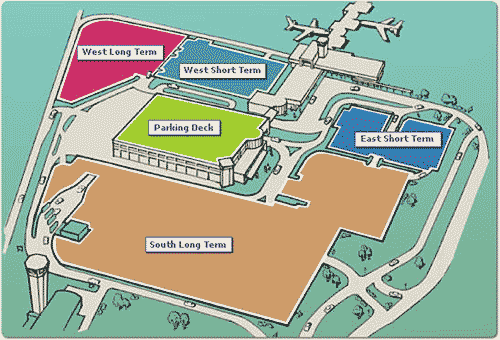
serve the traveling public. The new Little Rock airport parking deck opened
in 2001. It is connected to the terminal via a skybridge, enabling customers
to go from car-seat-to-plane-seat out of the weather. At
Little Rock National, we believe that we must build today to be ready
for tomorrow. A $3 million renovation of the baggage claim wing has been
completed and upgrades to the second level, including the concourse, are
now underway. During the past 14 years, almost $180 million in improvement
have been made at the airport to ensure that it will continue to well
serve the traveling public. The new Little Rock airport parking deck opened
in 2001. It is connected to the terminal via a skybridge, enabling customers
to go from car-seat-to-plane-seat out of the weather.
The space devoted to concessions at the airport has also been greatly
expanded, giving customers more choices from more locations. Airport restaurants,
gift shops and newsstands are located on the concourse level of the terminal
- both pre-and-post screening.
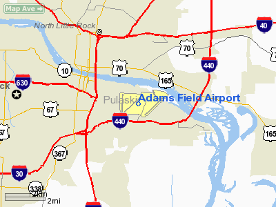
Location
& QuickFacts
| FAA Information Effective: |
2005-10-27 |
| Airport Identifier: |
LIT |
| Longitude/Latitude: |
092-13-27.5000W/34-43-46.0000N
-92.224306/34.729444 (Estimated) |
| Elevation: |
262
ft / 79.86 m (Surveyed) |
| Land: |
2000
acres |
| From nearest city: |
2
nautical miles E of Little Rock, AR |
| Location: |
Pulaski
County, AR |
| Magnetic Variation: |
02E
(2000) |
Owner
& Manager
| Ownership: |
Publicly
owned |
| Owner: |
City
Of Little Rock |
| Address: |
Arpt
Cmsn, No 1 Arpt Drive
Little Rock, AR 72202 |
| Phone number: |
501-372-3439 |
| Manager: |
Deborah
Schwartz |
| Address: |
Arpt
Cmsn, No 1 Arpt Drive
Little Rock, AR 72202 |
| Phone number: |
501-372-3439 |
Airport
Operations and Facilities
| Airport Use: |
Open
to public |
| Wind indicator: |
Yes |
| Segmented Circle: |
No |
| Control Tower: |
Yes |
| Attendance Schedule: |
ALL/ALL/ALL |
| Lighting Schedule: |
DUSK-DAWN |
| Beacon Color: |
Clear-Green
(lighted land airport) |
| Landing fee charge: |
Yes |
| Sectional chart: |
Memphis |
| Region: |
ASW
- Southwest |
| Boundary ARTCC: |
ZME
- Memphis |
| Tie-in FSS: |
JBR
- Jonesboro |
| FSS on Airport: |
No |
| FSS Phone: |
870-935-3471 |
| FSS Toll Free: |
1-800-WX-BRIEF |
| NOTAMs Facility: |
LIT
(NOTAM-d service avaliable) |
| Certification type/date: |
CS
5/1973 |
| Federal Agreements: |
NGPSY3 |
Airport
Communications
Airport
Services
| Fuel available: |
100LLA
B |
| Airframe Repair: |
MAJOR |
| Power Plant Repair: |
MAJOR |
| Bottled Oxygen: |
HIGH |
| Bulk Oxygen: |
HIGH |
Runway
Information
Runway
04L/22R
| Dimension: |
8273
x 150 ft / 2521.6 x 45.7 m |
| Surface: |
CONC,
Good Condition |
| Surface Treatment: |
Saw-cut
or plastic Grooved |
| Weight Limit: |
Single
wheel: 75000 lbs.
Dual wheel: 200000 lbs.
Dual tandem wheel: 350000 lbs. |
| Edge Lights: |
High
PERIMETER LGTS. |
| |
Runway
04L |
Runway
22R |
| Longitude: |
092-14-16.8842W |
092-13-04.9772W |
| Latitude: |
34-43-21.0455N |
34-44-17.3563N |
| Elevation: |
253.00
ft |
262.00
ft |
| Alignment: |
47 |
127 |
| ILS Type: |
ILS/DME |
ILS/DME |
| Traffic Pattern: |
Left |
Right |
| Markings: |
Precision
instrument, Good Condition |
Precision
instrument, Good Condition |
| Displaced threshold: |
297.00
ft |
0.00
ft |
| RVR Equipment: |
touchdown,
midfield, rollout |
touchdown,
midfield, rollout |
| Approach lights: |
MALSR |
ALSF2 |
| Runway End Identifier: |
No |
|
| Centerline Lights: |
Yes |
Yes |
| Touchdown Lights: |
|
Yes |
| Obstruction: |
23
ft rr, 670.0 ft from runway, 557 ft left of centerline,
20:1 slope to clear
APCH RATIO 42:1 FM DSPLCD THLD. |
,
50:1 slope to clear |
| Decleard distances: |
Take
off run available 8273.00 ft
Take off distance available 8273.00 ft
Actual stop distance available 8273.00 ft
Landing distance available 7976.00 ft |
Take
off run available 8273.00 ft
Take off distance available 8273.00 ft
Actual stop distance available 8273.00 ft
Landing distance available 8273.00 ft |
|
Runway
04R/22L
| Dimension: |
7200
x 150 ft / 2194.6 x 45.7 m |
| Surface: |
CONC,
Good Condition |
| Surface Treatment: |
Saw-cut
or plastic Grooved |
| Weight Limit: |
Single
wheel: 75000 lbs.
Dual wheel: 200000 lbs.
Dual tandem wheel: 350000 lbs. |
| Edge Lights: |
High
PERIMETER LGTS. |
| |
Runway
04R |
Runway
22L |
| Longitude: |
092-13-07.2676W |
092-12-04.6764W |
| Latitude: |
34-43-16.9376N |
34-44-05.9371N |
| Elevation: |
260.00
ft |
259.00
ft |
| Alignment: |
47 |
127 |
| ILS Type: |
ILS |
ILS |
| Traffic Pattern: |
Right |
Left |
| Markings: |
Precision
instrument, Good Condition
RY 04R/22L MARKINGS FADED. |
Precision
instrument, Good Condition |
| Crossing Height: |
0.00
ft |
60.00
ft |
| VASI: |
|
4-light
PAPI on left side |
| Visual Glide Angle: |
0.00° |
3.00° |
| RVR Equipment: |
touchdown,
rollout |
touchdown,
rollout |
| Approach lights: |
MALSR
MALSR OTS INDEFLY. |
MALSF |
| Centerline Lights: |
Yes |
Yes |
| Obstruction: |
78
ft pole, 2874.0 ft from runway, 820 ft right of centerline,
34:1 slope to clear |
72
ft trees, 3301.0 ft from runway, 754 ft right of centerline,
43:1 slope to clear |
| Decleard distances: |
Take
off run available 7200.00 ft
Take off distance available 7200.00 ft
Actual stop distance available 7200.00 ft
Landing distance available 7200.00 ft |
Take
off run available 7200.00 ft
Take off distance available 7200.00 ft
Actual stop distance available 7200.00 ft
Landing distance available 7200.00 ft |
|
Runway
18/36
| Dimension: |
5124
x 150 ft / 1561.8 x 45.7 m |
| Surface: |
CONC,
Good Condition |
| Surface Treatment: |
Saw-cut
or plastic Grooved |
| Weight Limit: |
Single
wheel: 75000 lbs.
Dual wheel: 100000 lbs.
Dual tandem wheel: 135000 lbs. |
| Edge Lights: |
High
PERIMETER LGTS. |
| |
Runway
18 |
Runway
36 |
| Longitude: |
092-14-17.4847W |
092-14-19.1045W |
| Latitude: |
34-44-12.3666N |
34-43-21.7075N |
| Elevation: |
258.00
ft |
253.00
ft |
| Alignment: |
127 |
2 |
| Traffic Pattern: |
Left |
Left |
| Markings: |
Non-precision
instrument, Good Condition |
Non-precision
instrument, Good Condition |
| Crossing Height: |
62.00
ft |
64.00
ft |
| Displaced threshold: |
99.00
ft |
100.00
ft |
| VASI: |
4-box
on left side |
4-box
on left side |
| Visual Glide Angle: |
4.00° |
4.00° |
| Obstruction: |
35
ft tree, 1286.0 ft from runway, 164 ft left of centerline,
31:1 slope to clear
APCH RATIO 39:1 BASED ON DSPLCD THLD +35 FT TREE 1385
FT DIST 164 FT LEFT. |
105
ft trees, 2489.0 ft from runway, 351 ft right of centerline,
21:1 slope to clear
APCH RATIO 24:1 BASED ON DSPLCD THLD; 105 FT TREES
2579 FT DIST 351 FT R. |
| Decleard distances: |
Take
off run available 5124.00 ft
Take off distance available 5124.00 ft
Actual stop distance available 5124.00 ft
Landing distance available 5024.00 ft |
Take
off run available 5124.00 ft
Take off distance available 5124.00 ft
Actual stop distance available 5124.00 ft
Landing distance available 5024.00 ft |
|
Helipad
H1
| Dimension: |
50
x 50 ft / 15.2 x 15.2 m |
| Surface: |
CONC,
Good Condition |
| |
Runway
H1 |
Runway
|
| Traffic Pattern: |
Left |
Left |
|
Radio
Navigation Aids
| ID |
Type |
Name |
Ch |
Freq |
Var |
Dist |
| TYV |
NDB |
Toneyville |
|
290.00 |
04E |
16.8
nm |
| CWS |
NDB |
Conway |
|
302.00 |
05E |
23.5
nm |
| SGT |
NDB |
Stuttgart |
|
269.00 |
02E |
31.5
nm |
| BDQ |
NDB |
Bridge |
|
208.00 |
04E |
34.4
nm |
| MVQ |
NDB |
Malvern |
|
215.00 |
04E |
35.7
nm |
| SRC |
NDB |
Searcy |
|
323.00 |
02E |
37.8
nm |
| MPJ |
NDB |
Morrilton |
|
410.00 |
07E |
41.7
nm |
| HBZ |
NDB |
Heber
Springs |
|
256.00 |
03E |
48.3
nm |
| LRF |
TACAN |
Jacksonville |
029X |
|
04E |
11.8
nm |
| PBF |
VOR/DME |
Pine
Bluff |
107X |
116.00 |
04E |
32.6
nm |
| HOT |
VOR/DME |
Hot
Springs |
037X |
110.00 |
04E |
45.4
nm |
| LIT |
VORTAC |
Little
Rock |
086X |
113.90 |
05E |
3.8
nm |
Remarks
- LARGE
CONCENTRATIONS OF BIRDS INVOF ARPT; MOST ACTIVITY BTN SR-SS
UP TO 1500 FT MSL.
- CARGO
& TERMINAL RAMPS ARE NON-MOVEMENT AREAS.
- NO
GENERAL AVIATION PARKING ON TERMINAL OR CARGO RAMP.
- TWY
A MKD FOR ACFT WITH WINGSPAN LESS THAN 79 FT.
- ACFT
NOT VISIBLE FM ATCT ON TWY M BTN CARGO APRON & TWY F
Little Rock National Airport - Adams Field Airport
One Airport Drive
Little Rock, AR 72202-4402
Phone: 501-372-3439
Fax: 501-372-0612
URL: http://www.lrn-airport.com/
Images and information placed above are from
http://www.lrn-airport.com/
http://www.airport-data.com/airport/LIT/
We thank them for the data!
|
General Info |
|
Country |
United States |
|
State |
ARKANSAS |
|
FAA ID |
LIT |
|
Latitude |
34-43-46.000N |
|
Longitude |
092-13-27.500W |
|
Elevation |
262 feet |
|
Near City |
LITTLE ROCK |
We don't guarantee the information is fresh and accurate. The data may be wrong or outdated.
For more up-to-date information please refer to other sources.
|
|