|
 |
|
||||
|
|
|||||||||||||||||||||||||||||||||||||||||||||||||||||||||||||||||||||||||||||||||||||||||||||||||||||||||||||||||||||||||||||||||||||||||||||||||||||||||||||||||
|
FAA Information Effective: |
2005-10-27 |
| Airport Identifier: |
05AZ |
| Longitude/Latitude: |
114-38-03.8290W/32-40-58.1740N |
| Elevation: |
200 ft / 60.96 m (Estimated) |
| Land: |
0 acres |
| From nearest city: |
4 nautical miles SW of Yuma, AZ |
| Location: |
Yuma County, AZ |
| Magnetic Variation: |
13E (1985) |
|
Ownership: |
Privately owned |
| Owner: |
Yuma Regional Medical Center |
| Address: |
2400 Ave A |
| Phone number: |
602-344-2000 |
| Manager: |
Robert T. Olsen |
| Address: |
2400 Ave A |
| Phone number: |
602-344-2000 |
|
Airport Use: |
Private |
| Wind indicator: |
Yes |
| Segmented Circle: |
Yes |
| Control Tower: |
No |
| Attendance Schedule: |
UNATNDD |
| Landing fee charge: |
No |
| Sectional chart: |
Phoenix |
| Region: |
AWP - Western-Pacific |
| Boundary ARTCC: |
ZLA - Los Angeles |
| Tie-in FSS: |
PRC - Prescott |
| FSS on Airport: |
No |
| FSS Phone: |
928-778-7810 |
| FSS Toll Free: |
1-800-WX-BRIEF |
|
Airframe Repair: |
NONE |
|
Power Plant Repair: |
NONE |
|
Dimension: |
40 x 40 ft / 12.2 x 12.2 m |
||||||
| Surface: |
CONC, |
||||||
|
|||||||
|
ID |
Type |
Name |
Ch |
Freq |
Var |
Dist |
| OEG |
NDB |
Golden Eagle |
|
413.00 |
12E |
14.2 nm |
| NYL |
TACAN |
Yuma |
084X |
|
14E |
2.4 nm |
| MXL |
VOR/DME |
Mexicali |
097X |
115.00 |
14E |
30.0 nm |
| BZA |
VORTAC |
Bard |
115X |
116.80 |
14E |
5.4 nm |
| IPL |
VORTAC |
Imperial |
106X |
115.90 |
14E |
44.4 nm |
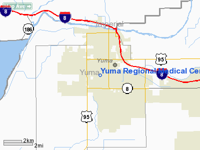
Yuma Regional Medical Center Heliport
Address: Maricopa County, AZ
Tel: 602-275-2398
| General Info | |
|---|---|
| Country | United States |
| State | ARIZONA |
| FAA ID | 05AZ |
| Latitude | 32-40-58.174N |
| Longitude | 114-38-03.829W |
| Elevation | 200 feet |
| Near City | YUMA |

 |
|
Copyright 2004-2026 © by Airports-Worldwide.com, Vyshenskoho st. 36, Lviv 79010, Ukraine Legal Disclaimer |