 |
|
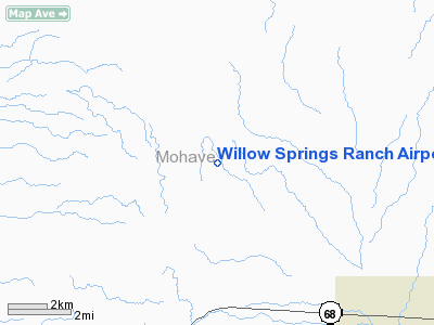
Willow Springs Ranch Airport |
Location & QuickFacts
|
FAA
Information Effective: |
2005-10-27 |
|
Airport Identifier: |
1AZ8 |
|
Longitude/Latitude: |
114-22-22.8560W/35-17-44.9880N
-114.373016/35.295830 (Estimated) |
|
Elevation: |
3750 ft / 1143.00 m (Estimated) |
|
Land: |
160 acres |
|
From nearest city: |
19 nautical miles NE of Bullhead City, AZ |
|
Location: |
Mohave County, AZ |
|
Magnetic Variation: |
14E (1985) |
Owner & Manager
|
Ownership: |
Privately owned |
|
Owner: |
Ronald E. Gardner |
|
Address: |
5000 Estrella Road
Kingman, AZ 86401 |
|
Phone number: |
714-645-7213 |
|
Manager: |
Ronald E. Gardner |
|
Address: |
5000 Estrella Road
Kingman, AZ 86401 |
|
Phone number: |
714-645-7213 |
Airport Operations and Facilities
|
Airport
Use: |
Private |
|
Wind indicator: |
Yes |
|
Segmented Circle: |
No |
|
Control Tower: |
No |
|
Attendance Schedule: |
UNATNDD |
|
Sectional chart: |
Phoenix |
|
Region: |
AWP - Western-Pacific |
|
Boundary ARTCC: |
ZLA - Los Angeles |
|
Tie-in FSS: |
PRC - Prescott |
|
FSS Phone: |
928-778-7810 |
|
FSS Toll Free: |
1-800-WX-BRIEF |
Airport Communications
Runway Information
Runway 13/31
|
Dimension: |
2600
x 50 ft / 792.5 x 15.2 m |
|
Surface: |
DIRT,
|
|
|
Runway 13 |
Runway 31 |
|
Traffic Pattern: |
Left |
Left |
|
Radio Navigation Aids
|
ID |
Type |
Name |
Ch |
Freq |
Var |
Dist |
|
IGM |
VOR/DME |
Kingman |
025X |
108.80 |
15E |
21.6
nm |
|
EED |
VORTAC |
Needles |
099X |
115.20 |
15E |
32.2
nm |
|
GFS |
VORTAC |
Goffs |
091X |
114.40 |
15E |
40.7
nm |
|
PGS |
VORTAC |
Peach
Springs |
057X |
112.00 |
15E |
45.1
nm |
|
BLD |
VORTAC |
Boulder
City |
114X |
116.70 |
15E |
48.4
nm |
Remarks
-
NO TKOF OR LNDGS AT
NIGHT.
-
LIVESTOCK ON INVOF ARPT.
-
RY 31 HAS APRXLY A 2%
UPHILL GRADE.
-
VFR, PRIVATE USE ONLY.
Based Aircraft
|
Aircraft
based on field: |
1 |
|
Single Engine Airplanes: |
1 |
Willow Springs Ranch Airport
Address:
Mohave County,
AZ
Tel:
714-645-7213
Images and information placed above are from
http://www.airport-data.com/airport/1AZ8/
We thank them for the data!
| General
Info |
| Country |
United
States |
| State |
ARIZONA
|
| FAA ID |
1AZ8 |
| Latitude |
35-17-44.988N
|
| Longitude |
114-22-22.856W
|
| Elevation |
3750 feet
|
| Near City |
BULLHEAD
CITY |
We don't guarantee the information is fresh and accurate. The data may be wrong or outdated.
For more up-to-date information please refer to other sources.
|
|


