 |
|
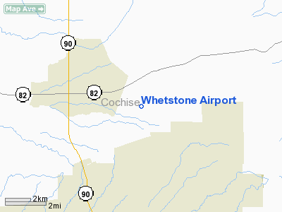
Location & QuickFacts
|
FAA
Information Effective: |
2005-10-27 |
|
Airport Identifier: |
11AZ |
|
Longitude/Latitude: |
110-17-24.2790W/31-41-01.3270N
-110.290077/31.683702 (Estimated) |
|
Elevation: |
4250 ft / 1295.40 m (Estimated) |
|
Land: |
0
acres |
|
From nearest city: |
3
nautical miles NE of Huachuca City, AZ |
|
Location: |
Cochise County, AZ |
|
Magnetic Variation: |
12E (1985) |
Owner & Manager
|
Ownership: |
Privately owned |
|
Owner: |
Whetstone Airport
OWNERS: PAUL PELLETT, PHONE 520-456-1829 AND SUSAN ULMER, PHONE
520-456-0483. |
|
Address: |
2114 North Columbine Place
Huachuca City, AZ 85616 |
|
Phone number: |
520-456-0483 |
|
Manager: |
Whetstone Manager |
|
Address: |
2114 North Columbine Place
Huachuca City, AZ 85616 |
|
Phone number: |
520-456-0483 |
Airport Operations and Facilities
|
Airport
Use: |
Private |
|
Wind indicator: |
Yes |
|
Segmented Circle: |
Yes |
|
Control Tower: |
No |
|
Attendance Schedule: |
ALL/ALL/ALL |
|
Landing fee charge: |
No |
|
Sectional chart: |
Phoenix |
|
Region: |
AWP - Western-Pacific |
|
Boundary ARTCC: |
ZAB - Albuquerque |
|
Tie-in FSS: |
PRC - Prescott |
|
FSS on Airport: |
No |
|
FSS Phone: |
928-778-7810 |
|
FSS Toll Free: |
1-800-WX-BRIEF |
Airport Services
|
Airframe
Repair: |
NONE |
|
Power
Plant Repair: |
NONE |
|
Bottled Oxygen: |
NONE |
|
Bulk Oxygen: |
NONE |
Runway Information
Runway 08/26
|
Dimension: |
3850
x 150 ft / 1173.5 x 45.7 m |
|
Surface: |
TURF-DIRT, Poor Condition |
|
|
Runway 08 |
Runway 26 |
|
Traffic Pattern: |
Left |
Right |
|
Runway End Identifier: |
No |
No |
|
Centerline Lights: |
No |
No |
|
Touchdown Lights: |
No |
No |
|
Obstruction: |
4
ft fence, 50.0 ft from runway, 13:1 slope to clear |
4
ft fence, 50.0 ft from runway, 13:1 slope to clear |
|
Radio Navigation Aids
|
ID |
Type |
Name |
Ch |
Freq |
Var |
Dist |
|
DAO |
NDB |
Dragoo |
|
410.00 |
13E |
6.5
nm |
|
ENZ |
NDB |
Nogales |
|
394.00 |
12E |
32.6
nm |
|
NOG |
NDB |
Nogales |
|
265.00 |
13E |
45.3
nm |
|
ARH |
TACAN |
Fort
Huachuca |
053X |
|
12E |
6.4
nm |
|
DMA |
TACAN |
Davis
Monthan |
123X |
|
12E |
41.6
nm |
|
FHU |
VOR |
Libby |
|
113.60 |
13E |
6.6
nm |
|
OLS |
VOR/DME |
Nogales |
019X |
108.20 |
12E |
32.9
nm |
|
CIE |
VORTAC |
Cochise |
105X |
115.80 |
13E |
34.3
nm |
|
DUG |
VORTAC |
Douglas |
025X |
108.80 |
13E |
37.4
nm |
|
TUS |
VORTAC |
Tucson |
107X |
116.00 |
12E |
40.4
nm |
Remarks
-
RWY NOT WELL MAINT -
BRUSH ON BOTH ENDS.
-
E111 VFR; PRIVATE USE.
Based Aircraft
|
Aircraft
based on field: |
11 |
|
Single Engine Airplanes: |
8 |
|
Gliders: |
1 |
|
Ultralights: |
2 |
Operational Statistics
|
Aircraft
Operations: |
41/Week |
|
General Aviation
Local: |
95.2% |
|
General Aviation
Itinerant: |
4.8% |
Whetstone Airport
Address:
Cochise County,
AZ
Tel:
520-456-0483
Images and information placed above are from
http://www.airport-data.com/airport/11AZ/
We thank them for the data!
| General
Info |
| Country |
United
States |
| State |
ARIZONA
|
| FAA ID |
11AZ |
| Latitude |
31-41-01.327N
|
| Longitude |
110-17-24.279W
|
| Elevation |
4250 feet
|
| Near City |
HUACHUCA
CITY |
We don't guarantee the information is fresh and accurate. The data may be wrong or outdated.
For more up-to-date information please refer to other sources.
|
|


