 |
|
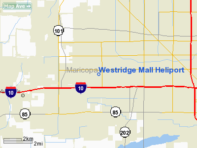
Location & QuickFacts
|
FAA Information
Effective: |
2005-10-27 |
|
Airport Identifier: |
AZ29 |
|
Longitude/Latitude: |
112-13-25.5540W/33-28-32.1520N
-112.223765/33.475598 (Estimated) |
|
Elevation: |
1055
ft / 321.56 m (Estimated) |
|
Land: |
0
acres |
|
From nearest city: |
8
nautical miles W of Phoenix, AZ |
|
Location: |
Maricopa
County, AZ |
|
Magnetic Variation: |
13E
(1985) |
Owner & Manager
|
Ownership: |
Privately
owned |
|
Owner: |
Westcor
Aviation Inc |
|
Address: |
11411
N. Tatum Blvd.
Phoenix, AZ 85028 |
|
Phone number: |
602-991-6558 |
|
Manager: |
Bob
Oliver |
|
Address: |
11411
N. Tatum Blvd.
Phoenix, AZ 85020 |
|
Phone number: |
602-991-6550 |
Airport Operations and Facilities
|
Airport Use: |
Private |
|
Wind indicator: |
No |
|
Segmented Circle: |
No |
|
Control Tower: |
No |
|
Attendance Schedule: |
UNATNDD |
|
Landing fee charge: |
No |
|
Sectional chart: |
Phoenix |
|
Region: |
AWP
- Western-Pacific |
|
Boundary ARTCC: |
ZAB
- Albuquerque |
|
Tie-in FSS: |
PRC
- Prescott |
|
FSS on Airport: |
No |
|
FSS Phone: |
928-778-7810 |
|
FSS Toll Free: |
1-800-WX-BRIEF |
Runway Information
Helipad H1
|
Dimension: |
150
x 150 ft / 45.7 x 45.7 m |
|
Surface: |
ASPH,
|
|
|
Runway H1 |
Runway |
|
Traffic
Pattern: |
Left |
Left |
|
Radio Navigation Aids
|
ID |
Type |
Name |
Ch |
Freq |
Var |
Dist |
|
SDL |
NDB |
Scottsdale |
|
224.00 |
12E |
18.3
nm |
|
CHD |
NDB |
Chandler |
|
407.00 |
12E |
24.4
nm |
|
FFZ |
NDB |
Falcon Field |
|
281.00 |
12E |
24.6
nm |
|
LUF |
TACAN |
Luke |
077X |
|
13E |
8.7
nm |
|
PXR |
VORTAC |
Phoenix |
103X |
115.60 |
12E |
13.0
nm |
|
BXK |
VORTAC |
Buckeye |
043X |
110.60 |
14E |
30.2
nm |
|
IWA |
VORTAC |
Willie |
080X |
113.30 |
13E |
30.5
nm |
|
GBN |
VORTAC |
Gila
Bend |
113X |
116.60 |
14E |
38.6
nm |
|
TFD |
VORTAC |
Stanfield |
095X |
114.80 |
12E |
38.8
nm |
|
PHX |
VOT |
Phoenix Sky Harbor |
|
109.00 |
|
11.1
nm |
Remarks
-
OWNER
DESIRES THAT HELIPORT NOT BE CHARTED.
-
VFR;
PVT USE.
Westridge Mall Heliport
Address:
Maricopa County, AZ
Tel:
602-991-6558,
602-991-6550
Images and information placed above are from
http://www.airport-data.com/airport/AZ29/
We thank them for the data!
| General Info |
| Country |
United States |
| State |
ARIZONA |
| FAA ID |
AZ29 |
| Latitude |
33-28-32.152N |
| Longitude |
112-13-25.554W |
| Elevation |
1055 feet |
| Near City |
PHOENIX |
We don't guarantee the information is fresh and accurate. The data may be wrong or outdated.
For more up-to-date information please refer to other sources.
|
|


