 |
|
Location & QuickFacts
|
FAA
Information Effective: |
2005-10-27 |
|
Airport Identifier: |
AZ49 |
|
Longitude/Latitude: |
112-15-13.5250W/32-53-44.1770N
-112.253757/32.895605 (Estimated) |
|
Elevation: |
1615 ft / 492.25 m (Estimated) |
|
Land: |
0
acres |
|
From nearest city: |
15 nautical miles W of Stanfield, AZ |
|
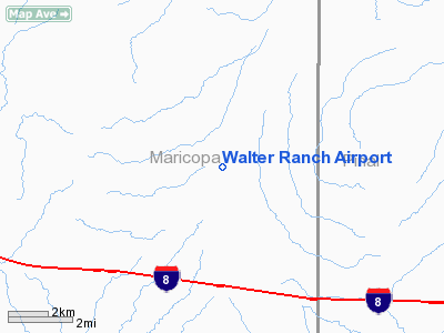
Location: |
Maricopa County, AZ |
|
Magnetic Variation: |
13E (1985) |
Owner & Manager
|
Ownership: |
Privately owned |
|
Owner: |
Donald D. Walter |
|
Address: |
12434 N. Teal Dr.
Fountain Hills, AZ 85268 |
|
Phone number: |
602-837-8633 |
|
Manager: |
Donald D. Walter |
|
Address: |
12434 N. Teal Dr.
Fountain Hills, AZ 85268 |
|
Phone number: |
602-837-8633 |
Airport Operations and Facilities
|
Airport
Use: |
Private |
|
Wind indicator: |
Yes |
|
Segmented Circle: |
No |
|
Control Tower: |
No |
|
Attendance Schedule: |
UNATNDD |
|
Landing fee charge: |
No |
|
Sectional chart: |
Phoenix |
|
Region: |
AWP - Western-Pacific |
|
Boundary ARTCC: |
ZAB - Albuquerque |
|
Tie-in FSS: |
PRC - Prescott |
|
FSS Phone: |
928-778-7810 |
|
FSS Toll Free: |
1-800-WX-BRIEF |
Runway Information
Runway 17/35
|
Dimension: |
2600
x 75 ft / 792.5 x 22.9 m |
|
Surface: |
DIRT,
|
|
|
Runway 17 |
Runway 35 |
|
Traffic Pattern: |
Left |
Left |
|
Obstruction: |
50
ft hill, 600.0 ft from runway |
25
ft hill, 100.0 ft from runway |
|
Radio Navigation Aids
|
ID |
Type |
Name |
Ch |
Freq |
Var |
Dist |
|
CHD |
NDB |
Chandler |
|
407.00 |
12E |
31.6
nm |
|
FFZ |
NDB |
Falcon
Field |
|
281.00 |
12E |
42.9
nm |
|
SDL |
NDB |
Scottsdale |
|
224.00 |
12E |
47.4
nm |
|
LUF |
TACAN |
Luke |
077X |
|
13E |
39.1
nm |
|
TFD |
VORTAC |
Stanfield |
095X |
114.80 |
12E |
17.4
nm |
|
GBN |
VORTAC |
Gila
Bend |
113X |
116.60 |
14E |
21.5
nm |
|
PXR |
VORTAC |
Phoenix |
103X |
115.60 |
12E |
35.3
nm |
|
IWA |
VORTAC |
Willie |
080X |
113.30 |
13E |
39.0
nm |
|
BXK |
VORTAC |
Buckeye |
043X |
110.60 |
14E |
44.1
nm |
|
PHX |
VOT |
Phoenix
Sky Harbor |
|
109.00 |
|
34.7
nm |
Remarks
Based Aircraft
|
Aircraft
based on field: |
2 |
|
Single Engine Airplanes: |
2 |
Walter Ranch Airport
Address:
Maricopa County,
AZ
Tel:
602-837-8633
Images and information placed above are from
http://www.airport-data.com/airport/AZ49/
We thank them for the data!
| General
Info |
| Country |
United
States |
| State |
ARIZONA
|
| FAA ID |
AZ49 |
| Latitude |
32-53-44.177N
|
| Longitude |
112-15-13.525W
|
| Elevation |
1615 feet
|
| Near City |
STANFIELD
|
We don't guarantee the information is fresh and accurate. The data may be wrong or outdated.
For more up-to-date information please refer to other sources.
|
|


