 |
|
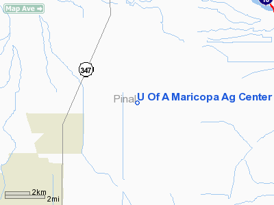
University Of Arizona Maricopa Ag Center Airport |
Location & QuickFacts
|
FAA
Information Effective: |
2005-10-27 |
|
Airport Identifier: |
3AZ2 |
|
Longitude/Latitude: |
111-59-00.5070W/33-04-49.1840N
-111.983474/33.080329 (Estimated) |
|
Elevation: |
1181 ft / 359.97 m (Estimated) |
|
Land: |
0
acres |
|
From nearest city: |
4
nautical miles NE of Maricopa, AZ |
|
Location: |
Pinal County, AZ |
|
Magnetic Variation: |
13E (1985) |
Owner & Manager
|
Ownership: |
Publicly owned |
|
Owner: |
Univ Of Az Maricopa Ag Center |
|
Address: |
37860 W. Smith-enhe Road
Maricopa, AZ 85239 |
|
Phone number: |
602-568-2273 |
|
Manager: |
Roy S. Rauschkolb |
|
Address: |
37860 W. Smith-enke Rd
Maricopa, AZ 85239 |
|
Phone number: |
602-568-2273 |
Airport Operations and Facilities
|
Airport
Use: |
Open to public |
|
Wind indicator: |
Yes |
|
Segmented Circle: |
No |
|
Control Tower: |
No |
|
Attendance Schedule: |
ALL/MON-FRI/0800-1700 |
|
Sectional chart: |
Phoenix |
|
Region: |
AWP - Western-Pacific |
|
Boundary ARTCC: |
ZAB - Albuquerque |
|
Tie-in FSS: |
PRC - Prescott |
|
FSS Phone: |
928-778-7810 |
|
FSS Toll Free: |
1-800-WX-BRIEF |
Runway Information
Runway 18/36
|
Dimension: |
5300
x 100 ft / 1615.4 x 30.5 m |
|
Surface: |
DIRT,
|
|
|
Runway 18 |
Runway 36 |
|
Traffic Pattern: |
Left |
Left |
|
Obstruction: |
10
ft trees, 30.0 ft from runway |
8
ft hill, 50.0 ft from runway |
|
Radio Navigation Aids
|
ID |
Type |
Name |
Ch |
Freq |
Var |
Dist |
|
CHD |
NDB |
Chandler |
|
407.00 |
12E |
14.3
nm |
|
FFZ |
NDB |
Falcon
Field |
|
281.00 |
12E |
26.1
nm |
|
SDL |
NDB |
Scottsdale |
|
224.00 |
12E |
33.2
nm |
|
LUF |
TACAN |
Luke |
077X |
|
13E |
34.0
nm |
|
TFD |
VORTAC |
Stanfield |
095X |
114.80 |
12E |
12.3
nm |
|
PXR |
VORTAC |
Phoenix |
103X |
115.60 |
12E |
21.2
nm |
|
IWA |
VORTAC |
Willie |
080X |
113.30 |
13E |
21.4
nm |
|
GBN |
VORTAC |
Gila
Bend |
113X |
116.60 |
14E |
35.6
nm |
|
BXK |
VORTAC |
Buckeye |
043X |
110.60 |
14E |
47.9
nm |
|
PHX |
VOT |
Phoenix
Sky Harbor |
|
109.00 |
|
21.4
nm |
Remarks
U Of A Maricopa Ag Center Airport
Address:
Pinal County,
AZ
Tel:
602-568-2273
Images and information placed above are from
http://www.airport-data.com/airport/3AZ2/
We thank them for the data!
| General
Info |
| Country |
United
States |
| State |
ARIZONA
|
| FAA ID |
3AZ2 |
| Latitude |
33-04-49.184N
|
| Longitude |
111-59-00.507W
|
| Elevation |
1181 feet
|
| Near City |
MARICOPA
|
We don't guarantee the information is fresh and accurate. The data may be wrong or outdated.
For more up-to-date information please refer to other sources.
|
|


