 |
|
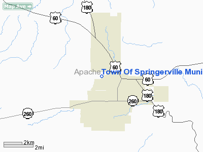
Town Of Springerville Municipal Airport |
Location & QuickFacts
|
FAA
Information Effective: |
2005-10-27 |
|
Airport Identifier: |
D68 |
|
Longitude/Latitude: |
109-18-36.0900W/34-08-07.6000N
-109.310025/34.135444 (Estimated) |
|
Elevation: |
7051 ft / 2149.14 m (Estimated) |
|
Land: |
500 acres |
|
From nearest city: |
1
nautical miles W of Springerville, AZ |
|
Location: |
Apache County, AZ |
|
Magnetic Variation: |
12E (1995) |
Owner & Manager
|
Ownership: |
Publicly owned |
|
Owner: |
Town Of Springerville |
|
Address: |
Po Box 390
Springerville, AZ 85938 |
|
Phone number: |
928-333-2656
CITY MGR - SCOTT GARMS |
|
Manager: |
Harold Swartz
JANE ANDERSON - CO-MANAGER FOR ARPT, PER B. SCOTT GARMS, SPRINGERVILLE
TOWN MANAGER (928) 333-2656. |
|
Address: |
905 West Airport Rd
Springerville, AZ 85938 |
|
Phone number: |
928-333-5746 |
Airport Operations and Facilities
|
Airport
Use: |
Open to public |
|
Wind indicator: |
Yes |
|
Segmented Circle: |
Yes |
|
Control Tower: |
No |
|
Attendance Schedule: |
OCT-MAY/ALL/0800-1700,JUN-SEP/ALL/0700-1800 |
|
Lighting Schedule: |
DUSK-DAWN
ACTVT MIRL RY 03/21 & RY 11/29 - CTAF. PAPI RYS 03 & 21
ON DURG DAYLIGHT HRS, AFTER DUSK ACTVT - CTAF. |
|
Beacon Color: |
Clear-Green (lighted land airport) |
|
Landing fee charge: |
No |
|
Sectional chart: |
Phoenix |
|
Region: |
AWP - Western-Pacific |
|
Boundary ARTCC: |
ZAB - Albuquerque |
|
Tie-in FSS: |
PRC - Prescott |
|
FSS on Airport: |
No |
|
FSS Phone: |
928-778-7810 |
|
FSS Toll Free: |
1-800-WX-BRIEF |
|
NOTAMs Facility: |
PRC (NOTAM-d service avaliable) |
|
Federal Agreements: |
NGY |
Airport Communications
|
CTAF: |
122.800 |
|
Unicom: |
122.800 |
Airport Services
|
Fuel
available: |
100LLA |
|
Airframe
Repair: |
MAJOR |
|
Power
Plant Repair: |
MAJOR |
Runway Information
Runway 03/21
|
Dimension: |
8417 x 75 ft /
2565.5 x 22.9 m |
|
Surface: |
ASPH,
Good Condition |
|
Weight Limit: |
Single
wheel: 30000 lbs. |
|
Edge Lights: |
Medium |
|
|
Runway 03 |
Runway 21 |
|
Longitude: |
109-19-14.7300W |
109-18-05.4300W |
|
Latitude: |
34-07-19.1300N |
34-08-19.2200N |
|
Elevation: |
7051.00 ft |
7020.00 ft |
|
Alignment: |
44 |
127 |
|
Traffic Pattern: |
Left |
Right |
|
Markings: |
Basic, Good Condition |
Basic, Good Condition |
|
Crossing Height: |
35.00 ft |
35.00 ft |
|
VASI: |
2-light PAPI on left side |
2-light PAPI on left side |
|
Visual Glide Angle: |
4.00� |
3.00� |
|
Runway End Identifier: |
No |
No |
|
Centerline Lights: |
No |
No |
|
Touchdown Lights: |
No |
No |
|
Obstruction: |
5
ft fence, 200.0 ft from runway |
,
50:1 slope to clear |
|
Runway 11/29
|
Dimension: |
4589 x 60 ft /
1398.7 x 18.3 m |
|
Surface: |
ASPH,
Good Condition |
|
Edge Lights: |
Medium |
|
|
Runway 11 |
Runway 29 |
|
Longitude: |
109-18-39.4000W |
109-17-56.1100W |
|
Latitude: |
34-08-10.9600N |
34-07-43.3000N |
|
Elevation: |
7030.00 ft |
7030.00 ft |
|
Alignment: |
127 |
127 |
|
Traffic Pattern: |
Left |
Left |
|
Markings: |
Basic, Good Condition |
Basic, Good Condition |
|
Runway End Identifier: |
No |
No |
|
Centerline Lights: |
No |
No |
|
Touchdown Lights: |
No |
No |
|
Radio Navigation Aids
|
ID |
Type |
Name |
Ch |
Freq |
Var |
Dist |
|
SOW |
NDB |
Show
Low |
|
206.00 |
13E |
35.6
nm |
|
SJN |
VORTAC |
St
Johns |
070X |
112.30 |
12E |
19.2
nm |
Remarks
-
MILITARY TFC NEAR AIRPORT.
Based Aircraft
|
Aircraft
based on field: |
17 |
|
Single Engine Airplanes: |
17 |
Operational Statistics
|
Aircraft
Operations: |
79/Week |
|
Air Taxi: |
20.0% |
|
General Aviation
Local: |
20.0% |
|
General Aviation
Itinerant: |
57.6% |
|
Military: |
2.4% |
Town Of Springerville Municipal Airport
Address:
Apache County,
AZ
Tel:
928-333-2656,
928-333-5746
Images and information placed above are from
http://www.airport-data.com/airport/D68/
We thank them for the data!
| General
Info |
| Country |
United
States |
| State |
ARIZONA
|
| FAA ID |
D68 |
| Time |
UTC-7
|
| Latitude |
34.135444
34� 08' 07.60" N |
| Longitude |
-109.310025
109� 18' 36.09" W |
| Elevation |
7051 feet
2149 meters |
| Type |
Civil
|
| Magnetic
Variation |
010� E
(01/06) |
| Beacon |
Yes |
| Operating
Agency |
U.S.CIVIL
AIRPORT WHEREIN PERMIT COVERS USE BY TRANSIT MILITARY AIRCRAFT |
| Operating
Hours |
SEE REMARKS
FOR OPERATING HOURS OR COMMUNICATIONS FOR POSSIBLE HOURS |
We don't guarantee the information is fresh and accurate. The data may be wrong or outdated.
For more up-to-date information please refer to other sources.
|
|


