 |
|
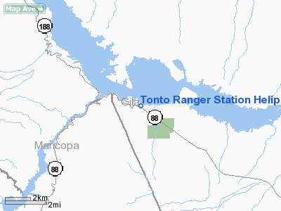
Tonto Ranger Station Heliport |
Location & QuickFacts
|
FAA
Information Effective: |
2005-10-27 |
|
Airport Identifier: |
4AZ3 |
|
Longitude/Latitude: |
111-07-26.4400W/33-39-59.1740N
-111.124011/33.666437 (Estimated) |
|
Elevation: |
2165 ft / 659.89 m (Estimated) |
|
Land: |
0
acres |
|
From nearest city: |
1
nautical miles E of Roosevelt, AZ |
|
Location: |
Gila County, AZ |
|
Magnetic Variation: |
12E (1990) |
Owner & Manager
|
Ownership: |
Publicly owned |
|
Owner: |
Us Forest Service |
|
Address: |
2324 E Mcdowell Rd
Phoenix, AZ 85006 |
|
Phone number: |
602-483-9149 |
|
Manager: |
Ronald C. Fisher |
|
Address: |
7975 N Hayden Rd, Suite A-105
Scottsdale, AZ 85258 |
|
Phone number: |
602-483-9149 |
Airport Operations and Facilities
|
Airport
Use: |
Open to public |
|
Segmented Circle: |
No |
|
Control Tower: |
No |
|
Attendance Schedule: |
UNATNDD |
|
Sectional chart: |
Phoenix |
|
Region: |
AWP - Western-Pacific |
|
Boundary ARTCC: |
ZAB - Albuquerque |
|
Tie-in FSS: |
PRC - Prescott |
|
FSS on Airport: |
No |
|
FSS Phone: |
928-778-7810 |
|
FSS Toll Free: |
1-800-WX-BRIEF |
Runway Information
Helipad H1
|
Dimension: |
20 x 20 ft / 6.1
x 6.1 m |
|
Surface: |
CONC,
|
|
|
Runway H1 |
Runway |
|
Traffic Pattern: |
Left |
Left |
|
Helipad H2
|
Dimension: |
20 x 20 ft / 6.1
x 6.1 m |
|
Surface: |
CONC,
|
|
|
Runway H2 |
Runway |
|
Traffic Pattern: |
Left |
Left |
|
Radio Navigation Aids
|
ID |
Type |
Name |
Ch |
Freq |
Var |
Dist |
|
GAZ |
NDB |
Globe |
|
255.00 |
13E |
29.6
nm |
|
FFZ |
NDB |
Falcon
Field |
|
281.00 |
12E |
32.9
nm |
|
SDL |
NDB |
Scottsdale |
|
224.00 |
12E |
39.3
nm |
|
CHD |
NDB |
Chandler |
|
407.00 |
12E |
41.9
nm |
|
IWA |
VORTAC |
Willie |
080X |
113.30 |
13E |
34.3
nm |
|
PXR |
VORTAC |
Phoenix |
103X |
115.60 |
12E |
44.7
nm |
|
PHX |
VOT |
Phoenix
Sky Harbor |
|
109.00 |
|
46.4
nm |
Remarks
-
PROVIDED VFR PR USE
& BOTH TONTO RANGER STATION HELIPORT SITES WILL COORDINATE SIMULTANEOUS
TKF/LDG RTES.
Based Aircraft
|
Aircraft
based on field: |
2 |
|
Helicopters: |
2 |
Tonto Ranger Station Heliport
Address:
Gila County,
AZ
Tel:
602-483-9149
Images and information placed above are from
http://www.airport-data.com/airport/4AZ3/
We thank them for the data!
| General
Info |
| Country |
United
States |
| State |
ARIZONA
|
| FAA ID |
4AZ3 |
| Latitude |
33-39-59.174N
|
| Longitude |
111-07-26.440W
|
| Elevation |
2165 feet
|
| Near City |
ROOSEVELT
|
We don't guarantee the information is fresh and accurate. The data may be wrong or outdated.
For more up-to-date information please refer to other sources.
|
|


