 |
|
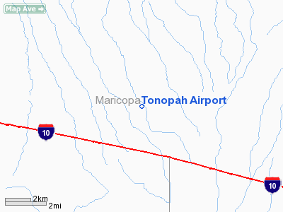
Location & QuickFacts
|
FAA
Information Effective: |
2005-10-27 |
|
Airport Identifier: |
AZ85 |
|
Longitude/Latitude: |
112-57-36.6510W/33-32-02.1370N
-112.960181/33.533927 (Estimated) |
|
Elevation: |
1248 ft / 380.39 m (Estimated) |
|
Land: |
25 acres |
|
From nearest city: |
3
nautical miles NW of Tonopah, AZ |
|
Location: |
Maricopa County, AZ |
|
Magnetic Variation: |
13E (1985) |
Owner & Manager
|
Ownership: |
Privately owned |
|
Owner: |
Allen Gustavson, Jr. |
|
Address: |
6540 N. 419 Ave. P.o. Box 207
Tonopah, AZ 85354 |
|
Phone number: |
602-386-3805 |
|
Manager: |
Allen Gustavson, Jr. |
|
Address: |
6530 N 419 Th Ave Po Box 207
Tonopah, AZ 85354 |
|
Phone number: |
602-386-3839 |
Airport Operations and Facilities
|
Airport
Use: |
Private |
|
Wind indicator: |
Yes |
|
Segmented Circle: |
No |
|
Control Tower: |
No |
|
Attendance Schedule: |
ALL/ALL/ALL |
|
Landing fee charge: |
No |
|
Sectional chart: |
Phoenix |
|
Region: |
AWP - Western-Pacific |
|
Boundary ARTCC: |
ZAB - Albuquerque |
|
Tie-in FSS: |
PRC - Prescott |
|
FSS on Airport: |
No |
|
FSS Phone: |
928-778-7810 |
|
FSS Toll Free: |
1-800-WX-BRIEF |
Runway Information
Runway 13/31
|
Dimension: |
3075
x 60 ft / 937.3 x 18.3 m |
|
Surface: |
DIRT,
|
|
|
Runway 13 |
Runway 31 |
|
Traffic Pattern: |
Left |
Left |
|
Radio Navigation Aids
|
ID |
Type |
Name |
Ch |
Freq |
Var |
Dist |
|
LUF |
TACAN |
Luke |
077X |
|
13E |
29.1
nm |
|
BXK |
VORTAC |
Buckeye |
043X |
110.60 |
14E |
8.3
nm |
|
GBN |
VORTAC |
Gila
Bend |
113X |
116.60 |
14E |
37.6
nm |
|
PXR |
VORTAC |
Phoenix |
103X |
115.60 |
12E |
50.0
nm |
|
PHX |
VOT |
Phoenix
Sky Harbor |
|
109.00 |
|
48.1
nm |
Remarks
Based Aircraft
|
Aircraft
based on field: |
3 |
|
Single Engine Airplanes: |
3 |
Tonopah Airport
Address:
Maricopa County,
AZ
Tel:
602-386-3805,
602-386-3839
Images and information placed above are from
http://www.airport-data.com/airport/AZ85/
We thank them for the data!
| General
Info |
| Country |
United
States |
| State |
ARIZONA
|
| FAA ID |
AZ85 |
| Latitude |
33-32-02.137N
|
| Longitude |
112-57-36.651W
|
| Elevation |
1248 feet
|
| Near City |
TONOPAH
|
We don't guarantee the information is fresh and accurate. The data may be wrong or outdated.
For more up-to-date information please refer to other sources.
|
|


