 |
|
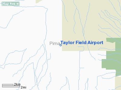
Location & QuickFacts
|
FAA
Information Effective: |
2005-10-27 |
|
Airport Identifier: |
0AZ1 |
|
Longitude/Latitude: |
111-19-25.3820W/32-18-03.2660N
-111.323717/32.300907 (Estimated) |
|
Elevation: |
2130 ft / 649.22 m (Estimated) |
|
Land: |
109 acres |
|
From nearest city: |
13 nautical miles SW of Marana, AZ |
|
Location: |
Pima County, AZ |
|
Magnetic Variation: |
12E (1980) |
Owner & Manager
|
Ownership: |
Publicly owned |
|
Owner: |
The State Of Arizona |
|
Address: |
5301 North Anway Rd
Marana, AZ 85653 |
|
Manager: |
Doug Somerville
TAYLOR FIELD FLYING CLUB, INC. |
|
Address: |
1701 N. Forgeus
Tucson, AZ 85716 |
|
Phone number: |
602-795-6777
ALSO 602-325-5317 |
Airport Operations and Facilities
|
Airport
Use: |
Open to public |
|
Wind indicator: |
Yes |
|
Segmented Circle: |
Yes |
|
Control Tower: |
No |
|
Attendance Schedule: |
ALL/SAT&SUN/0700-2000 |
|
Sectional chart: |
Phoenix |
|
Region: |
AWP - Western-Pacific |
|
Traffic Pattern
Alt: |
800 ft |
|
Boundary ARTCC: |
ZAB - Albuquerque |
|
Tie-in FSS: |
PRC - Prescott |
|
FSS on Airport: |
No |
|
FSS Phone: |
928-778-7810 |
|
FSS Toll Free: |
1-800-WX-BRIEF |
Runway Information
Runway 03/21
|
Dimension: |
2000 x 40 ft /
609.6 x 12.2 m |
|
Surface: |
DIRT,
|
|
|
Runway 03 |
Runway 21 |
|
Traffic Pattern: |
Left |
Left |
|
Obstruction: |
|
30
ft pline, 300.0 ft from runway |
|
Runway 14/32
|
Dimension: |
3250 x 50 ft /
990.6 x 15.2 m |
|
Surface: |
DIRT,
|
|
|
Runway 14 |
Runway 32 |
|
Traffic Pattern: |
Left |
Left |
|
Obstruction: |
|
30
ft pline, 300.0 ft from runway |
|
Runway 16/34
|
Dimension: |
2500 x 75 ft /
762.0 x 22.9 m |
|
Surface: |
DIRT,
|
|
|
Runway 16 |
Runway 34 |
|
Traffic Pattern: |
Left |
Left |
|
Radio Navigation Aids
|
ID |
Type |
Name |
Ch |
Freq |
Var |
Dist |
|
AVQ |
NDB |
Marana |
|
245.00 |
12E |
8.6
nm |
|
RYN |
NDB |
Ryan |
|
338.00 |
12E |
12.8
nm |
|
RBJ |
NDB |
Robles |
|
220.00 |
12E |
13.8
nm |
|
DMA |
TACAN |
Davis
Monthan |
123X |
|
12E |
24.1
nm |
|
TUS |
VORTAC |
Tucson |
107X |
116.00 |
12E |
24.2
nm |
|
TFD |
VORTAC |
Stanfield |
095X |
114.80 |
12E |
46.0
nm |
Remarks
-
ULTRALIGHT TPA 300 FT.
-
RY 16/34 MKD WITH X'S
BOTH ENDS; RESERVED FOR ULTRALIGHT TYPE ACFT ONLY.
-
OWNER DESIRES ARPT NOT
BE CHARTED.
-
(ARPT STATUS) ARPT CLSD
INDEFLY.
-
VFR PRIVATE USE ONLY.
Based Aircraft
|
Aircraft
based on field: |
23 |
|
Single Engine Airplanes: |
10 |
|
Multi Engine Airplanes: |
1 |
|
Gliders: |
1 |
|
Ultralights: |
11 |
Taylor Field Airport
Address:
Pima County,
AZ
Tel:
602-795-6777
Images and information placed above are from
http://www.airport-data.com/airport/0AZ1/
We thank them for the data!
| General
Info |
| Country |
United
States |
| State |
ARIZONA
|
| FAA ID |
0AZ1 |
| Latitude |
32-18-03.266N
|
| Longitude |
111-19-25.382W
|
| Elevation |
2130 feet
|
| Near City |
MARANA
|
We don't guarantee the information is fresh and accurate. The data may be wrong or outdated.
For more up-to-date information please refer to other sources.
|
|


