 |
|
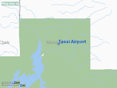
Location & QuickFacts
|
FAA
Information Effective: |
2005-10-27 |
|
Airport Identifier: |
AZ01 |
|
Longitude/Latitude: |
113-57-53.8490W/36-15-08.9460N
-113.964958/36.252485 (Estimated) |
|
Elevation: |
1544 ft / 470.61 m (Estimated) |
|
Land: |
0
acres |
|
From nearest city: |
16 nautical miles N of Meadview, AZ |
|
Location: |
Mohave County, AZ |
|
Magnetic Variation: |
14E (1985) |
Owner & Manager
|
Ownership: |
Publicly owned |
|
Owner: |
Lake Mead Nat. Rec. Area |
|
Address: |
601 Nevada Highway
Boulder City, NV 89005 |
|
Phone number: |
702-293-8932
OR 702-293-8908 |
|
Manager: |
Dale Antonich |
|
Address: |
601 Nevada Highway
Boulder City, NV 89005 |
|
Phone number: |
702-293-8908 |
Airport Operations and Facilities
|
Airport
Use: |
Open to public |
|
Wind indicator: |
Yes |
|
Segmented Circle: |
No |
|
Control Tower: |
No |
|
Attendance Schedule: |
UNATNDD |
|
Sectional chart: |
Las Vegas |
|
Region: |
AWP - Western-Pacific |
|
Boundary ARTCC: |
ZLA - Los Angeles |
|
Tie-in FSS: |
PRC - Prescott |
|
FSS on Airport: |
No |
|
FSS Phone: |
928-778-7810 |
|
FSS Toll Free: |
1-800-WX-BRIEF |
Runway Information
Runway 06/24
|
Dimension: |
1400 x 60 ft /
426.7 x 18.3 m |
|
Surface: |
DIRT,
|
|
|
Runway 06 |
Runway 24 |
|
Traffic Pattern: |
Left |
Left |
|
Radio Navigation Aids
|
ID |
Type |
Name |
Ch |
Freq |
Var |
Dist |
|
MMM |
VORTAC |
Mormon
Mesa |
090X |
114.30 |
16E |
34.5
nm |
|
PGS |
VORTAC |
Peach
Springs |
057X |
112.00 |
15E |
42.9
nm |
|
BLD |
VORTAC |
Boulder
City |
114X |
116.70 |
15E |
46.3
nm |
Remarks
-
FOR OFFICIAL USE ONLY.
-
PRVDD VFR PRIVATE USE
ONLY.
Tassi Airport
Address:
Mohave County,
AZ
Tel:
702-293-8932,
702-293-8908
Images and information placed above are from
http://www.airport-data.com/airport/AZ01/
We thank them for the data!
| General
Info |
| Country |
United
States |
| State |
ARIZONA
|
| FAA ID |
AZ01 |
| Latitude |
36-15-08.946N
|
| Longitude |
113-57-53.849W
|
| Elevation |
1544 feet
|
| Near City |
MEADVIEW
|
We don't guarantee the information is fresh and accurate. The data may be wrong or outdated.
For more up-to-date information please refer to other sources.
|
|


