 |
|
Location & QuickFacts
|
FAA
Information Effective: |
2005-10-27 |
|
Airport Identifier: |
AZ77 |
|
Longitude/Latitude: |
111-56-08.5870W/35-14-18.0400N
-111.935719/35.238344 (Estimated) |
|
Elevation: |
6958 ft / 2120.80 m (Estimated) |
|
Land: |
0
acres |
|
From nearest city: |
14 nautical miles SE of Williams, AZ |
|
Location: |
Coconino County, AZ |
|
Magnetic Variation: |
13E (1985) |
Owner & Manager
|
Ownership: |
Privately owned |
|
Owner: |
Ronald J. Haarer |
|
Address: |
353 W. Southern Hills Road
Phoenix, AZ 85023 |
|
Phone number: |
602-869-0866 |
|
Manager: |
Ronald J. Haarer |
|
Address: |
353 W. Southern Hills Road
Phoenix, AZ 85023 |
|
Phone number: |
602-869-0866 |
Airport Operations and Facilities
|
Airport
Use: |
Private |
|
Wind indicator: |
Yes |
|
Segmented Circle: |
No |
|
Control Tower: |
No |
|
Attendance Schedule: |
UNATNDD |
|
Landing fee charge: |
No |
|
Sectional chart: |
Phoenix |
|
Region: |
AWP - Western-Pacific |
|
Boundary ARTCC: |
ZAB - Albuquerque |
|
Tie-in FSS: |
PRC - Prescott |
|
FSS on Airport: |
No |
|
FSS Phone: |
928-778-7810 |
|
FSS Toll Free: |
1-800-WX-BRIEF |
Runway Information
Runway 12/30
|
Dimension: |
3200 x 100 ft
/ 975.4 x 30.5 m |
|
Surface: |
ASPH,
|
|
|
Runway 12 |
Runway 30 |
|
Traffic Pattern: |
Left |
Left |
|
Obstruction: |
40
ft trees, 100.0 ft from runway |
40
ft trees, 100.0 ft from runway |
|
Radio Navigation Aids
|
ID |
Type |
Name |
Ch |
Freq |
Var |
Dist |
|
PUU |
NDB |
Pulliam |
|
379.00 |
13E |
14.3
nm |
|
FLG |
VOR/DME |
Flagstaff |
085Y |
113.85 |
14E |
14.0
nm |
|
GCN |
VOR/DME |
Grand
Canyon |
078X |
113.10 |
15E |
44.6
nm |
|
DRK |
VORTAC |
Drake |
088X |
114.10 |
14E |
41.9
nm |
|
PRC |
VOT |
Prescott |
|
110.00 |
|
42.6
nm |
Remarks
Based Aircraft
|
Aircraft
based on field: |
1 |
|
Single Engine Airplanes: |
1 |
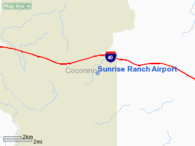
Sunrise Ranch Airport
Address:
Coconino County,
AZ
Tel:
602-869-0866
Images and information placed above are from
http://www.airport-data.com/airport/AZ77/
We thank them for the data!
| General
Info |
| Country |
United
States |
| State |
ARIZONA
|
| FAA ID |
AZ77 |
| Latitude |
35-14-18.040N
|
| Longitude |
111-56-08.587W
|
| Elevation |
6958 feet
|
| Near City |
WILLIAMS
|
We don't guarantee the information is fresh and accurate. The data may be wrong or outdated.
For more up-to-date information please refer to other sources.
|
|


