 |
|
Sky Ranch Association Carefree Airport |
Location & QuickFacts
|
FAA
Information Effective: |
2005-10-27 |
|
Airport Identifier: |
18AZ |
|
Longitude/Latitude: |
111-53-52.5270W/33-49-05.1410N
-111.897924/33.818095 (Estimated) |
|
Elevation: |
2568 ft / 782.73 m (Estimated) |
|
Land: |
55 acres |
|
From nearest city: |
1
nautical miles E of Carefree, AZ |
|
Location: |
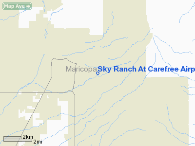
Maricopa County, AZ |
|
Magnetic Variation: |
13E (1985) |
Owner & Manager
|
Ownership: |
Privately owned |
|
Owner: |
Sky Ranch Association |
|
Address: |
P.o. Box 3162
Carefree, AZ 85377 |
|
Phone number: |
480-488-3571 |
|
Manager: |
Skip Atwell |
|
Address: |
P.o. Box 3162
Carefree, AZ 85377 |
|
Phone number: |
480-488-3571 |
Airport Operations and Facilities
|
Airport
Use: |
Private |
|
Wind indicator: |
Yes |
|
Segmented Circle: |
No |
|
Control Tower: |
No |
|
Attendance Schedule: |
ALL/ALL/0800-1700 |
|
Lighting Schedule: |
RDO-CTL
ACTVT LIRL RWY 06/24 - 122.975. |
|
Landing fee charge: |
Yes |
|
Sectional chart: |
Phoenix |
|
Region: |
AWP - Western-Pacific |
|
Traffic Pattern
Alt: |
942 ft |
|
Boundary ARTCC: |
ZAB - Albuquerque |
|
Tie-in FSS: |
PRC - Prescott |
|
FSS on Airport: |
No |
|
FSS Phone: |
928-778-7810 |
|
FSS Toll Free: |
1-800-WX-BRIEF |
Airport Communications
Airport Services
|
Fuel
available: |
100LL |
|
Bottled Oxygen: |
NONE |
|
Bulk Oxygen: |
NONE |
Runway Information
Runway 06/24
|
Dimension: |
4037 x 50 ft /
1230.5 x 15.2 m |
|
Surface: |
ASPH,
|
|
Weight Limit: |
Single
wheel: 12500 lbs. |
|
Edge Lights: |
Low |
|
|
Runway 06 |
Runway 24 |
|
Traffic Pattern: |
Right |
Left |
|
Markings: |
Basic, Good Condition |
Basic, Good Condition |
|
Displaced threshold: |
0.00 ft |
500.00 ft |
|
Runway End Identifier: |
Yes |
Yes |
|
Centerline Lights: |
No |
No |
|
Touchdown Lights: |
No |
No |
|
Obstruction: |
20
ft cactus, 400.0 ft from runway, 10:1 slope to clear
ROAD 95' LEFT; +5' SIGN 90' LEFT. |
20
ft brush, 200.0 ft from runway
ROAD AT 150'; +5' TERRAIN AND +4' SIGN 90' RIGHT. |
|
Radio Navigation Aids
|
ID |
Type |
Name |
Ch |
Freq |
Var |
Dist |
|
SDL |
NDB |
Scottsdale |
|
224.00 |
12E |
11.4
nm |
|
FFZ |
NDB |
Falcon
Field |
|
281.00 |
12E |
23.0
nm |
|
CHD |
NDB |
Chandler |
|
407.00 |
12E |
33.5
nm |
|
LUF |
TACAN |
Luke |
077X |
|
13E |
29.4
nm |
|
PXR |
VORTAC |
Phoenix |
103X |
115.60 |
12E |
23.4
nm |
|
IWA |
VORTAC |
Willie |
080X |
113.30 |
13E |
33.3
nm |
|
PHX |
VOT |
Phoenix
Sky Harbor |
|
109.00 |
|
23.7
nm |
Remarks
-
<
GO AND TOUCH>
-
<
MOUNTAINS E,>
-
WASH IN RWY SAFETY AREA
FOR RWY 24.
-
AVOID LOW FLYING OVER
HOMES IN ARPT VICINITY.
-
GLIDER TOWING OPERATIONS
AND OPERATING AREA.
-
NO TKOF OR LDG BY HELICOPTERS
PERMITTED.
-
TWY AND RAMPS ARE RATED
LESS THAN 12,500 LBS GWT.
Based Aircraft
|
Aircraft
based on field: |
112 |
|
Single Engine Airplanes: |
91 |
|
Multi Engine Airplanes: |
19 |
|
Gliders: |
2 |
Operational Statistics
|
Aircraft
Operations: |
81/Week |
|
General Aviation
Local: |
95.2% |
|
General Aviation
Itinerant: |
4.8% |
Sky Ranch At Carefree
Airport
Address:
Maricopa County,
AZ
Tel:
480-488-3571
Images and information placed above are from
http://www.airport-data.com/airport/18AZ/
We thank them for the data!
| General
Info |
| Country |
United
States |
| State |
ARIZONA
|
| FAA ID |
18AZ |
| Latitude |
33-49-05.141N
|
| Longitude |
111-53-52.527W
|
| Elevation |
2568 feet
|
| Near City |
CAREFREE
|
We don't guarantee the information is fresh and accurate. The data may be wrong or outdated.
For more up-to-date information please refer to other sources.
|
|


