 |
|
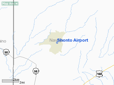
Location & QuickFacts
|
FAA
Information Effective: |
2005-10-27 |
|
Airport Identifier: |
53AZ |
|
Longitude/Latitude: |
110-39-17.5080W/36-35-16.9910N
-110.654863/36.588053 (Estimated) |
|
Elevation: |
6449 ft / 1965.66 m (Estimated) |
|
Land: |
17 acres |
|
From nearest city: |
1
nautical miles SW of Shonto, AZ |
|
Location: |
Navajo County, AZ |
|
Magnetic Variation: |
13E (1985) |
Owner & Manager
|
Ownership: |
Publicly owned |
|
Owner: |
The Navajo Tribe |
|
Address: |
Box 706
Window Rock, AZ 86515 |
|
Phone number: |
602-871-6283 |
|
Manager: |
Jim Pomeroy |
|
Address: |
Box 706
Window Rock, AZ 86515 |
|
Phone number: |
602-871-6203 |
Airport Operations and Facilities
|
Airport
Use: |
Open to public |
|
Wind indicator: |
No |
|
Segmented Circle: |
No |
|
Control Tower: |
No |
|
Attendance Schedule: |
UNATNDD |
|
Landing fee charge: |
No |
|
Sectional chart: |
Denver |
|
Region: |
AWP - Western-Pacific |
|
Boundary ARTCC: |
ZDV - Denver |
|
Tie-in FSS: |
PRC - Prescott |
|
FSS on Airport: |
No |
|
FSS Phone: |
928-778-7810 |
|
FSS Toll Free: |
1-800-WX-BRIEF |
Airport Services
|
Airframe
Repair: |
NONE |
|
Power
Plant Repair: |
NONE |
Runway Information
Runway 01/19
|
Dimension: |
3500 x 75 ft /
1066.8 x 22.9 m |
|
Surface: |
DIRT,
|
|
|
Runway 01 |
Runway 19 |
|
Traffic Pattern: |
Left |
Left |
|
Radio Navigation Aids
|
ID |
Type |
Name |
Ch |
Freq |
Var |
Dist |
|
PBY |
NDB |
Peabody |
|
259.00 |
13E |
13.6
nm |
|
PGA |
VOR/DME |
Page |
123X |
117.60 |
13E |
43.4
nm |
|
TBC |
VORTAC |
Tuba
City |
082X |
113.50 |
15E |
40.9
nm |
Remarks
-
CAUTION: WATCH FOR LIVESTOCK
AND VEHICLE TRAFFIC ON RWY.
-
RWY NOT REGULARLY MAINTAINED.
-
+20' TERRAIN APRXLY
700' FROM THR RWY 19. (SLOPE RATIO 35:1).
-
VFR ONLY.
Shonto Airport
Address:
Navajo County,
AZ
Tel:
602-871-6203
Images and information placed above are from
http://www.airport-data.com/airport/53AZ/
We thank them for the data!
| General
Info |
| Country |
United
States |
| State |
ARIZONA
|
| FAA ID |
53AZ |
| Latitude |
36-35-16.991N
|
| Longitude |
110-39-17.508W
|
| Elevation |
6449 feet
|
| Near City |
SHONTO
|
We don't guarantee the information is fresh and accurate. The data may be wrong or outdated.
For more up-to-date information please refer to other sources.
|
|


