 |
|
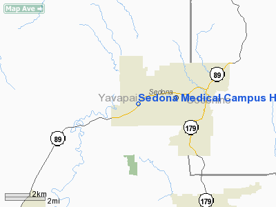
Sedona Medical Campus Heliport |
Location & QuickFacts
|
FAA
Information Effective: |
2005-10-27 |
|
Airport Identifier: |
5AZ8 |
|
Longitude/Latitude: |
111-49-24.0000W/34-51-20.0000N
-111.823333/34.855556 (Estimated) |
|
Elevation: |
4456 ft / 1358.19 m (Estimated) |
|
Land: |
0
acres |
|
From nearest city: |
5
nautical miles E of Sedona, AZ |
|
Location: |
Yavapai County, AZ |
|
Magnetic Variation: |
13E (1995) |
Owner & Manager
|
Ownership: |
Privately owned |
|
Owner: |
Marcus Medicus, Inc. |
|
Address: |
202 South Willard
Cottonwood, AZ 86326 |
|
Phone number: |
602-257-1764 |
|
Manager: |
Marcus Medicus, Inc. |
|
Address: |
202 South Willard
Cottonwood, AZ 86326 |
|
Phone number: |
602-257-1764 |
Airport Operations and Facilities
|
Airport
Use: |
Private |
|
Wind indicator: |
Yes |
|
Segmented Circle: |
No |
|
Control Tower: |
No |
|
Attendance Schedule: |
ALL/ALL/ALL |
|
Lighting Schedule: |
PHONE REQ
FOR PERIMETER & FLOOD LGTS CALL 602-257-1764. |
|
Sectional chart: |
Phoenix |
|
Region: |
AWP - Western-Pacific |
|
Boundary ARTCC: |
ZAB - Albuquerque |
|
Tie-in FSS: |
PRC - Prescott |
|
FSS on Airport: |
No |
|
FSS Phone: |
928-778-7810 |
|
FSS Toll Free: |
1-800-WX-BRIEF |
Airport Communications
Runway Information
Helipad H1
|
Dimension: |
80 x 80 ft / 24.4
x 24.4 m |
|
Surface: |
CONC,
|
|
|
Runway H1 |
Runway |
|
Traffic Pattern: |
Left |
Left |
|
Radio Navigation Aids
|
ID |
Type |
Name |
Ch |
Freq |
Var |
Dist |
|
PUU |
NDB |
Pulliam |
|
379.00 |
13E |
18.8
nm |
|
FLG |
VOR/DME |
Flagstaff |
085Y |
113.85 |
14E |
19.0
nm |
|
DRK |
VORTAC |
Drake |
088X |
114.10 |
14E |
33.7
nm |
|
PRC |
VOT |
Prescott |
|
110.00 |
|
32.0
nm |
Remarks
-
PRVDD VFR/PVT USE; OPNS
LIMITED TO 120-360; USERS ADVISED OF UNLGTD RADIO TOWERS.
Sedona Medical Campus Heliport
Address:
Yavapai County,
AZ
Tel:
602-257-1764
Images and information placed above are from
http://www.airport-data.com/airport/5AZ8/
We thank them for the data!
| General
Info |
| Country |
United
States |
| State |
ARIZONA
|
| FAA ID |
5AZ8 |
| Latitude |
34-51-20.000N
|
| Longitude |
111-49-24.000W
|
| Elevation |
4456 feet
|
| Near City |
SEDONA
|
We don't guarantee the information is fresh and accurate. The data may be wrong or outdated.
For more up-to-date information please refer to other sources.
|
|


