 |
|
Location & QuickFacts
|
FAA
Information Effective: |
2005-10-27 |
|
Airport Identifier: |
28AZ |
|
Longitude/Latitude: |
113-10-52.6920W/33-55-22.1060N
-113.181303/33.922807 (Estimated) |
|
Elevation: |
2208 ft / 673.00 m (Estimated) |
|
Land: |
55 acres |
|
From nearest city: |
1
nautical miles S of Aguila, AZ |
|
Location: |
Maricopa County, AZ |
|
Magnetic Variation: |
13E (1985) |
Owner & Manager
|
Ownership: |
Privately owned |
|
Owner: |
Valley Of The Eagle Mgt Co. |
|
Address: |
Po Box 133
Aguila, AZ 85320 |
|
Phone number: |
602-685-2637 |
|
Manager: |
Richard Hladky |
|
Address: |
Po Box 368
Aguila, AZ 85320 |
|
Phone number: |
520-685-2526 |
Airport Operations and Facilities
|
Airport
Use: |
Private |
|
Wind indicator: |
Yes |
|
Segmented Circle: |
No |
|
Control Tower: |
No |
|
Attendance Schedule: |
ALL/ALL/0800-1700 |
|
Landing fee charge: |
No |
|
Sectional chart: |
Phoenix |
|
Region: |
AWP - Western-Pacific |
|
Boundary ARTCC: |
ZAB - Albuquerque |
|
Tie-in FSS: |
PRC - Prescott |
|
FSS on Airport: |
No |
|
FSS Phone: |
928-778-7810 |
|
FSS Toll Free: |
1-800-WX-BRIEF |
Runway Information
Runway 17/35
|
Dimension: |
3500
x 75 ft / 1066.8 x 22.9 m
200'OVRN ON EACH RWY END.
125' WIDTH AVBL BUT OVERGROWN WITH BRUSH BOTH SIDES OF RY. |
|
Surface: |
DIRT,
Good Condition |
|
|
Runway 17 |
Runway 35 |
|
Traffic Pattern: |
Right |
Left |
|
Obstruction: |
10
ft road, 210.0 ft from runway, 21:1 slope to clear |
10
ft road, 210.0 ft from runway, 21:1 slope to clear |
|
Radio Navigation Aids
|
ID |
Type |
Name |
Ch |
Freq |
Var |
Dist |
|
LUF |
TACAN |
Luke |
077X |
|
13E |
46.3
nm |
|
BXK |
VORTAC |
Buckeye |
043X |
110.60 |
14E |
33.4
nm |
Remarks
-
CAUTION: PVT ARPT 1
MILE EAST AND PVT ARPT 3000' SW.
-
+4 FT FENCE +1 FT BERM
AND MINUS 1 FT DITCH ALONG WEST SIDE OF RWY 17/35.
-
PRVDD VFR CONDITIONS
ONLY; COORDINATE OPS WITH EAGLE ROOST ARPT, HOUGH ARPT, & HILLAIR
ARPT; ALERT ARPT USERS OF HIGH-SPEED LOW-LEVEL MTR'S IN THE AREA.
Based Aircraft
|
Aircraft
based on field: |
7 |
|
Single Engine Airplanes: |
7 |
Operational Statistics
|
Aircraft
Operations: |
19/Month |
|
General Aviation
Local: |
33.3% |
|
General Aviation
Itinerant: |
66.7% |
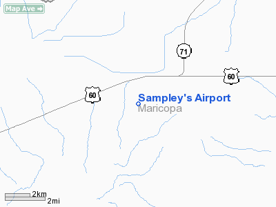
Sampley's Airport
Address:
Maricopa County,
AZ
Tel:
602-685-2637,
520-685-2526
Images and information placed above are from
http://www.airport-data.com/airport/28AZ/
We thank them for the data!
| General
Info |
| Country |
United
States |
| State |
ARIZONA
|
| FAA ID |
28AZ |
| Latitude |
33-55-22.106N
|
| Longitude |
113-10-52.692W
|
| Elevation |
2208 feet
|
| Near City |
AGUILA
|
We don't guarantee the information is fresh and accurate. The data may be wrong or outdated.
For more up-to-date information please refer to other sources.
|
|


