 |
|
Location & QuickFacts
|
FAA
Information Effective: |
2005-10-27 |
|
Airport Identifier: |
5AZ5 |
|
Longitude/Latitude: |
110-44-23.0000W/32-10-44.0000N
-110.739722/32.178889 (Estimated) |
|
Elevation: |
3102 ft / 945.49 m (Estimated) |
|
Land: |
5
acres |
|
From nearest city: |
4
nautical miles E of Tucson, AZ |
|
Location: |
Pima County, AZ |
|
Magnetic Variation: |
12E (1995) |
Owner & Manager
|
Ownership: |
Privately owned |
|
Owner: |
U.s. National Park Service |
|
Address: |
3693 South Old Spanish Trail
Tucson, AZ 85730-5699 |
|
Phone number: |
520-733-5130 |
|
Manager: |
Charles Scott |
|
Address: |
3693 South Old Spanish Trail
Tucson, AZ 85730-5699 |
|
Phone number: |
520-733-5130 |
Airport Operations and Facilities
|
Airport
Use: |
Private |
|
Wind indicator: |
Yes |
|
Segmented Circle: |
No |
|
Control Tower: |
No |
|
Attendance Schedule: |
UNATNDD |
|
Sectional chart: |
Phoenix |
|
Region: |
AWP - Western-Pacific |
|
Boundary ARTCC: |
ZAB - Albuquerque |
|
Tie-in FSS: |
PRC - Prescott |
|
FSS on Airport: |
No |
|
FSS Phone: |
928-778-7810 |
|
FSS Toll Free: |
1-800-WX-BRIEF |
Runway Information
Helipad H1
|
Dimension: |
90 x 90 ft / 27.4
x 27.4 m |
|
Surface: |
ASPH-CONC, |
|
|
Runway H1 |
Runway |
|
Traffic Pattern: |
Left |
Left |
|
Radio Navigation Aids
|
ID |
Type |
Name |
Ch |
Freq |
Var |
Dist |
|
RYN |
NDB |
Ryan |
|
338.00 |
12E |
21.6
nm |
|
AVQ |
NDB |
Marana |
|
245.00 |
12E |
27.9
nm |
|
RBJ |
NDB |
Robles |
|
220.00 |
12E |
32.2
nm |
|
DAO |
NDB |
Dragoo |
|
410.00 |
13E |
41.0
nm |
|
ENZ |
NDB |
Nogales |
|
394.00 |
12E |
45.9
nm |
|
DMA |
TACAN |
Davis
Monthan |
123X |
|
12E |
7.3
nm |
|
ARH |
TACAN |
Fort
Huachuca |
053X |
|
12E |
41.1
nm |
|
FHU |
VOR |
Libby |
|
113.60 |
13E |
40.5
nm |
|
OLS |
VOR/DME |
Nogales |
019X |
108.20 |
12E |
46.3
nm |
|
TUS |
VORTAC |
Tucson |
107X |
116.00 |
12E |
10.2
nm |
Remarks
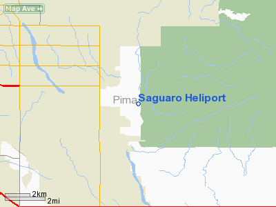
Saguaro Heliport
Address:
Pima County,
AZ
Tel:
520-733-5130
Images and information placed above are from
http://www.airport-data.com/airport/5AZ5/
We thank them for the data!
| General
Info |
| Country |
United
States |
| State |
ARIZONA
|
| FAA ID |
5AZ5 |
| Latitude |
32-10-25.000N
|
| Longitude |
110-44-12.000W
|
| Elevation |
3102 feet
|
| Near City |
TUCSON
|
We don't guarantee the information is fresh and accurate. The data may be wrong or outdated.
For more up-to-date information please refer to other sources.
|
|


