|
|
Location & QuickFacts
|
FAA
Information Effective: |
2005-10-27 |
|
Airport
Identifier: |
44A |
|
Longitude/Latitude: |
114-41-52.8340W/32-31-06.1930N
-114.698009/32.518387 (Estimated) |
|
Elevation: |
163 ft / 49.68 m (Estimated) |
|
Land: |
640 acres |
|
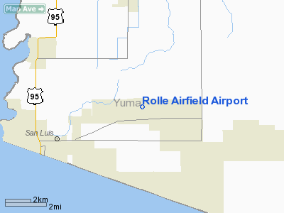
From
nearest city: |
5
nautical miles EN of San Luis, AZ |
|
Location: |
Yuma County, AZ |
|
Magnetic
Variation: |
13E (1985) |
Owner & Manager
|
Ownership: |
Publicly owned |
|
Owner: |
Us Dept Of Interior |
|
Address: |
Po Box D
Yuma, AZ 85366 |
|
Phone number: |
928-343-8125 |
|
Manager: |
David Gaines |
|
Address: |
2191 East 32nd Street
Yuma, AZ 85365 |
|
Phone number: |
928-726-5882 |
Airport Operations and Facilities
|
Airport
Use: |
Open to public |
|
Wind indicator: |
Yes |
|
Segmented Circle: |
Yes |
|
Control Tower: |
No |
|
Attendance Schedule: |
UNATNDD |
|
Sectional chart: |
Phoenix |
|
Region: |
AWP - Western-Pacific |
|
Boundary ARTCC: |
ZLA - Los Angeles |
|
Tie-in FSS: |
PRC - Prescott |
|
FSS Phone: |
928-778-7810 |
|
FSS Toll Free: |
1-800-WX-BRIEF |
|
NOTAMs Facility: |
PRC (NOTAM-d service avaliable) |
Airport Communications
Runway Information
Runway 17/35
|
Dimension: |
2800
x 60 ft / 853.4 x 18.3 m |
|
Surface: |
ASPH,
Good Condition |
|
|
Runway 17 |
Runway 35 |
|
Traffic Pattern: |
Left |
Left |
|
Markings: |
Basic, Fair Condition |
Basic, Fair Condition |
|
Radio Navigation Aids
|
ID |
Type |
Name |
Ch |
Freq |
Var |
Dist |
|
OEG |
NDB |
Golden
Eagle |
|
413.00 |
12E |
24.0
nm |
|
NYL |
TACAN |
Yuma |
084X |
|
14E |
8.8
nm |
|
MXL |
VOR/DME |
Mexicali |
097X |
115.00 |
14E |
27.4
nm |
|
BZA |
VORTAC |
Bard |
115X |
116.80 |
14E |
15.8
nm |
|
IPL |
VORTAC |
Imperial |
106X |
115.90 |
14E |
43.3
nm |
Remarks
-
ARPT UNLGTD - FREQUENT
NIGHT MILITARY OPERATIONS CONDUCTED.
-
OIL TREATED AREA SURROUNDING
EXISTING PAVED RWY IS HEAVILY RUTTED.
-
VFR USE ONLY; CAUTION
EXERCIXED IN MCAS/YUMA ARPT AREA.
Operational Statistics
|
Aircraft
Operations: |
95/Week |
|
General Aviation
Local: |
59.2% |
|
Military: |
40.8% |
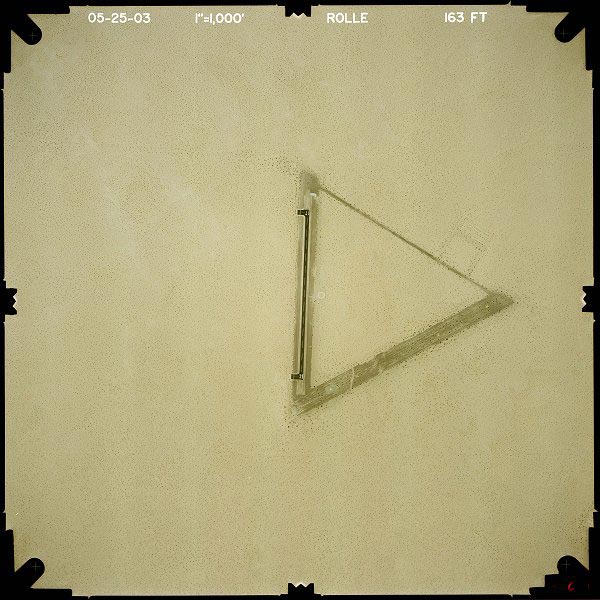
Rolle
Airfield Airport
Address:
Yuma County,
AZ
Tel:
928-343-8125,
928-726-5882
|
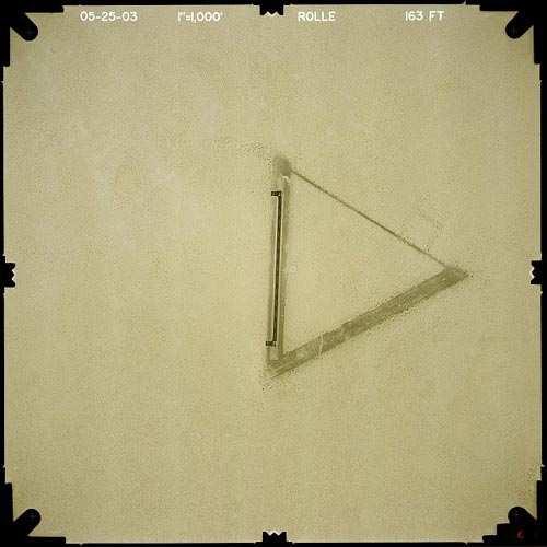 |
(Click on the image to enlarge) |
Images and information placed above are from
http://www.airport-data.com/airport/44A/
http://www.dot.state.az.us/aviation/airports/airports_list.asp?FAA=44A
We thank them for the data!
| General
Info |
| Country |
United
States |
| State |
ARIZONA
|
| FAA ID |
44A |
| Latitude |
32-31-06.193N
|
| Longitude |
114-41-52.834W
|
| Elevation |
163 feet
|
| Near City |
SAN LUIS
|
We don't guarantee the information is fresh and accurate. The data may be wrong or outdated.
For more up-to-date information please refer to other sources.
|
|