 |
|
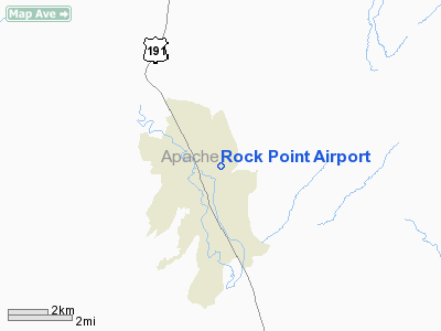
Location & QuickFacts
|
FAA
Information Effective: |
2005-10-27 |
|
Airport Identifier: |
49AZ |
|
Longitude/Latitude: |
109-37-07.3950W/36-43-55.0040N
-109.618721/36.731946 (Estimated) |
|
Elevation: |
4999 ft / 1523.70 m (Estimated) |
|
Land: |
40 acres |
|
From nearest city: |
1
nautical miles N of Rock Point, AZ |
|
Location: |
Apache County, AZ |
|
Magnetic Variation: |
13E (1985) |
Owner & Manager
|
Ownership: |
Publicly owned |
|
Owner: |
Navajo Tribe |
|
Address: |
Box 706
Window Rock, AZ 86515 |
|
Manager: |
Jim Pomeroy |
|
Address: |
Window Rock Arpt
Window Rock, AZ 86515 |
|
Phone number: |
602-871-6283 |
Airport Operations and Facilities
|
Airport
Use: |
Open to public |
|
Wind indicator: |
No |
|
Segmented Circle: |
No |
|
Control Tower: |
No |
|
Attendance Schedule: |
UNATNDD |
|
Landing fee charge: |
No |
|
Sectional chart: |
Denver |
|
Region: |
AWP - Western-Pacific |
|
Boundary ARTCC: |
ZDV - Denver |
|
Tie-in FSS: |
PRC - Prescott |
|
FSS on Airport: |
No |
|
FSS Phone: |
928-778-7810 |
|
FSS Toll Free: |
1-800-WX-BRIEF |
Airport Services
|
Airframe
Repair: |
NONE |
|
Power
Plant Repair: |
NONE |
Runway Information
Runway 01/19
|
Dimension: |
3700 x 50 ft /
1127.8 x 15.2 m
WIDTH VARIES PLUS OR MINUS 10'. |
|
Surface: |
DIRT,
Poor Condition |
|
|
Runway 01 |
Runway 19 |
|
Traffic Pattern: |
Left |
Left |
|
Radio Navigation Aids
|
ID |
Type |
Name |
Ch |
Freq |
Var |
Dist |
|
PBY |
NDB |
Peabody |
|
259.00 |
13E |
41.3
nm |
Remarks
-
< REGULARLY NOT>
-
VEHICLES AND LIVESTOCK
MAY OCCASIONALLY BE ON RWY.
-
LARGE FREE STANDING
ROCK APRXLY 1000' TO EAST OF RWY.
-
NORTH 950' OF RWY NOT
GRADED. SOFT AND SANDY SOIL AND SOFT SHOULDERS.
-
VFR ONLY.
Operational Statistics
|
Aircraft
Operations: |
5/Month |
|
General Aviation
Local: |
16.7% |
|
General Aviation
Itinerant: |
83.3% |
Rock Point Airport
Address:
Apache County,
AZ
Tel:
602-871-6283
Images and information placed above are from
http://www.airport-data.com/airport/49AZ/
We
thank them for the data!
| General
Info |
| Country |
United
States |
| State |
ARIZONA
|
| FAA ID |
49AZ |
| Latitude |
36-43-55.004N
|
| Longitude |
109-37-07.395W
|
| Elevation |
4999 feet
|
| Near City |
ROCK POINT
|
We don't guarantee the information is fresh and accurate. The data may be wrong or outdated.
For more up-to-date information please refer to other sources.
|
|


