 |
|
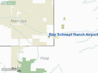
Ray Schnepf Ranch Airport |
|
|
Location & QuickFacts
|
FAA Information
Effective: |
2005-10-27 |
|
Airport Identifier: |
47AZ |
|
Longitude/Latitude: |
111-35-37.4740W/33-13-27.1930N
-111.593743/33.224220 (Estimated) |
|
Elevation: |
1458
ft / 444.40 m (Estimated) |
|
Land: |
4 acres |
|
From nearest
city: |
3
nautical miles SE of Queen Creek, AZ |
|
Location: |
Maricopa County,
AZ |
|
Magnetic Variation: |
12E
(1985) |
Owner & Manager
|
Ownership: |
Privately
owned |
|
Owner: |
Ray
Schnepf |
|
Address: |
22601 E. Cloud
Rd
Queen Creek, AZ 85242 |
|
Phone number: |
602-987-3100 |
|
Manager: |
Ray Schnepf |
|
Address: |
22601
E. Cloud Rd
Queen Creek, AZ 85242 |
|
Phone number: |
602-987-3100 |
Airport Operations
and Facilities
|
Airport Use: |
Private |
|
Wind indicator: |
Yes |
|
Segmented Circle: |
No |
|
Control Tower: |
No |
|
Attendance
Schedule: |
UNATNDD |
|
Landing fee
charge: |
No |
|
Sectional chart: |
Phoenix |
|
Region: |
AWP - Western-Pacific |
|
Boundary ARTCC: |
ZAB
- Albuquerque |
|
Tie-in FSS: |
PRC - Prescott |
|
FSS on Airport: |
No |
|
FSS Phone: |
928-778-7810 |
|
FSS Toll Free: |
1-800-WX-BRIEF |
Airport Services
|
Airframe Repair: |
NONE |
|
Power Plant
Repair: |
NONE |
Runway Information
Runway 08/26
|
Dimension: |
3200 x 60
ft / 975.4 x 18.3 m |
|
Surface: |
GRAVEL, |
|
|
Runway 08 |
Runway 26 |
|
Traffic Pattern: |
Left |
Left |
|
Radio Navigation Aids
|
ID |
Type |
Name |
Ch |
Freq |
Var |
Dist |
|
CHD |
NDB |
Chandler |
|
407.00 |
12E |
11.1
nm |
|
FFZ |
NDB |
Falcon
Field |
|
281.00 |
12E |
15.9
nm |
|
SDL |
NDB |
Scottsdale |
|
224.00 |
12E |
29.0
nm |
|
GAZ |
NDB |
Globe |
|
255.00 |
13E |
47.2
nm |
|
LUF |
TACAN |
Luke |
077X |
|
13E |
43.7
nm |
|
IWA |
VORTAC |
Willie |
080X |
113.30 |
13E |
5.6
nm |
|
PXR |
VORTAC |
Phoenix |
103X |
115.60 |
12E |
22.7
nm |
|
TFD |
VORTAC |
Stanfield |
095X |
114.80 |
12E |
25.8
nm |
|
PHX |
VOT |
Phoenix Sky Harbor |
|
109.00 |
|
24.4
nm |
Remarks
-
PVT ROAD CROSSES
RWY 300' W OF MIDFIELD.
-
AIRSPACE STUDY
NOT WARRANTED.
Based Aircraft
|
Aircraft based
on field: |
1 |
|
Single Engine
Airplanes: |
1 |
Ray Schnepf Ranch Airport
Address:
Maricopa County,
AZ
Tel:
602-987-3100
Images and information placed above are from
http://www.airport-data.com/airport/47AZ/
We
thank them for the data!
| General
Info |
| Country |
United
States |
| State |
ARIZONA
|
| FAA ID |
47AZ
|
| Latitude |
33-13-27.193N
|
| Longitude |
111-35-37.474W
|
| Elevation |
1458 feet
|
| Near City |
QUEEN
CREEK |
We don't guarantee the information is fresh and accurate. The data may be wrong or outdated.
For more up-to-date information please refer to other sources.
|
|


