 |
|
|
|
|
|
Location & QuickFacts
|
FAA Information
Effective: |
2005-10-27 |
|
Airport Identifier: |
AS89 |
|
Longitude/Latitude: |
112-11-00.0000W/33-32-17.0000N
-112.183333/33.538056 (Estimated) |
|
Elevation: |
3995 ft / 1217.68 m (Estimated) |
|
Land: |
0
acres |
|
From nearest
city: |
0
nautical miles N of Glendale, AZ |
|
Location: |
Maricopa County, AZ |
|
Magnetic Variation: |
12E (1995) |
Owner & Manager
|
Ownership: |
Privately owned |
|
Owner: |
City Of Glendale |
|
Address: |
6801 N. Glen Harbor Blvd, #201
Glendale, AZ 85307 |
|
Phone number: |
623-930-2188 |
|
Manager: |
Mark Ripley |
|
Address: |
6801 N. Glen Harbor Blvd, #201
Glendale, AZ 85307 |
|
Phone number: |
623-930-2188 |
Airport Operations
and Facilities
|
Airport Use: |
Private |
|
Wind indicator: |
Yes |
|
Segmented
Circle: |
No |
|
Control Tower: |
No |
|
Attendance
Schedule: |
UNATNDD
OPEN TO THE PUBLIC BY PERMIT ONLY. CTC THE GLENDALE POLICE
DISPATCHER AT 623-930-3000. |
|
Lighting Schedule: |
PHONE REQ |
|
Sectional
chart: |
Phoenix |
|
Region: |
AWP - Western-Pacific |
|
Boundary ARTCC: |
ZAB - Albuquerque |
|
Tie-in FSS: |
PRC - Prescott |
|
FSS Phone: |
928-778-7810 |
|
FSS Toll Free: |
1-800-WX-BRIEF |
Runway Information
Helipad H1
|
Dimension: |
65 x 65
ft / 19.8 x 19.8 m |
|
Surface: |
CONC,
|
|
|
Runway H1 |
Runway |
|
Traffic Pattern: |
Left |
Left |
|
Radio Navigation Aids
|
ID |
Type |
Name |
Ch |
Freq |
Var |
Dist |
|
SDL |
NDB |
Scottsdale |
|
224.00 |
12E |
14.8 nm |
|
FFZ |
NDB |
Falcon
Field |
|
281.00 |
12E |
23.0 nm |
|
CHD |
NDB |
Chandler |
|
407.00 |
12E |
24.9 nm |
|
LUF |
TACAN |
Luke |
077X |
|
13E |
9.9 nm |
|
PXR |
VORTAC |
Phoenix |
103X |
115.60 |
12E |
12.4 nm |
|
IWA |
VORTAC |
Willie |
080X |
113.30 |
13E |
30.2 nm |
|
BXK |
VORTAC |
Buckeye |
043X |
110.60 |
14E |
32.5 nm |
|
TFD |
VORTAC |
Stanfield |
095X |
114.80 |
12E |
41.6 nm |
|
GBN |
VORTAC |
Gila
Bend |
113X |
116.60 |
14E |
42.8 nm |
|
PHX |
VOT |
Phoenix
Sky Harbor |
|
109.00 |
|
10.8 nm |
Remarks
-
PROVIDED PRIVATE USE, VFR
OPERATIONS, OBSTRUCTION FREE INGRESS AND EGRESS ROUTES, AND RECOMMEND HELIPAD
LIGHTING IF OPNS CONDUCTED BETWEEN SUNSET AND SUNRISE.
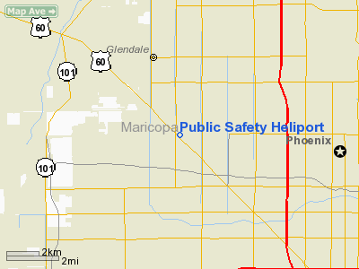
Public Safety Heliport
Address:
Maricopa County, AZ
Tel:
623-930-2188
Images and information placed above are from
http://www.airport-data.com/airport/AS89/
We
thank them for the data!
| General
Info |
| Country |
United
States |
| State |
ARIZONA
|
| FAA ID |
AS89 |
| Latitude |
33-32-17.000N
|
| Longitude |
112-11-00.000W
|
| Elevation |
3995 feet
|
| Near City |
GLENDALE
|
We don't guarantee the information is fresh and accurate. The data may be wrong or outdated.
For more up-to-date information please refer to other sources.
|
|


