 |
|
|
|
|
|
Location & QuickFacts
|
FAA Information
Effective: |
2005-10-27 |
|
Airport Identifier: |
55AZ |
|
Longitude/Latitude: |
111-57-35.4890W/32-52-26.1910N
-111.959858/32.873942 (Estimated) |
|
Elevation: |
1309 ft / 398.98 m (Estimated) |
|
Land: |
0
acres |
|
From nearest
city: |
0
nautical miles SE of Stanfield, AZ |
|
Location: |
Pinal County, AZ |
|
Magnetic Variation: |
12E (1985) |
Owner & Manager
|
Ownership: |
Privately owned |
|
Owner: |
Custom Farm Svc. Of Az |
|
Address: |
|
|
Manager: |
John Goodwin |
|
Address: |
Box 338
Stanfield, AZ 85272 |
|
Phone number: |
602-424-3322 |
Airport Operations
and Facilities
|
Airport Use: |
Private |
|
Wind indicator: |
Yes |
|
Segmented
Circle: |
No |
|
Control Tower: |
No |
|
Attendance
Schedule: |
SUMMER/ALL/DAWN-DUSK,WINTER/MON-SAT/DAWN-DUSK |
|
Landing fee
charge: |
No |
|
Sectional
chart: |
Phoenix |
|
Region: |
AWP - Western-Pacific |
|
Boundary ARTCC: |
ZAB - Albuquerque |
|
Tie-in FSS: |
PRC - Prescott |
|
FSS on Airport: |
No |
|
FSS Phone: |
928-778-7810 |
|
FSS Toll Free: |
1-800-WX-BRIEF |
Airport Services
|
Fuel available: |
100 |
|
Airframe Repair: |
MINOR |
|
Power Plant
Repair: |
MINOR |
Runway Information
Runway 18/36
|
Dimension: |
2400 x 50
ft / 731.5 x 15.2 m |
|
Surface: |
DIRT,
|
|
|
Runway 18 |
Runway 36 |
|
Traffic Pattern: |
Left |
Left |
|
Obstruction: |
45
ft pline, 625.0 ft from runway |
35
ft pline, 1320.0 ft from runway |
|
Radio Navigation Aids
|
ID |
Type |
Name |
Ch |
Freq |
Var |
Dist |
|
CHD |
NDB |
Chandler |
|
407.00 |
12E |
24.8 nm |
|
FFZ |
NDB |
Falcon
Field |
|
281.00 |
12E |
37.1 nm |
|
SDL |
NDB |
Scottsdale |
|
224.00 |
12E |
45.5 nm |
|
AVQ |
NDB |
Marana |
|
245.00 |
12E |
46.8 nm |
|
LUF |
TACAN |
Luke |
077X |
|
13E |
45.2 nm |
|
TFD |
VORTAC |
Stanfield |
095X |
114.80 |
12E |
2.7 nm |
|
IWA |
VORTAC |
Willie |
080X |
113.30 |
13E |
30.1 nm |
|
PXR |
VORTAC |
Phoenix |
103X |
115.60 |
12E |
33.6 nm |
|
GBN |
VORTAC |
Gila
Bend |
113X |
116.60 |
14E |
36.4 nm |
|
PHX |
VOT |
Phoenix
Sky Harbor |
|
109.00 |
|
33.8 nm |
Remarks
-
SPRAY AIRCRAFT USE THIS
AIRPORT FOR NIGHT SPRAY OPERATIONS.
-
TIE-DOWNS ONLY NO HGR SPACE.
-
ARIZONA HIGHWAY NR 84 NORTH
SIDE OF AIRPORT.
-
ESTABD PRIOR TO 5/15/59.
Based Aircraft
|
Aircraft based on field: |
10 |
|
Single Engine Airplanes: |
9 |
|
Helicopters: |
1 |
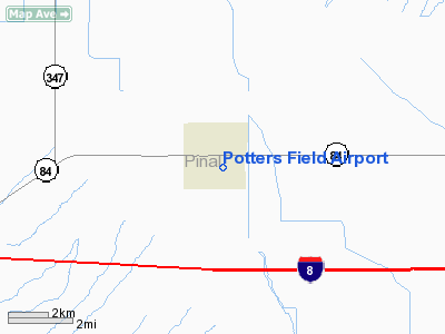
Potters Field Airport
Address:
Pinal County, AZ
Tel:
602-424-3322
Images and information placed above are from
http://www.airport-data.com/airport/55AZ/
We
thank them for the data!
| General
Info |
| Country |
United
States |
| State |
ARIZONA
|
| FAA ID |
55AZ |
| Latitude |
32-52-26.191N
|
| Longitude |
111-57-35.489W
|
| Elevation |
1309 feet
|
| Near City |
STANFIELD
|
We don't guarantee the information is fresh and accurate. The data may be wrong or outdated.
For more up-to-date information please refer to other sources.
|
|


