|
|
|
|
|
|
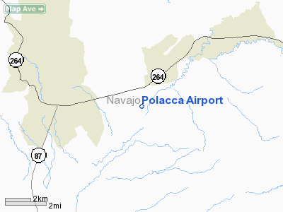
Location & QuickFacts
|
FAA Information
Effective: |
2005-10-27 |
|
Airport Identifier: |
P10 |
|
Longitude/Latitude: |
110-25-24.4750W/35-47-30.0200N
-110.423465/35.791672 (Estimated) |
|
Elevation: |
5573 ft / 1698.65 m (Estimated) |
|
Land: |
50 acres |
|
From nearest
city: |
3
nautical miles SW of Polacca, AZ |
|
Location: |
Navajo County, AZ |
|
Magnetic Variation: |
13E (1985) |
Owner & Manager
|
Ownership: |
Publicly owned |
|
Owner: |
The Hopi Tribe |
|
Address: |
Po Box 123
Kykotsmovi, AZ 86039 |
|
Phone number: |
520-734-3000 |
|
Manager: |
Bureau Of Indian Affairs |
|
Address: |
Superintendent, Hopi Agency, Po Box 158
Keams Canyon, AZ 86034 |
|
Phone number: |
520-738-2228 |
Airport Operations
and Facilities
|
Airport Use: |
Open to public |
|
Wind indicator: |
Yes |
|
Segmented
Circle: |
No |
|
Control Tower: |
No |
|
Attendance
Schedule: |
UNATNDD |
|
Lighting Schedule: |
SS-SR |
|
Landing fee
charge: |
No |
|
Sectional
chart: |
Denver |
|
Region: |
AWP - Western-Pacific |
|
Traffic Pattern
Alt: |
825 ft |
|
Boundary ARTCC: |
ZDV - Denver |
|
Tie-in FSS: |
PRC - Prescott |
|
FSS on Airport: |
No |
|
FSS Phone: |
928-778-7810 |
|
FSS Toll Free: |
1-800-WX-BRIEF |
|
NOTAMs Facility: |
PRC (NOTAM-d service avaliable) |
Airport Communications
Airport Services
|
Airframe Repair: |
NONE |
|
Power Plant
Repair: |
NONE |
|
Bottled Oxygen: |
NONE |
|
Bulk Oxygen: |
NONE |
Runway Information
Runway 04/22
|
Dimension: |
4200 x 50
ft / 1280.2 x 15.2 m |
|
Surface: |
ASPH,
Poor Condition |
|
Edge Lights: |
Low |
|
|
Runway 04 |
Runway 22 |
|
Traffic Pattern: |
Left |
Left |
|
Markings: |
Basic, Poor Condition |
Basic, Poor Condition |
|
Runway End Identifier: |
No |
No |
|
Centerline Lights: |
No |
No |
|
Touchdown Lights: |
No |
No |
|
Radio Navigation Aids
|
ID |
Type |
Name |
Ch |
Freq |
Var |
Dist |
|
PBY |
NDB |
Peabody |
|
259.00 |
13E |
41.1
nm |
|
TBC |
VORTAC |
Tuba
City |
082X |
113.50 |
15E |
45.7
nm |
|
INW |
VORTAC |
Winslow |
073X |
112.60 |
14E |
47.5
nm |
Remarks
-
ROAD CROSSING
RWY.
-
WASH IN RWY SAFETY
ZONE.
-
RY 04/22 IN POOR
CONDITION HAS NUMEROUS CRACKS AND HOLES.
-
THIS AIRPORT UNDERLIES
A MILITARY OPERATIONS AREA (MOA). PILOTS NEED TO BE AWARE OF ALL
RESTRICTIONS AND CHECK FOR ANY NOTAMS IN ADVANCE OF FLYING THRU
THE MOA.
Based Aircraft
|
Aircraft based
on field: |
4 |
|
Single Engine
Airplanes: |
3 |
|
Multi Engine
Airplanes: |
1 |
Operational Statistics
|
Aircraft Operations: |
102/Week |
|
Air Taxi: |
22.6% |
|
General Aviation
Local: |
75.5% |
|
General Aviation
Itinerant: |
1.9% |
Polacca Airport
Address:
Navajo County,
AZ
Tel:
520-734-3000,
520-738-2228
|
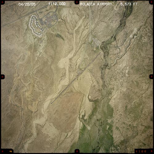 |
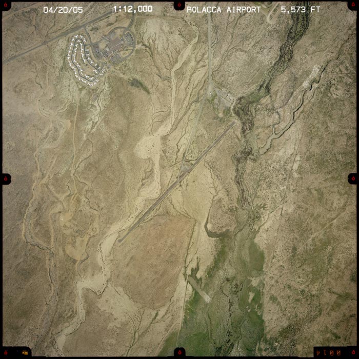
(Click on the photo
to enlarge) |
Images and information placed above are from
http://www.airport-data.com/airport/P10/
http://www.dot.state.az.us/aviation/airports/airports_list.asp?FAA=P10
We
thank them for the data!
| General
Info |
| Country |
United
States |
| State |
ARIZONA
|
| FAA ID |
P10 |
| Latitude |
35.791672
35� 47' 30.02" N |
| Longitude |
-110.423467
110� 25' 24.48" W |
| Elevation |
5573 feet
1699 meters |
| Magnetic
Variation |
011� E
(01/05) |
| Operating
Agency |
U.S.CIVIL
AIRPORT WHEREIN PERMIT COVERS USE BY TRANSIT MILITARY AIRCRAFT |
We don't guarantee the information is fresh and accurate. The data may be wrong or outdated.
For more up-to-date information please refer to other sources.
|
|