 |
|
|
|
|
|
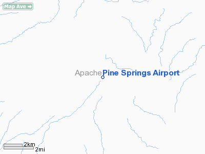
Location & QuickFacts
|
FAA Information
Effective: |
2005-10-27 |
|
Airport Identifier: |
45AZ |
|
Longitude/Latitude: |
109-16-33.3500W/35-24-03.0790N
-109.275931/35.400855 (Estimated) |
|
Elevation: |
6930 ft / 2112.26 m (Estimated) |
|
Land: |
30 acres |
|
From nearest
city: |
0
nautical miles E of Pine Springs, AZ |
|
Location: |
Apache County, AZ |
|
Magnetic Variation: |
12E (1985) |
Owner & Manager
|
Ownership: |
Publicly owned |
|
Owner: |
Navajo Tribe |
|
Address: |
Box 706
Window Rock, AZ 86515 |
|
Phone number: |
602-871-6283 |
|
Manager: |
Jim Pomeroyy |
|
Address: |
Box 706
Window Rock, AZ 86515 |
|
Phone number: |
602-871-6283 |
Airport Operations
and Facilities
|
Airport Use: |
Open to public |
|
Wind indicator: |
Yes |
|
Segmented
Circle: |
No |
|
Control Tower: |
No |
|
Attendance
Schedule: |
UNATNDD |
|
Landing fee
charge: |
No |
|
Sectional
chart: |
Phoenix |
|
Region: |
AWP - Western-Pacific |
|
Boundary ARTCC: |
ZAB - Albuquerque |
|
Tie-in FSS: |
PRC - Prescott |
|
FSS on Airport: |
No |
|
FSS Phone: |
928-778-7810 |
|
FSS Toll Free: |
1-800-WX-BRIEF |
Airport Services
|
Airframe Repair: |
NONE |
|
Power Plant
Repair: |
NONE |
|
Bottled Oxygen: |
NONE |
|
Bulk Oxygen: |
NONE |
Runway Information
Runway 05/23
|
Dimension: |
2275 x 100
ft / 693.4 x 30.5 m |
|
Surface: |
DIRT,
|
|
|
Runway 05 |
Runway 23 |
|
Traffic Pattern: |
Left |
Left |
|
Runway End Identifier: |
No |
No |
|
Centerline Lights: |
No |
No |
|
Touchdown Lights: |
No |
No |
|
Radio Navigation Aids
|
ID |
Type |
Name |
Ch |
Freq |
Var |
Dist |
|
AWR |
NDB |
Window
Rock |
|
254.00 |
12E |
18.8 nm |
|
GUP |
VORTAC |
Gallup |
098X |
115.10 |
14E |
20.3 nm |
|
ZUN |
VORTAC |
Zuni |
081X |
113.40 |
14E |
26.8 nm |
Remarks
-
WATER TANK 1 MI NE. LIVESTOCK
& NO RGLR MAINT.
-
VFR ONLY.
Operational Statistics
|
Aircraft Operations: |
5/Month |
|
General Aviation Local: |
16.7% |
|
General Aviation Itinerant: |
83.3% |
Pine Springs Airport
Address:
Apache County, AZ
Tel:
602-871-6283
Images and information placed above are from
http://www.airport-data.com/airport/45AZ/
We
thank them for the data!
| General Info |
| Country |
United
States |
| State |
ARIZONA
|
| FAA ID |
45AZ |
| Latitude |
35-24-03.079N
|
| Longitude |
109-16-33.350W
|
| Elevation |
6930 feet
|
| Near City |
PINE SPRINGS
|
We don't guarantee the information is fresh and accurate. The data may be wrong or outdated.
For more up-to-date information please refer to other sources.
|
|


