 |
|
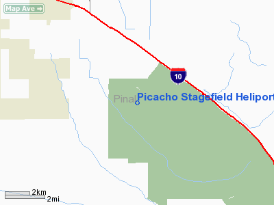
Picacho Stagefield Heliport |
|
|
Location & QuickFacts
|
FAA Information
Effective: |
2005-10-27 |
|
Airport Identifier: |
PCA |
|
Longitude/Latitude: |
111-28-30.0000W/32-39-30.0000N
-111.475000/32.658333 (Estimated) |
|
Elevation: |
1675 ft / 510.54 m (Estimated) |
|
Land: |
0
acres |
|
From nearest
city: |
4
nautical miles SE of Picacho, AZ |
|
Location: |
Pinal County, AZ |
|
Magnetic Variation: |
12E (1995) |
Owner & Manager
|
Ownership: |
Army owned |
|
Owner: |
Arizona Army National Guard |
|
Address: |
Asf No 2 Silverball Ahp
Marana, AZ 85653-9598 |
|
Phone number: |
520-682-4631 |
|
Manager: |
Maj. Nettles |
|
Address: |
Silverbell Ahp
Marana, AZ 85653-9398 |
|
Phone number: |
520-682-4631 |
Airport Operations
and Facilities
|
Wind indicator: |
Yes |
|
Segmented
Circle: |
No |
|
Control Tower: |
Yes |
|
Sectional
chart: |
Phoenix |
|
Region: |
AWP - Western-Pacific |
|
Boundary ARTCC: |
ZAB - Albuquerque |
|
Tie-in FSS: |
PRC - Prescott |
|
FSS on Airport: |
No |
|
FSS Phone: |
928-778-7810 |
|
FSS Toll Free: |
1-800-WX-BRIEF |
Airport Communications
Runway Information
Helipad H1
|
Dimension: |
1500
x 75 ft / 457.2 x 22.9 m |
|
Surface: |
ASPH,
|
|
|
Runway H1 |
Runway |
|
Traffic Pattern: |
Left |
Left |
|
Helipad H2
|
Dimension: |
1500
x 75 ft / 457.2 x 22.9 m |
|
Surface: |
ASPH,
|
|
|
Runway H2 |
Runway |
|
Traffic Pattern: |
Left |
Left |
|
Helipad H3
|
Dimension: |
1500
x 75 ft / 457.2 x 22.9 m |
|
Surface: |
ASPH,
|
|
|
Runway H3 |
Runway |
|
Traffic Pattern: |
Left |
Left |
|
Helipad H4
|
Dimension: |
1500
x 75 ft / 457.2 x 22.9 m |
|
Surface: |
ASPH,
|
|
|
Runway H4 |
Runway |
|
Traffic Pattern: |
Left |
Left |
|
Radio Navigation Aids
|
ID |
Type |
Name |
Ch |
Freq |
Var |
Dist |
|
AVQ |
NDB |
Marana |
|
245.00 |
12E |
19.8
nm |
|
RYN |
NDB |
Ryan |
|
338.00 |
12E |
35.1
nm |
|
RBJ |
NDB |
Robles |
|
220.00 |
12E |
35.6
nm |
|
CHD |
NDB |
Chandler |
|
407.00 |
12E |
40.2
nm |
|
DMA |
TACAN |
Davis
Monthan |
123X |
|
12E |
42.5
nm |
|
TFD |
VORTAC |
Stanfield |
095X |
114.80 |
12E |
25.8
nm |
|
IWA |
VORTAC |
Willie |
080X |
113.30 |
13E |
39.8
nm |
|
TUS |
VORTAC |
Tucson |
107X |
116.00 |
12E |
44.2
nm |
Remarks
-
OPERATED AS SCHEDULED
BY AZ ARNG. PPR FOR USE DSN 853-2700/2526 AND COML (520) 682-4631
SILVERBELL BASE OPNS. MILITARY HELIPORT ONLY.
-
EXTSV HELICOPTER
TRAINING ON AND INVOF HELIPORT.
-
FOR SELF-ANNOUNCE
USE FREQ 148.75.
-
OPER AS SKED BY
AZ ARNG, PPR DSN 853-5631, C520-616-5631. SILVER BELL NGHP OPS
BASED AT PINAL AIRPARK (MZJ).
Picacho Stagefield Heliport
Address:
Pinal County,
AZ
Tel:
520-682-4631
Images and information placed above are from
http://www.airport-data.com/airport/PCA/
We
thank them for the data!
| General
Info |
| Country |
United
States |
| State |
ARIZONA
|
| FAA ID |
PCA |
| Latitude |
32-39-30.000N
|
| Longitude |
111-28-30.000W
|
| Elevation |
1675 feet
|
| Near City |
PICACHO
|
We don't guarantee the information is fresh and accurate. The data may be wrong or outdated.
For more up-to-date information please refer to other sources.
|
|


