
|
 |
|
||||
|
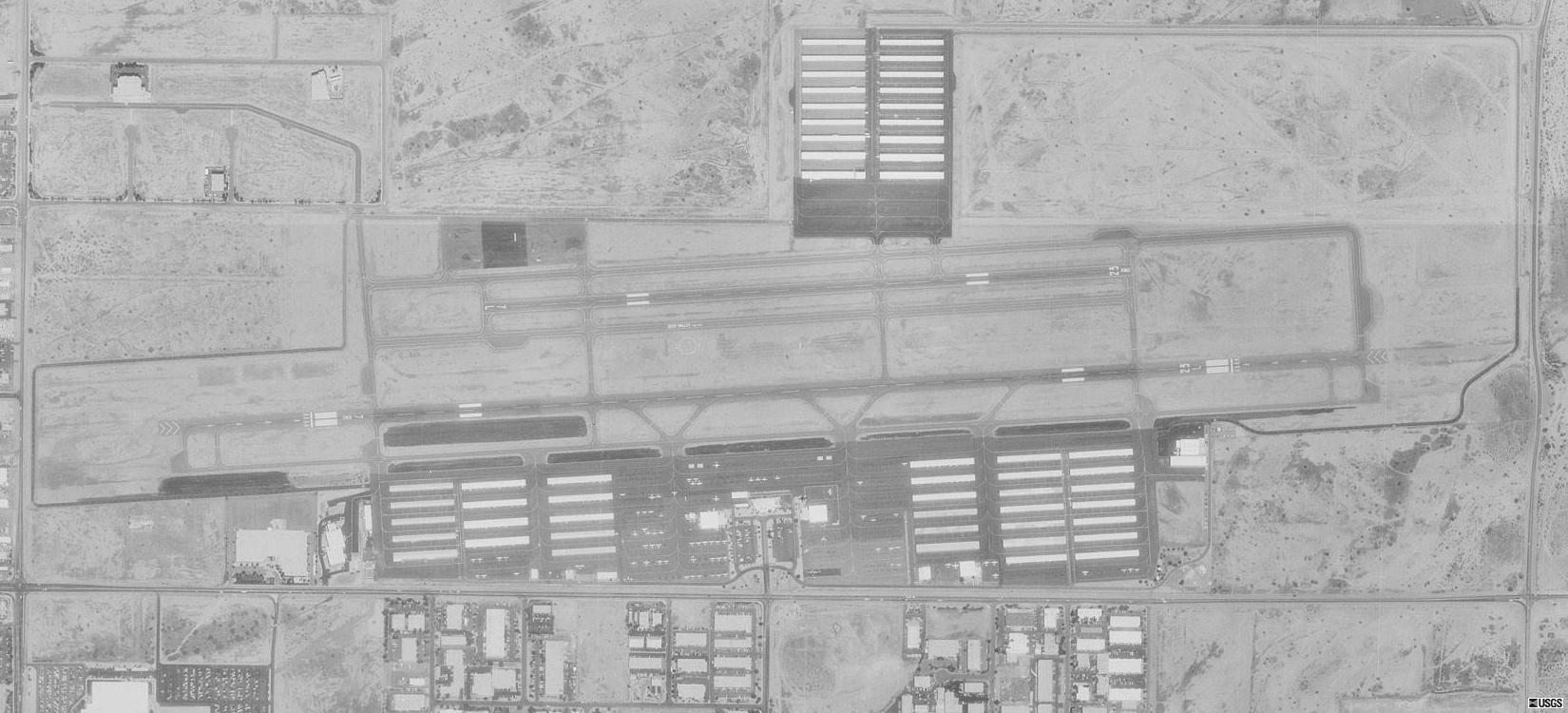
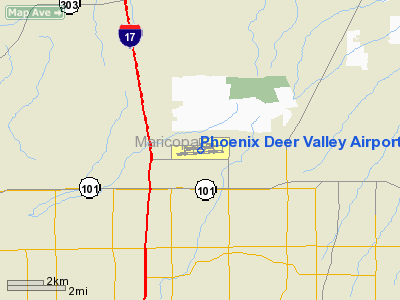
Phoenix Deer Valley Airport (IATA: DVT, ICAO: KDVT, FAA LID: DVT) is a public use airport located 15 nautical miles (28 km) north of the central business district of Phoenix, a city in Maricopa County, Arizona, United States. It is owned by the City of Phoenix. According to the FAA's National Plan of Integrated Airport Systems for 2009–2013, it is categorized as a reliever airport for the Phoenix Sky Harbor International Airport. In 2009, it recorded 402,335 aircraft movements, making it the 22nd busiest airport in the world in terms of aircraft movements. UsageIn 2009, Deer Valley was the busiest general aviation airport and 14th busiest in the United States. There is no scheduled airline service. However charter service is still available through several companies. Two large flight training academies, Westwind School of Aeronautics and TransPac Aviation Academy, are located at Deer Valley. These two schools account for a majority of operations at the airport. Facilities and aircraftPhoenix Deer Valley Airport covers an area of 914 acres (370 ha) at an elevation of 1,478 feet (450 m) above mean sea level. It has two asphalt paved runways: 7R/25L is 8,197 by 100 feet (2,498 x 30 m) and 7L/25R is 4,508 by 75 feet (1,374 x 23 m). For the 12-month period ending December 31, 2008, the airport had 376,504 aircraft operations, an average of 1,031 per day: 65% general aviation, 35% military and <1% scheduled commercial. At that time there were 987 aircraft based at this airport: 85% single-engine, 10% multi-engine, 2% jet, 2% helicopter, <1% glider, and <1% military. The above content comes from Wikipedia and is published under free licenses – click here to read more.
About Phoenix Deer Valley AirportPhoenix Deer Valley Airport is a general aviation reliever airport for Phoenix Sky Harbor International Airport. The airport is home to more than 1,250 based aircraft and had more than 352,000 takeoffs and landings in 2004.
|
||||||||||||||||||||||||||||||||||||||||||||||||||||||||||||||||||||||||||||||||||||||||||||||||||||||||||||||||||||||||||||||||||||||||||||||||||||||||||||||||||||||||||||||||||||||||||||||||||||||||||||||||||||||||||||||||||||||||||||||||||||||||||||||||||||||||||||||||||||||||||||||||||||||||||||||||||||||||||||||||||||||||||||||||||||||||||||||||||||||||||||||||||||||||||||||||||||||||||
|
FAA Information Effective: |
2005-10-27 |
|
Airport Identifier: |
DVT |
| Longitude/Latitude: |
112-04-57.2210W/33-41-17.9400N |
|
Elevation: |
1478 ft / 450.49 m (Surveyed) |
| Land: |
914 acres |
|
From nearest city: |
15 nautical miles N of Phoenix, AZ |
| Location: |
Maricopa County, AZ |
|
Magnetic Variation: |
12E (2000) |
|
Ownership: |
Publicly owned |
|
Owner: |
City Of Phoenix |
| Address: |
3400 Sky Harbor Blvd |
|
Phone number: |
602-273-3300 |
| Manager: |
Ken Mckinney |
|
Address: |
702 W Deer Valley Dr |
| Phone number: |
623-869-0975 |
|
Airport Use: |
Open to public |
| Wind indicator: |
Yes |
|
Segmented Circle: |
Yes |
| Control Tower: |
Yes |
|
Attendance Schedule: |
ALL/ALL/0600-2100 |
| Lighting Schedule: |
DUSK-DAWN |
|
Beacon Color: |
Clear-Green (lighted land airport) |
| Landing fee charge: |
No |
|
Sectional chart: |
Phoenix |
| Region: |
AWP - Western-Pacific |
|
Boundary ARTCC: |
ZAB - Albuquerque |
| Tie-in FSS: |
PRC - Prescott |
|
FSS on Airport: |
No |
| FSS Phone: |
928-778-7810 |
|
FSS Toll Free: |
1-800-WX-BRIEF |
| NOTAMs Facility: |
DVT (NOTAM-d service avaliable) |
|
Federal Agreements: |
NGY |
|
CTAF: |
118.400 |
|
Fuel available: |
100LLA |
|
Airframe Repair: |
MAJOR |
|
Power Plant Repair: |
MAJOR |
| Bottled Oxygen: |
HIGH |
|
Bulk Oxygen: |
HIGH |
|
Dimension: |
4500 x 75
ft / 1371.6 x 22.9 m |
||||||||||||||||||||||||||||||||||||||||||
| Surface: |
ASPH, Good Condition |
||||||||||||||||||||||||||||||||||||||||||
| Weight Limit: |
Single wheel: 20000 lbs. |
||||||||||||||||||||||||||||||||||||||||||
| Edge Lights: |
Medium |
||||||||||||||||||||||||||||||||||||||||||
|
|||||||||||||||||||||||||||||||||||||||||||
|
Dimension: |
8208 x 100
ft / 2501.8 x 30.5 m |
|||||||||||||||||||||||||||||||||||||||||||||
| Surface: |
ASPH, Good Condition |
|||||||||||||||||||||||||||||||||||||||||||||
| Weight Limit: |
Single
wheel: 40000 lbs. |
|||||||||||||||||||||||||||||||||||||||||||||
| Edge Lights: |
Medium |
|||||||||||||||||||||||||||||||||||||||||||||
|
||||||||||||||||||||||||||||||||||||||||||||||
|
ID |
Type |
Name |
Ch |
Freq |
Var |
Dist |
|
SDL |
NDB |
Scottsdale |
|
224.00 |
12E |
9.4 nm |
|
FFZ |
NDB |
Falcon Field |
|
281.00 |
12E |
22.2 nm |
|
CHD |
NDB |
Chandler |
|
407.00 |
12E |
28.9 nm |
|
LUF |
TACAN |
Luke |
077X |
|
13E |
17.4 nm |
|
PXR |
VORTAC |
Phoenix |
103X |
115.60 |
12E |
16.3 nm |
|
IWA |
VORTAC |
Willie |
080X |
113.30 |
13E |
31.7 nm |
|
BXK |
VORTAC |
Buckeye |
043X |
110.60 |
14E |
39.8 nm |
|
TFD |
VORTAC |
Stanfield |
095X |
114.80 |
12E |
49.0 nm |
|
PHX |
VOT |
Phoenix Sky Harbor |
|
109.00 |
|
15.7 nm |
|
Aircraft based on field: |
923 |
|
Single Engine Airplanes: |
815 |
|
Multi Engine Airplanes: |
75 |
|
Helicopters: |
13 |
|
Military: |
20 |
|
Aircraft Operations: |
797/Day |
|
General Aviation Local: |
99.8% |
|
Military: |
0.2% |
Phoenix Deer Valley Airport
702 W. Deer Valley Dr.
Phoenix, AZ
Tel 623-869-0975
URL: http://phoenix.gov/AVIATION/deervalley/about/index.html
| General Info | |
|---|---|
| Country | United States |
| State | ARIZONA |
| FAA ID | DVT |
| Latitude | 33-41-17.940N |
| Longitude | 112-04-57.221W |
| Elevation | 1478 feet |
| Near City | PHOENIX |

 |
|
Copyright 2004-2026 © by Airports-Worldwide.com, Vyshenskoho st. 36, Lviv 79010, Ukraine Legal Disclaimer |
 Deer
Valley Municipal Airport was built in 1960 as a private airfield
with a single runway. This simple facility had no control tower
and very limited amenities. In 1971, the City of Phoenix purchased
the 482 acre site. Operations began inauspiciously, with a temporary
air traffic control tower sitting atop a four foot mound of dirt.
Locals joked that the mobile unit looked more like a hot dog stand.
They were not too far off. The aging piece of equipment was actually
being used as a hothouse for growing tomatoes before being called
back into service for the airport.
Deer
Valley Municipal Airport was built in 1960 as a private airfield
with a single runway. This simple facility had no control tower
and very limited amenities. In 1971, the City of Phoenix purchased
the 482 acre site. Operations began inauspiciously, with a temporary
air traffic control tower sitting atop a four foot mound of dirt.
Locals joked that the mobile unit looked more like a hot dog stand.
They were not too far off. The aging piece of equipment was actually
being used as a hothouse for growing tomatoes before being called
back into service for the airport. 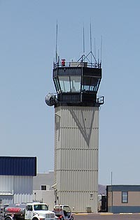 In 1975,
a new terminal was constructed and the FAA began directing air traffic.
Moving into a modern control tower, the FAA replaced Deer Valley's
four hard working radio operators with 26 air traffic controllers.
The airport also became home to the Phoenix Police Department who
utilize a 12,000 square foot hangar for their citywide helicopter
operations.
In 1975,
a new terminal was constructed and the FAA began directing air traffic.
Moving into a modern control tower, the FAA replaced Deer Valley's
four hard working radio operators with 26 air traffic controllers.
The airport also became home to the Phoenix Police Department who
utilize a 12,000 square foot hangar for their citywide helicopter
operations.