 |
|
|
|
|
|
Location & QuickFacts
|
FAA Information
Effective: |
2005-10-27 |
|
Airport Identifier: |
L25 |
|
Longitude/Latitude: |
114-02-46.8580W/36-05-36.9500N
-114.046349/36.093597 (Estimated) |
|
Elevation: |
2941 ft / 896.42 m (Estimated) |
|
Land: |
8
acres |
|
From nearest
city: |
3
nautical miles N of Meadview, AZ |
|
Location: |
Mohave County, AZ |
|
Magnetic Variation: |
14E (1985) |
Owner & Manager
|
Ownership: |
Publicly owned |
|
Owner: |
National Park Service
LAKE MEAD NATIONAL RECREATION AREA. |
|
Address: |
601 Nevada Highway
Boulder City, NV 89005 |
|
Phone number: |
702-293-8908 |
|
Manager: |
National Park Service
AMGR BRUCE LENNON |
|
Address: |
601 Nevada Highway
Boulder City, NV 89005 |
|
Phone number: |
702-293-8908 |
Airport Operations
and Facilities
|
Airport Use: |
Open to public |
|
Wind indicator: |
Yes |
|
Control Tower: |
No |
|
Attendance
Schedule: |
UNATNDD |
|
Landing fee
charge: |
No |
|
Sectional
chart: |
Las Vegas |
|
Region: |
AWP - Western-Pacific |
|
Boundary ARTCC: |
ZLA - Los Angeles |
|
Tie-in FSS: |
PRC - Prescott |
|
FSS on Airport: |
No |
|
FSS Phone: |
928-778-7810 |
|
FSS Toll Free: |
1-800-WX-BRIEF |
|
NOTAMs Facility: |
PRC (NOTAM-d service avaliable) |
Airport Communications
Runway Information
Runway 01/19
|
Dimension: |
2900 x 110
ft / 883.9 x 33.5 m
RWY 01/19 RY 01/19 550 FT STOPWAY SOUTH OF RY 01 COVERED WITH
LARGE LOOSE ROCKS & LOW VEGETATION.
RWY 01/19 CENTER 50 FT IS CLEAR OF VEGETATION. GRAVEL APRON
AREA LCTD WEST SIDE OF RY 19 NEAR APCH END. |
|
Surface: |
DIRT,
Good Condition
RY 01/19 EAST 15 FT AND WEST 40 FT OF RY WIDTH, FULL LENGTH
OF RY, ARE ROUGH WITH LOOSE GRAVEL. |
|
|
Runway 01 |
Runway 19 |
|
Traffic Pattern: |
Right |
Left |
|
Radio Navigation Aids
|
ID |
Type |
Name |
Ch |
Freq |
Var |
Dist |
|
LSV |
TACAN |
Nellis |
012X |
|
15E |
48.4 nm |
|
PGS |
VORTAC |
Peach
Springs |
057X |
112.00 |
15E |
37.3 nm |
|
BLD |
VORTAC |
Boulder
City |
114X |
116.70 |
15E |
40.2 nm |
|
MMM |
VORTAC |
Mormon
Mesa |
090X |
114.30 |
16E |
42.1 nm |
Remarks
-
BE ALERT TO WILDLIFE ON INVOF
ARPT.
-
SCATTERED +5 FT BUSHES ALONG
THE EAST AND WEST SIDE OF RY 01/19.
-
SIGNS 1050 FT FM RY 01, 90 FT
LEFT; 200 FT FM RY 19, 110 FT LEFT.
-
VFR, PUBLIC USE.
Operational Statistics
|
Aircraft Operations: |
25/Month |
|
Air Taxi: |
66.7% |
|
General Aviation Itinerant: |
33.3% |
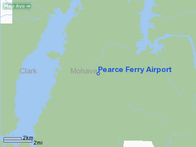
Pearce Ferry Airport
Address: Meadview, AZ
Tel:
702-293-8908
Images and information placed above are from
http://www.airport-data.com/airport/L25/
We thank them for the data!
| General Info |
| Country |
United
States |
| State |
ARIZONA
|
| FAA ID |
L25 |
| Latitude |
36-05-36.950N
|
| Longitude |
114-02-46.858W
|
| Elevation |
2941 feet
|
| Near City |
MEADVIEW
|
We don't guarantee the information is fresh and accurate. The data may be wrong or outdated.
For more up-to-date information please refer to other sources.
|
|


