 |
|
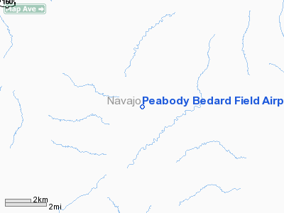
Peabody Bedard Field Airport |
|
|
Location
& QuickFacts
| FAA Information Effective: |
2005-10-27 |
| Airport Identifier: |
38AZ |
| Longitude/Latitude: |
110-25-04.4930W/36-28-17.9940N
-110.417915/36.471665 (Estimated) |
| Elevation: |
6564
ft / 2000.71 m (Estimated) |
| Land: |
0
acres |
| From nearest city: |
17
nautical miles SW of Kayenta, AZ |
| Location: |
Navajo
County, AZ |
| Magnetic Variation: |
13E
(1985) |
Owner
& Manager
| Ownership: |
Privately
owned |
| Owner: |
Peabody
Coal Company |
| Address: |
2836
W. Shamrell Blvd
Flagstaff, AZ 86001 |
| Phone number: |
928-214-8328 |
| Manager: |
Peabody
Flight Dept |
| Address: |
2836
W. Shamrell Blvd
Flagstaff, AZ 86001 |
| Phone number: |
928-214-8328 |
Airport
Operations and Facilities
| Airport Use: |
Private |
| Wind indicator: |
Yes |
| Segmented Circle: |
No |
| Control Tower: |
No |
| Attendance Schedule: |
UNATNDD |
| Lighting Schedule: |
RDO-CTL
ACTVT MIRL RY 02/20 - FREQ 122.8. |
| Sectional chart: |
Las
Vegas |
| Region: |
AWP
- Western-Pacific |
| Boundary ARTCC: |
ZDV
- Denver |
| Tie-in FSS: |
PRC
- Prescott |
| FSS Phone: |
928-778-7810 |
| FSS Toll Free: |
1-800-WX-BRIEF |
| NOTAMs Facility: |
(NOTAM-d
service avaliable) |
Airport
Communications
Runway
Information
Runway
02/20
| Dimension: |
7500
x 75 ft / 2286.0 x 22.9 m |
| Surface: |
ASPH,
|
| Edge Lights: |
Medium |
| |
Runway
02 |
Runway
20 |
| Traffic Pattern: |
Left |
Left |
| Markings: |
Non-precision
instrument, Fair Condition |
Non-precision
instrument, Fair Condition |
| VASI: |
2-box
on left side |
2-box
on left side |
| Visual Glide Angle: |
3.00� |
3.00� |
| Runway End Identifier: |
Yes |
Yes |
|
Radio
Navigation Aids
| ID |
Type |
Name |
Ch |
Freq |
Var |
Dist |
| PBY |
NDB |
Peabody |
|
259.00 |
13E |
0.3
nm |
| TBC |
VORTAC |
Tuba
City |
082X |
113.50 |
15E |
46.3
nm |
Address: Navajo
County, AZ
Tel:
928-214-8328
Images and information placed above are from
http://www.airport-data.com/airport/38AZ/
We thank them for the data!
| General Info
|
| Country |
United States
|
| State |
ARIZONA
|
| FAA ID |
38AZ
|
| Latitude |
36-28-17.994N
|
| Longitude |
110-25-04.493W
|
| Elevation |
6547 feet
|
| Near City |
KAYENTA
|
We don't guarantee the information is fresh and accurate. The data may be wrong or outdated.
For more up-to-date information please refer to other sources.
|
|


