 |
|
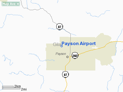
| Payson Airport |
| IATA: PJB – ICAO: KPAN – FAA LID: PAN |
| Summary |
| Airport type |
Public |
| Owner |
Town of Payson |
| Location |
Payson, Arizona |
| Elevation AMSL |
5,157 ft / 1,572 m |
| Coordinates |
34°15′25″N 111°20′21″W / 34.25694°N 111.33917°W / 34.25694; -111.33917 |
| Runways |
| Direction |
Length |
Surface |
| ft |
m |
| 6/24 |
5,500 |
1,676 |
Asphalt |
| Helipads |
| Number |
Length |
Surface |
| ft |
m |
| H1 |
50 |
15 |
Concrete |
| Statistics (2005) |
| Aircraft operations |
41,850 |
| Based aircraft |
41 |
| Source: Federal Aviation Administration |
Payson Airport (IATA: PJB, ICAO: KPAN, FAA LID: PAN) is a public airport located one mile (2 km) west of the central business district of Payson, a town in Gila County, Arizona, United States. The airport covers 80 acres and has one runway and one helipad. It is mostly used for general aviation, and is host to a number of fire-fighting aircraft during the summer fire season.
Although most U.S. airports use the same three-letter location identifier for the FAA and IATA, Payson Airport is assigned PAN by the FAA and PJB by the IATA (which assigned PAN to Pattani, Thailand).
The above content comes from Wikipedia and is published under free licenses – click here to read more.
Location & QuickFacts
|
FAA
Information Effective: |
2005-10-27 |
|
Airport Identifier: |
PAN |
|
Longitude/Latitude: |
111-20-21.3210W/34-15-24.6110N
-111.339256/34.256836 (Estimated) |
|
Elevation: |
5157 ft / 1571.85 m (Surveyed) |
|
Land: |
65 acres |
|
From nearest city: |
1
nautical miles W of Payson, AZ |
|
Location: |
Gila County, AZ |
|
Magnetic Variation: |
12E (2005) |
Owner & Manager
|
Ownership: |
Publicly owned |
|
Owner: |
Town Of Payson |
|
Address: |
303 N Beeline Highway
Payson, AZ 85541 |
|
Phone number: |
928-474-5242 |
|
Manager: |
Ted Anderson |
|
Address: |
802 W. Airport Rd
Payson, AZ 85540 |
|
Phone number: |
928-472-4748 |
Airport Operations and Facilities
|
Airport
Use: |
Open to public |
|
Wind indicator: |
Yes |
|
Segmented Circle: |
Yes |
|
Control Tower: |
No |
|
Attendance Schedule: |
ALL/ALL/0800-1700 |
|
Lighting Schedule: |
DUSK-DAWN
MIRL PRESET LOW INTST, TO INCR INTST ACTVT - CTAF. PAPI RY 24 OPER
CONTINUOUSLY. |
|
Beacon Color: |
Clear-Green (lighted land airport) |
|
Landing fee charge: |
No
OVERNIGHT PARKING FEE. |
|
Sectional chart: |
Phoenix |
|
Region: |
AWP - Western-Pacific |
|
Boundary ARTCC: |
ZAB - Albuquerque |
|
Tie-in FSS: |
PRC - Prescott |
|
FSS on Airport: |
No |
|
FSS Phone: |
928-778-7810 |
|
FSS Toll Free: |
1-800-WX-BRIEF |
|
NOTAMs Facility: |
PRC (NOTAM-d service avaliable) |
|
Federal Agreements: |
NGY |
Airport Communications
|
CTAF: |
122.800 |
|
Unicom: |
122.800 |
Airport Services
|
Fuel
available: |
100LLA
FOR FUEL AFTER HRS CALL (928) 601-2460. |
|
Airframe
Repair: |
MINOR |
|
Power
Plant Repair: |
MINOR |
|
Bottled Oxygen: |
NONE |
|
Bulk Oxygen: |
NONE |
Runway Information
Runway 06/24
|
Dimension: |
5500 x 75 ft /
1676.4 x 22.9 m |
|
Surface: |
ASPH,
Good Condition |
|
Weight Limit: |
Single
wheel: 40000 lbs.
Dual wheel: 50000 lbs.
Dual tandem wheel: 100000 lbs. |
|
Edge Lights: |
Medium
PERIMETER LGTS OPER ON PHOTOCELL. |
|
|
Runway 06 |
Runway 24 |
|
Longitude: |
111-20-53.1190W |
111-19-49.5470W |
|
Latitude: |
34-15-18.0170N |
34-15-31.1930N |
|
Elevation: |
5139.00 ft |
5157.00 ft |
|
Alignment: |
76 |
127 |
|
Traffic Pattern: |
Left |
Right |
|
Markings: |
Basic, Good Condition |
Basic, Good Condition |
|
VASI: |
|
2-light PAPI on left side |
|
Touchdown Lights: |
No |
No |
|
Obstruction: |
,
50:1 slope to clear
6 FT GATE 78 FT FM RY END 126 FT RIGHT OF CNTRLN. |
15
ft trees, 200.0 ft from runway, 100 ft left of centerline |
|
Helipad H1
|
Dimension: |
50 x 50 ft / 15.2
x 15.2 m |
|
Surface: |
CONC,
Good Condition |
|
|
Runway H1 |
Runway |
|
Traffic Pattern: |
Left |
Left |
|
Radio Navigation Aids
|
ID |
Type |
Name |
Ch |
Freq |
Var |
Dist |
|
SDL |
NDB |
Scottsdale |
|
224.00 |
12E |
47.2 nm |
Remarks
-
PAEW RY 06/24 & TWY.
-
7 INCH RUTS ADJ RWY & TWY
SAFETY AREAS.
-
RY 24 CALM WIND RY.
-
NOISE ABATEMENT PROCEDURES IN
EFFECT CTC - AWOS 119.325.
-
AVOID ARR/DEP OVER TOWN BELOW
1,000 FT.
Based Aircraft
|
Aircraft based on field: |
85 |
|
Single Engine Airplanes: |
80 |
|
Multi Engine Airplanes: |
2 |
|
Helicopters: |
1 |
|
Gliders: |
2 |
Operational Statistics
|
Aircraft Operations: |
116/Day |
|
Air Taxi: |
4.2% |
|
General Aviation Local: |
59.5% |
|
General Aviation Itinerant: |
35.7% |
|
Military: |
0.6% |
Payson Airport
Address: Payson, AZ
Tel:
928-474-5242, 928-472-4748
Images
and information placed above are from
http://www.airport-data.com/airport/PAN/
We
thank them for the data!
| General Info |
| Country |
United
States |
| State |
ARIZONA
|
| FAA ID |
PAN |
| Latitude |
34-15-24.611N
|
| Longitude |
111-20-21.321W
|
| Elevation |
5157 feet
|
| Near City |
PAYSON
|
We don't guarantee the information is fresh and accurate. The data may be wrong or outdated.
For more up-to-date information please refer to other sources.
|
|


