 |
|
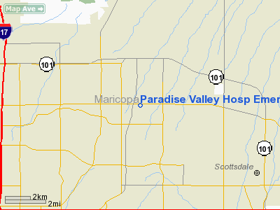
Paradise Valley Hospital Emergency Department Heliport |
Location & QuickFacts
|
FAA
Information Effective: |
2005-10-27 |
|
Airport Identifier: |
AZ95 |
|
Longitude/Latitude: |
111-59-49.5310W/33-38-22.1460N
-111.997092/33.639485 (Estimated) |
|
Elevation: |
1461 ft / 445.31 m (Estimated) |
|
Land: |
0
acres |
|
From nearest city: |
17 nautical miles SW of Phoenix, AZ |
|
Location: |
Maricopa County, AZ |
|
Magnetic Variation: |
13E (1985) |
Owner & Manager
|
Ownership: |
Privately owned |
|
Owner: |
Columbia/hca Of Azinc |
|
Address: |
3929 E. Bell Road
Phoenix, AZ 85032 |
|
Phone number: |
602-867-5694 |
|
Manager: |
David Stoppenbrink |
|
Address: |
3929 E. Bell Road
Phoenix, AZ 85032 |
|
Phone number: |
602-867-5694 |
Airport Operations and Facilities
|
Airport
Use: |
Private
MEDICAL. |
|
Wind indicator: |
Yes |
|
Segmented Circle: |
No |
|
Control Tower: |
No |
|
Attendance Schedule: |
UNATNDD |
|
Sectional chart: |
Phoenix |
|
Region: |
AWP - Western-Pacific |
|
Boundary ARTCC: |
ZAB - Albuquerque |
|
Tie-in FSS: |
PRC - Prescott |
|
FSS Phone: |
928-778-7810 |
|
FSS Toll Free: |
1-800-WX-BRIEF |
Runway Information
Helipad H1
|
Dimension: |
40
x 40 ft / 12.2 x 12.2 m |
|
Surface: |
CONC,
|
|
|
Runway H1 |
Runway |
|
Traffic Pattern: |
Left |
Left |
|
Radio Navigation Aids
|
ID |
Type |
Name |
Ch |
Freq |
Var |
Dist |
|
SDL |
NDB |
Scottsdale |
|
224.00 |
12E |
4.5 nm |
|
FFZ |
NDB |
Falcon
Field |
|
281.00 |
12E |
17.0 nm |
|
CHD |
NDB |
Chandler |
|
407.00 |
12E |
24.3 nm |
|
LUF |
TACAN |
Luke |
077X |
|
13E |
20.1 nm |
|
PXR |
VORTAC |
Phoenix |
103X |
115.60 |
12E |
12.5 nm |
|
IWA |
VORTAC |
Willie |
080X |
113.30 |
13E |
26.6 nm |
|
BXK |
VORTAC |
Buckeye |
043X |
110.60 |
14E |
42.9 nm |
|
TFD |
VORTAC |
Stanfield |
095X |
114.80 |
12E |
45.5 nm |
|
PHX |
VOT |
Phoenix
Sky Harbor |
|
109.00 |
|
12.3 nm |
Remarks
-
CONDL-VFR PRIVATE USE ONLY.
Paradise Valley Hosp Emerg Dept Heliport
Address:17
nautical miles SW of Phoenix, AZ
Tel:
602-867-5694
Images
and information placed above are from
http://www.airport-data.com/airport/AZ95/
We
thank them for the data!
| General Info |
| Country |
United
States |
| State |
ARIZONA
|
| FAA ID |
AZ95 |
| Latitude |
33-38-22.146N
|
| Longitude |
111-59-49.531W
|
| Elevation |
1461 feet
|
| Near City |
PHOENIX
|
We don't guarantee the information is fresh and accurate. The data may be wrong or outdated.
For more up-to-date information please refer to other sources.
|
|


