 |
|
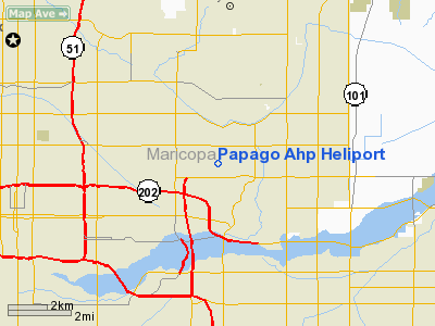
Papago Army Heliport (Ahp Heliport) |
Location & QuickFacts
|
FAA
Information Effective: |
2005-10-27 |
|
Airport Identifier: |
P18 |
|
Longitude/Latitude: |
111-57-49.5240W/33-28-19.1580N
-111.963757/33.471988 (Estimated) |
|
Elevation: |
1250 ft / 381.00 m (Estimated) |
|
Land: |
0
acres |
|
From nearest city: |
0
nautical miles of Phoenix, AZ |
|
Location: |
Maricopa County, AZ |
|
Magnetic Variation: |
13E (1985) |
Owner & Manager
|
Ownership: |
Army owned |
|
Owner: |
Us Army Atca-aso |
|
Address: |
Cameron Station
Alexandria, VA 22314 |
|
Address: |
|
Airport Operations and Facilities
|
Segmented Circle: |
No |
|
Control Tower: |
No |
|
Attendance Schedule: |
ALL/MON-FRI/1330-2300Z EXC HOL |
|
Lighting Schedule: |
RDO-CTL
PILOT CTL LGT PAD C, 126.05. |
|
Sectional chart: |
Los Angeles |
|
Region: |
AWP - Western-Pacific |
|
Boundary ARTCC: |
ZAB - Albuquerque |
|
Tie-in FSS: |
PRC - Prescott |
|
FSS on Airport: |
No |
|
FSS Phone: |
928-778-7810 |
|
FSS Toll Free: |
1-800-WX-BRIEF |
Airport Services
|
Bottled Oxygen: |
NONE |
|
Bulk Oxygen: |
NONE |
Runway Information
Helipad H1
|
Dimension: |
600 x 400 ft /
182.9 x 121.9 m |
|
Surface: |
ASPH,
|
|
|
Runway H1 |
Runway |
|
Traffic Pattern: |
Left |
Left |
|
Radio Navigation Aids
|
ID |
Type |
Name |
Ch |
Freq |
Var |
Dist |
|
SDL |
NDB |
Scottsdale |
|
224.00 |
12E |
9.9 nm |
|
FFZ |
NDB |
Falcon
Field |
|
281.00 |
12E |
11.6 nm |
|
CHD |
NDB |
Chandler |
|
407.00 |
12E |
14.6 nm |
|
LUF |
TACAN |
Luke |
077X |
|
13E |
21.2 nm |
|
PXR |
VORTAC |
Phoenix |
103X |
115.60 |
12E |
2.4 nm |
|
IWA |
VORTAC |
Willie |
080X |
113.30 |
13E |
18.7 nm |
|
TFD |
VORTAC |
Stanfield |
095X |
114.80 |
12E |
35.3 nm |
|
BXK |
VORTAC |
Buckeye |
043X |
110.60 |
14E |
43.2 nm |
|
GBN |
VORTAC |
Gila
Bend |
113X |
116.60 |
14E |
47.3 nm |
|
PHX |
VOT |
Phoenix
Sky Harbor |
|
109.00 |
|
3.1 nm |
Remarks
-
ARPT CLOSED TO H-46 AND H-53
COPTER AND F/W ACFT. REMAIN S OF CLSD RWY 8-26 FOR PAD LDG.
-
NS ABTMT - NOISE ABATEMENT
PROGRAM IN EFFECT.
-
RSTD: PPR DSN 853-2796.
-
FUEL - O/R - J8.
-
MISC - TFC ADVSY FR PHOENIX
APP. LTD MAINT.
Heliport
Communications
| WX ASOS at
PHX (3 nm SW): |
PHONE 602-231-8557 |
| WX ASOS at
SDL (9 nm N): |
PHONE 480-483-3049 |
| WX ASOS at
DVT (14 nm NW): |
PHONE 623-587-7764 |
| WX AWOS-3
at CHD (14 nm SE): |
128.325 (480-814-9952) [AWOS-3
AVAILABLE WHEN ATCT CLOSED] |
| WX AWOS-3
at GEU (17 nm W): |
119.425 (623-877-8609) |
| WX AWOS-3
at IWA (18 nm SE): |
133.50 (480-988-9428) |
- SKY HARBOR ATIS - 127.575 ADVSY
SVC - 41.50 126.05 244.3
Papago Ahp Heliport
Address: Phoenix, AZ
Tel:
928-778-7810
Images
and information placed above are from
http://www.airport-data.com/airport/P18/
We
thank them for the data!
| General Info |
| Country |
United
States |
| State |
ARIZONA
|
| FAA ID |
P18 |
| Latitude |
33-28-19.158N
|
| Longitude |
111-57-49.524W
|
| Elevation |
1250 feet
|
| Near City |
PHOENIX
|
We don't guarantee the information is fresh and accurate. The data may be wrong or outdated.
For more up-to-date information please refer to other sources.
|
|


