 |
|
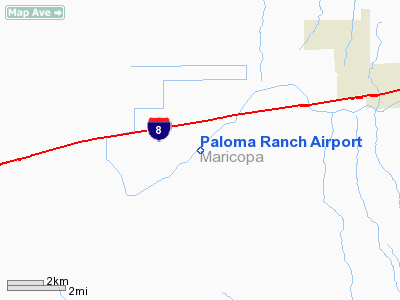
Location & QuickFacts
|
FAA
Information Effective: |
2005-10-27 |
|
Airport Identifier: |
29AZ |
|
Longitude/Latitude: |
112-54-00.6100W/32-54-20.1720N
-112.900169/32.905603 (Estimated) |
|
Elevation: |
737 ft / 224.64 m (Surveyed) |
|
Land: |
125 acres |
|
From nearest city: |
1
nautical miles SW of Paloma, AZ |
|
Location: |
Maricopa County, AZ |
|
Magnetic Variation: |
13E (1985) |
Owner & Manager
|
Ownership: |
Privately owned |
|
Owner: |
Paloma Irrigation & Drainage Dist |
|
Address: |
Hc-01 Box 175
Gila Bend, AZ 85337 |
|
Phone number: |
928-683-2236 |
|
Manager: |
John Utz |
|
Address: |
Hc-01 Box 175
Gila Bend, AZ 85337 |
|
Phone number: |
928-683-2236 |
Airport Operations and Facilities
|
Airport
Use: |
Private |
|
Wind indicator: |
Yes |
|
Segmented Circle: |
No |
|
Control Tower: |
No |
|
Attendance Schedule: |
UNATNDD |
|
Lighting Schedule: |
RDO-CTL
ACTIVATE LIRL 03/21 122.8. |
|
Landing fee charge: |
No |
|
Sectional chart: |
Phoenix |
|
Region: |
AWP - Western-Pacific |
|
Boundary ARTCC: |
ZAB - Albuquerque |
|
Tie-in FSS: |
PRC - Prescott |
|
FSS on Airport: |
No |
|
FSS Phone: |
928-778-7810 |
|
FSS Toll Free: |
1-800-WX-BRIEF |
Airport Communications
Airport Services
|
Fuel
available: |
A |
|
Airframe
Repair: |
NONE |
|
Power
Plant Repair: |
NONE |
Runway Information
Runway 03/21
|
Dimension: |
5500 x 60 ft /
1676.4 x 18.3 m |
|
Surface: |
ASPH,
|
|
Edge Lights: |
Low |
|
|
Runway 03 |
Runway 21 |
|
Traffic Pattern: |
Left |
Left |
|
Runway 18/36
|
Dimension: |
3000 x 150 ft
/ 914.4 x 45.7 m |
|
Surface: |
DIRT,
|
|
|
Runway 18 |
Runway 36 |
|
Traffic Pattern: |
Left |
Left |
|
Radio Navigation Aids
|
ID |
Type |
Name |
Ch |
Freq |
Var |
Dist |
|
LUF |
TACAN |
Luke |
077X |
|
13E |
46.1 nm |
|
GBN |
VORTAC |
Gila
Bend |
113X |
116.60 |
14E |
11.8 nm |
|
BXK |
VORTAC |
Buckeye |
043X |
110.60 |
14E |
33.1 nm |
Remarks
-
EXISTED PRIOR TO 05/15/59.
Paloma Ranch Airport
Address: 1
nautical miles SW of Paloma, AZ
Tel:
928-683-2236
Images
and information placed above are from
http://www.airport-data.com/airport/29AZ
We
thank them for the data!
| General Info |
| Country |
United
States |
| State |
ARIZONA
|
| FAA ID |
29AZ |
| Latitude |
32-54-20.172N
|
| Longitude |
112-54-00.610W
|
| Elevation |
737 feet
|
| Near City |
PALOMA
|
We don't guarantee the information is fresh and accurate. The data may be wrong or outdated.
For more up-to-date information please refer to other sources.
|
|


