 |
|
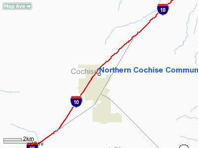
Northern Cochise Community Hospital Heliport |
Location & QuickFacts
|
FAA
Information Effective: |
2005-10-27 |
|
Airport Identifier: |
AZ16 |
|
Longitude/Latitude: |
109-50-02.2440W/32-16-20.2640N
-109.833957/32.272296 (Estimated) |
|
Elevation: |
4174 ft / 1272.24 m (Estimated) |
|
Land: |
0
acres |
|
From nearest city: |
1
nautical miles N of Willcox, AZ |
|
Location: |
Cochise County, AZ |
|
Magnetic Variation: |
12E (1985) |
Owner & Manager
|
Ownership: |
Privately owned |
|
Owner: |
Northern Cochise Comm Hosp |
|
Address: |
901 Rex Allen Drive
Willcox, AZ 85643 |
|
Phone number: |
602-384-3541 |
|
Manager: |
Chris Cronberg |
|
Address: |
901 Rex Allen Drive
Willcox, AZ 85643 |
|
Phone number: |
602-384-3541 |
Airport Operations and Facilities
|
Airport
Use: |
Private
MEDICAL. |
|
Wind
indicator: |
Yes |
|
Segmented
Circle: |
No |
|
Control
Tower: |
No |
|
Attendance
Schedule: |
ALL/ALL/ALL |
|
Lighting
Schedule: |
RDO-CTL |
|
Landing
fee charge: |
No |
|
Sectional
chart: |
Phoenix |
|
Region: |
AWP - Western-Pacific |
|
Boundary
ARTCC: |
ZAB - Albuquerque |
|
Tie-in
FSS: |
PRC - Prescott |
|
FSS
on Airport: |
No |
|
FSS
Phone: |
928-778-7810 |
|
FSS
Toll Free: |
1-800-WX-BRIEF |
Runway Information
Helipad H1
|
Dimension: |
40
x 40 ft / 12.2 x 12.2 m
40' X 40' CONC PAD WITHIN A 100' X 100' LNDG AREA. |
|
Surface: |
CONC,
|
|
Edge Lights: |
Low
RECESSED PAD LGTS 60W PERIPHERAL AMBER 40W AND FLOODS LGTS ON FENCE
500W. |
| |
Runway
H1 |
Runway
|
|
Traffic Pattern: |
Left |
Left |
|
Radio Navigation Aids
|
ID |
Type |
Name |
Ch |
Freq |
Var |
Dist |
|
DAO |
NDB |
Dragoo |
|
410.00 |
13E |
48.8 nm |
|
ARH |
TACAN |
Fort
Huachuca |
053X |
|
12E |
48.7 nm |
|
FHU |
VOR |
Libby |
|
113.60 |
13E |
48.9 nm |
|
CIE |
VORTAC |
Cochise |
105X |
115.80 |
13E |
14.9 nm |
|
SSO |
VORTAC |
San
Simon |
101X |
115.40 |
13E |
29.0 nm |
|
DUG |
VORTAC |
Douglas |
025X |
108.80 |
13E |
49.5 nm |
Remarks
Northern Cochise Community
Hospital Heliport
Address: Cochise
County, AZ
Tel:
602-384-3541
Images
and information placed above are from
http://www.airport-data.com/airport/AZ16/ We thank
them for the data!
| General Info |
| Country |
United
States |
| State |
ARIZONA
|
| FAA ID |
AZ16
|
| Latitude |
32-16-20.264N |
|
Longitude |
109-50-02.244W |
|
Elevation |
4174
feet |
| Near
City |
WILLCOX
|
We don't guarantee the information is fresh and accurate. The data may be wrong or outdated.
For more up-to-date information please refer to other sources.
|
|


