 |
|
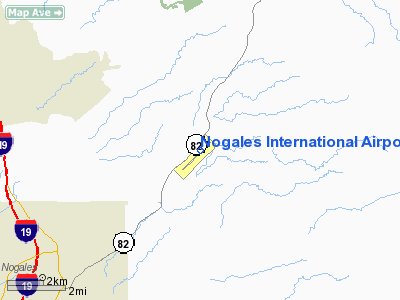
Nogales International Airport |
| Nogales International Airport |
| IATA: OLS – ICAO: KOLS – FAA LID: OLS |
| Summary |
| Airport type |
Public |
| Owner |
Santa Cruz County |
| Serves |
Nogales, Arizona |
| Elevation AMSL |
3,955 ft / 1,205 m |
| Coordinates |
31°25′04″N 110°50′52″W / 31.41778°N 110.84778°W / 31.41778; -110.84778 |
| Runways |
| Direction |
Length |
Surface |
| ft |
m |
| 3/21 |
7,199 |
2,194 |
Asphalt |
| Helipads |
| Number |
Length |
Surface |
| ft |
m |
| H1 |
97 |
30 |
Concrete |
| Statistics (2008) |
| Aircraft operations |
35,600 |
| Based aircraft |
22 |
| Source: Federal Aviation Administration |
Nogales International Airport (IATA: OLS, ICAO: KOLS, FAA LID: OLS) is a county-owned public-use airport located seven nautical miles (13 km) northeast of the central business district of Nogales, a city in Santa Cruz County, Arizona, United States. It is also a port of entry into the United States. The airport is included in the FAA's National Plan of Integrated Airport Systems for 2009–2013, which categorizes it as a general aviation facility. It is not served by any commercial airlines as of May 2009.
Facilities and aircraft
Nogales International Airport covers an area of 340 acres (138 ha) at an elevation of 3,955 feet (1,205 m) above mean sea level. It has one runway designated 3/21 with an asphalt surface measuring is 7,199 by 100 feet (2,194 x 30 m). It also has one helipad designated H1 with a concrete surface measuring 97 by 97 feet (30 x 30 m).
For the 12-month period ending April 17, 2008, the airport had 35,600 aircraft operations, an average of 97 per day: 83% general aviation, 11% military and 6% air taxi. At that time there were 22 aircraft based at this airport: 73% single-engine and 27% multi-engine.
The above content comes from Wikipedia and is published under free licenses – click here to read more.
Location & QuickFacts
|
FAA
Information Effective: |
2005-10-27 |
|
Airport Identifier: |
OLS |
|
Longitude/Latitude: |
110-50-52.4000W/31-25-03.8000N
-110.847889/31.417722 (Estimated) |
|
Elevation: |
3955 ft / 1205.48 m (Surveyed) |
|
Land: |
300 acres |
|
From nearest city: |
7
nautical miles NE of Nogales, AZ |
|
Location: |
Santa Cruz County, AZ |
|
Magnetic Variation: |
12E (1985) |
Owner & Manager
|
Ownership: |
Publicly owned |
|
Owner: |
Santa Cruz County |
|
Address: |
County Courthouse
Nogales, AZ 85621 |
|
Phone number: |
520-375-7930 |
|
Manager: |
Lawrence Tiffin |
|
Address: |
Hcr Box 197
Nogales, AZ 85621 |
|
Phone number: |
520-281-9120 |
Airport Operations and Facilities
|
Airport
Use: |
Open to public |
|
Wind indicator: |
Yes |
|
Segmented Circle: |
Yes |
|
Control Tower: |
No |
|
Attendance Schedule: |
ALL/ALL/0700-1900 |
|
Lighting Schedule: |
DUSK-DAWN
ACTVT MIRL RY 03/21 - CTAF. |
|
Beacon Color: |
Clear-Green (lighted land airport) |
|
Landing fee charge: |
No |
|
Sectional chart: |
Phoenix |
|
Region: |
AWP - Western-Pacific |
|
Boundary ARTCC: |
ZAB - Albuquerque |
|
Tie-in FSS: |
PRC - Prescott |
|
FSS on Airport: |
No |
|
FSS Phone: |
928-778-7810 |
|
FSS Toll Free: |
1-800-WX-BRIEF |
|
NOTAMs Facility: |
OLS (NOTAM-d service avaliable) |
|
Federal Agreements: |
NGY |
Airport Communications
|
CTAF: |
122.800 |
|
Unicom: |
122.800 |
Airport Services
|
Fuel
available: |
100LLA |
|
Airframe
Repair: |
MAJOR |
|
Power
Plant Repair: |
MAJOR |
|
Bottled Oxygen: |
NONE |
|
Bulk Oxygen: |
NONE |
Runway Information
Runway 03/21
|
Dimension: |
7199
x 90 ft / 2194.3 x 27.4 m |
|
Surface: |
ASPH,
Good Condition |
|
Weight Limit: |
Single
wheel: 21000 lbs.
GWT S-21 FOR CNTR 90', REMAINDER OF RWY WIDTH IS S-7. |
|
Edge Lights: |
Medium |
|
|
Runway 03 |
Runway 21 |
|
Longitude: |
110-51-22.4500W |
110-50-22.3910W |
|
Latitude: |
31-24-39.1890N |
31-25-28.3810N |
|
Elevation: |
3839.00 ft |
3955.00 ft |
|
Alignment: |
46 |
127 |
|
Traffic Pattern: |
Left |
Left |
|
Markings: |
Basic, Good Condition |
Nonstandard, Good Condition
RY 21 MARKED AS NPI, DSPLCD THLD MARKINGS YELLOW. |
|
Crossing Height: |
68.00 ft |
17.00 ft |
|
Displaced threshold: |
0.00 ft |
1912.00 ft |
|
VASI: |
2-box SAVASI on left side |
2-box SAVASI on left side |
|
Visual Glide Angle: |
3.00� |
4.00� |
|
Runway End Identifier: |
No |
No |
|
Centerline Lights: |
No |
No |
|
Touchdown Lights: |
No |
No |
|
Obstruction: |
,
50:1 slope to clear
RY 03 - 6 FT BRUSH, 90 FT FM RY END, 47 FT RIGHT. |
175
ft hill, 3000.0 ft from runway, 16:1 slope to clear
RY 21 29:1 TO DSPLCD THR. |
|
Helipad H1
|
Dimension: |
97
x 97 ft / 29.6 x 29.6 m |
|
Surface: |
CONC,
|
|
|
Runway H1 |
Runway |
|
Traffic Pattern: |
Left |
Left |
|
Radio Navigation Aids
|
ID |
Type |
Name |
Ch |
Freq |
Var |
Dist |
|
ENZ |
NDB |
Nogales |
|
394.00 |
12E |
0.2
nm |
|
NOG |
NDB |
Nogales |
|
265.00 |
13E |
13.9
nm |
|
DAO |
NDB |
Dragoo |
|
410.00 |
13E |
27.7
nm |
|
RYN |
NDB |
Ryan |
|
338.00 |
12E |
46.2
nm |
|
RBJ |
NDB |
Robles |
|
220.00 |
12E |
47.4
nm |
|
ARH |
TACAN |
Fort
Huachuca |
053X |
|
12E |
28.0
nm |
|
DMA |
TACAN |
Davis
Monthan |
123X |
|
12E |
44.6
nm |
|
FHU |
VOR |
Libby |
|
113.60 |
13E |
27.3
nm |
|
OLS |
VOR/DME |
Nogales |
019X |
108.20 |
12E |
0.2
nm |
|
TUS |
VORTAC |
Tucson |
107X |
116.00 |
12E |
40.9
nm |
Remarks
-
RY 21 DESIGNATED CALM
WIND RY.
-
CALL PRESCOTT AFSS ON
122.4 TO CLOSE ALL FLIGHT PLANS.
-
RY 03 IS CLSD TO TGL.
-
PRIMARY SFC TO RY 03
DOES NOT MEET GRADIENT STANDARDS FOR SAFETY.
Based Aircraft
|
Aircraft
based on field: |
35 |
|
Single Engine Airplanes: |
27 |
|
Multi Engine Airplanes: |
6 |
|
Jet Engine Airplanes: |
2 |
Operational Statistics
|
Aircraft
Operations: |
84/Day |
|
Air Taxi: |
7.6% |
|
General Aviation
Local: |
38.0% |
|
General Aviation
Itinerant: |
47.9% |
|
Military: |
6.6% |
Nogales International Airport
Address: Nogales, AZ
Tel:
520-375-7930,
520-281-9120
Images and information placed above are
from
http://www.airport-data.com/airport/OLS/
We thank them for the data!
| General
Info |
| Country |
United
States |
| State |
ARIZONA
|
| ICAO ID |
KOLS |
| FAA ID |
OLS |
| Time |
UTC-7
|
| Latitude |
31.417722
31� 25' 03.80" N |
| Longitude |
-110.847889
110� 50' 52.40" W |
| Elevation |
3955 feet
1205 meters |
| Type |
Civil
|
| Magnetic
Variation |
011� E
(01/05) |
| Beacon |
Yes |
| Operating
Agency |
U.S.CIVIL
AIRPORT WHEREIN PERMIT COVERS USE BY TRANSIT MILITARY AIRCRAFT |
| International
Clearance Status |
Airport
of Entry |
We don't guarantee the information is fresh and accurate. The data may be wrong or outdated.
For more up-to-date information please refer to other sources.
|
|


