 |
|
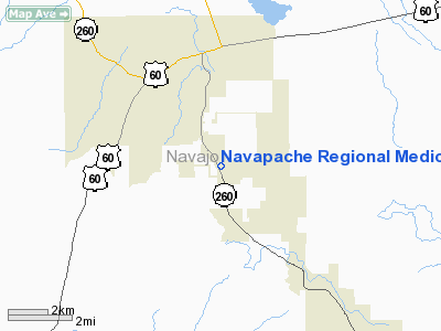
Navapache Regional Medical Center Heliport |
Location & QuickFacts
|
FAA
Information Effective: |
2005-10-27 |
|
Airport Identifier: |
AZ75 |
|
Longitude/Latitude: |
110-01-05.3930W/34-12-12.1530N
-110.018165/34.203376 (Estimated) |
|
Elevation: |
6500 ft / 1981.20 m (Estimated) |
|
Land: |
0
acres |
|
From nearest city: |
4
nautical miles S of Show Low, AZ |
|
Location: |
Navajo County, AZ |
|
Magnetic Variation: |
12E (1985) |
Owner & Manager
|
Ownership: |
Privately owned |
|
Owner: |
Navapache Regional Med Ctr |
|
Address: |
2200 Show Low Lake Rd.
Show Low, AZ 85901 |
|
Phone number: |
602-537-4375 |
|
Manager: |
Navapache Regional Med Ctr |
|
Address: |
2200 Show Low Lake Rd.
Show Low, AZ 85901 |
|
Phone number: |
602-537-4375
EXT 271. |
Airport Operations and Facilities
|
Airport
Use: |
Private
MEDICAL USE. |
|
Wind indicator: |
Yes |
|
Segmented Circle: |
No |
|
Control Tower: |
No |
|
Attendance Schedule: |
ALL/ALL/ALL |
|
Lighting Schedule: |
PHONE REQ
FOR PERIMETER LGTS CALL 602-537-4375 EXTN 271. |
|
Sectional chart: |
Phoenix |
|
Region: |
AWP - Western-Pacific |
|
Boundary ARTCC: |
ZAB - Albuquerque |
|
Tie-in FSS: |
PRC - Prescott |
|
FSS on Airport: |
No |
|
FSS Phone: |
928-778-7810 |
|
FSS Toll Free: |
1-800-WX-BRIEF |
Runway Information
Helipad H1
|
Dimension: |
64
x 64 ft / 19.5 x 19.5 m |
|
Surface: |
CONC,
|
|
|
Runway H1 |
Runway |
|
Traffic Pattern: |
Left |
Left |
|
Radio Navigation Aids
|
ID |
Type |
Name |
Ch |
Freq |
Var |
Dist |
|
SOW |
NDB |
Show
Low |
|
206.00 |
13E |
3.9
nm |
|
SJN |
VORTAC |
St
Johns |
070X |
112.30 |
12E |
45.4
nm |
Remarks
-
(PRIVATE USE VFR ONLY)
VFR PVT USE, SPONSOR SHALL ENSURE OBSTRUCTION FREE INGRESS AND EGRESS.
-
VFR PRIVATE USE ONLY.
Navapache
Regional Medical Center Heliport
Address: Show Low, AZ
Tel:
602-537-4375
Images
and information placed above are from
http://www.airport-data.com/airport/AZ75/
We
thank them for the data!
| General Info |
| Country |
United
States |
| State |
ARIZONA
|
| FAA ID |
AZ75 |
| Latitude |
34-12-12.153N
|
| Longitude |
110-01-05.393W
|
| Elevation |
6500 feet
|
| Near City |
SHOW LOW
|
We don't guarantee the information is fresh and accurate. The data may be wrong or outdated.
For more up-to-date information please refer to other sources.
|
|


