 |
|
Location & QuickFacts
|
FAA
Information Effective: |
2005-10-27 |
|
Airport Identifier: |
19AZ |
|
Longitude/Latitude: |
111-51-54.5460W/34-36-18.0850N
-111.865152/34.605024 (Estimated) |
|
Elevation: |
3370 ft / 1027.18 m (Estimated) |
|
Land: |
0
acres |
|
From nearest city: |
3
nautical miles N of Camp Verde, AZ |
|
Location: |
Yavapai County, AZ |
|
Magnetic Variation: |
13E (1985) |
Owner & Manager
|
Ownership: |
Privately owned |
|
Owner: |
Marvin Manley |
|
Address: |
Po Box 3423
Camp Verde, AZ 86322 |
|
Phone number: |
520-567-3086 |
|
Manager: |
Montezuma Airport Assn |
|
Address: |
Po Box 1749
Camp Verde, AZ 86332 |
|
Phone number: |
520-567-0056 |
Airport Operations and Facilities
|
Airport
Use: |
Private |
|
Wind indicator: |
Yes |
|
Segmented Circle: |
No |
|
Control Tower: |
No |
|
Attendance Schedule: |
UNATNDD |
|
Sectional chart: |
Phoenix |
|
Region: |
AWP - Western-Pacific |
|
Boundary ARTCC: |
ZAB - Albuquerque |
|
Tie-in FSS: |
PRC - Prescott |
|
FSS on Airport: |
No |
|
FSS Phone: |
928-778-7810 |
|
FSS Toll Free: |
1-800-WX-BRIEF |
Airport Services
|
Airframe
Repair: |
NONE |
|
Power
Plant Repair: |
NONE |
Runway
Information
Runway 17/35
|
Dimension: |
3300
x 60 ft / 1005.8 x 18.3 m
60 FT ASPH SUPERIMPOSED ON 150'TURF. |
|
Surface: |
ASPH,
|
|
|
Runway 17 |
Runway 35 |
|
Traffic Pattern: |
Left |
Left |
|
Radio Navigation Aids
|
ID |
Type |
Name |
Ch |
Freq |
Var |
Dist |
|
PUU |
NDB |
Pulliam |
|
379.00 |
13E |
33.7
nm |
|
FLG |
VOR/DME |
Flagstaff |
085Y |
113.85 |
14E |
33.9
nm |
|
DRK |
VORTAC |
Drake |
088X |
114.10 |
14E |
31.0
nm |
|
PRC |
VOT |
Prescott |
|
110.00 |
|
27.7
nm |
Remarks
-
AIRSPACE STUDY NOT WARRANTED.
Based Aircraft
|
Aircraft
based on field: |
38 |
|
Single Engine Airplanes: |
36 |
|
Multi Engine Airplanes: |
2 |
Operational Statistics
|
Aircraft
Operations: |
74/Week |
|
General Aviation
Local: |
93.8% |
|
General Aviation
Itinerant: |
6.3% |
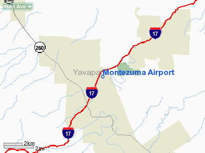
Montezuma Airport
Address: Yavapai
County, AZ
Tel:
520-567-0056
Images
and information placed above are from
http://www.airport-data.com/airport/19AZ/
We thank them for the
data!
| General
Info |
| Country |
United
States |
| State |
ARIZONA
|
| FAA ID |
19AZ
|
| Latitude |
34-36-18.085N
|
| Longitude |
111-51-54.546W
|
| Elevation |
3370 feet
|
| Near City |
CAMP VERDE
|
We don't guarantee the information is fresh and accurate. The data may be wrong or outdated.
For more up-to-date information please refer to other sources.
|
|


