Location & QuickFacts
|
FAA Information
Effective: |
2005-10-27 |
|
Airport Identifier: |
P03 |
|
Longitude/Latitude: |
109-41-23.0000W/31-22-16.0000N
-109.689722/31.371111 (Estimated) |
|
Elevation: |
4124
ft / 1257.00 m (Estimated) |
|
Land: |
500
acres |
|
From nearest city: |
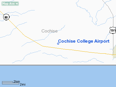
7 nautical miles W of Douglas, AZ |
|
Location: |
Cochise County, AZ |
|
Magnetic
Variation: |
12E (1985) |
Ownership:
Publicly owned
Owner:
Cochise College
Address: 4190 W. Hwy 80
Douglas, AZ 85607-6190
Phone number: 520-417-4114
ADDL PHONE 520-417-4101
Manager:
Carlos Cartagena
DIRECTOR OF AVIATION PROGRAMS
Address: Cochise Community College, 4190 W. Highway 80
Douglas, AZ 85607-9724
Phone number: 520-417-4114
Airport Operations and Facilities
|
Airport Use: |
Open
to public |
|
Wind indicator: |
Yes |
|
Segmented Circle: |
Yes |
|
Control Tower: |
No |
|
Attendance Schedule: |
ALL/MON-FRI/0645-1730 |
|
Lighting Schedule: |
DUSK-DAWN |
|
Beacon Color: |
Clear-Green (lighted land airport) |
|
Landing fee charge: |
No |
|
Sectional chart: |
Phoenix |
|
Region: |
AWP
- Western-Pacific |
|
Boundary ARTCC: |
ZAB
- Albuquerque |
|
Tie-in FSS: |
PRC
- Prescott |
|
FSS on Airport: |
No |
|
FSS Phone: |
928-778-7810 |
|
FSS Toll Free: |
1-800-WX-BRIEF |
|
NOTAMs Facility: |
PRC (NOTAM-d service avaliable) |
Airport Communications
|
CTAF: |
122.800 |
|
Unicom: |
122.800 |
Airport Services
|
Fuel available: |
100LL |
|
Airframe Repair: |
NONE |
|
Power Plant Repair: |
NONE |
Runway Information
Runway 05/23
|
Dimension: |
5303
x 72 ft / 1616.4 x 21.9 m |
|
Surface: |
ASPH,
Good Condition |
|
Edge Lights: |
Low |
|
|
Runway 05 |
Runway 23 |
|
Traffic
Pattern: |
Left |
Left |
|
Displaced
threshold: |
0.00 ft |
500.00 ft |
|
VASI: |
4-light PAPI on left side |
4-light PAPI on left side |
|
Visual Glide
Angle: |
3.00� |
3.00� |
|
Obstruction: |
15 ft road, 350.0 ft from runway, 149 ft
left of centerline, 10:1 slope to clear |
15 ft road, 600.0 ft from runway, 125 ft
left of centerline, 26:1 slope to clear |
|
Radio Navigation Aids
|
ID |
Type |
Name |
Ch |
Freq |
Var |
Dist |
|
DAO |
NDB |
Dragoo |
|
410.00 |
13E |
35.9 nm |
|
ARH |
TACAN |
Fort Huachuca |
053X |
|
12E |
35.7 nm |
|
FHU |
VOR |
Libby |
|
113.60 |
13E |
36.5 nm |
|
DUG |
VORTAC |
Douglas |
025X |
108.80 |
13E |
7.6 nm |
|
CIE |
VORTAC |
Cochise |
105X |
115.80 |
13E |
40.0 nm |
Remarks
-
UNMANNED
AERIAL VEHICAL OPERATING ON & INVOF ARPT.
-
E111 PROVIDED VFR
ONLY.
Based Aircraft
|
Aircraft
based on field: |
15 |
|
Single
Engine Airplanes: |
14 |
|
Multi
Engine Airplanes: |
1 |
Operational Statistics
|
Aircraft
Operations: |
152/Day |
|
Air
Taxi: |
0.9% |
|
General
Aviation Local: |
93.6% |
|
General
Aviation Itinerant: |
5.4% |
|
Military: |
0.1% |
Address: Cochise County, AZ
Tel:
520-417-4114