 |
|
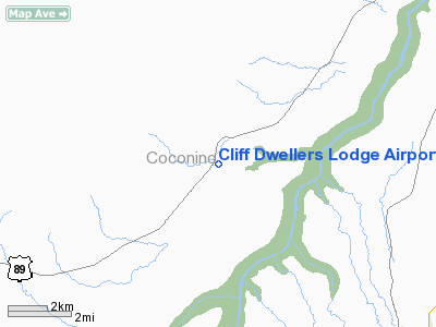
Cliff Dwellers Lodge Airport |
|
|
Location & QuickFacts
|
FAA Information
Effective: |
2005-10-27 |
|
Airport Identifier: |
AZ03 |
|
Longitude/Latitude: |
111-45-09.5900W/36-44-03.9510N
-111.752664/36.734431 (Estimated) |
|
Elevation: |
4217
ft / 1285.34 m (Surveyed) |
|
Land: |
68
acres |
|
From nearest city: |
7 nautical miles SW of Marble Canyon, AZ |
|
Location: |
Coconino County, AZ |
|
Magnetic
Variation: |
13E (1985) |
Ownership:
Privately owned
Owner:
U.s. Gov Bru Land Mgmt
Address: 411 E. 2nd
Vernal, UT 84078
Phone number: 801-789-3813
OR 800-433-8966.
Manager:
Ted C. Hatch
Address: Cliff Dwellers Lodge Rt 89-a
Marble Canyon, AZ 86036
CLIFF DWELLERS LODGE & TRADING CO.
Phone number: 602-355-2228
Airport Operations and Facilities
|
Airport Use: |
Private |
|
Wind indicator: |
Yes
WIND SOCK IS WORN & FADED HARD TO SEE FM THE AIR. |
|
Segmented
Circle: |
Yes |
|
Control
Tower: |
No |
|
Attendance
Schedule: |
UNATNDD |
|
Landing
fee charge: |
No |
|
Sectional
chart: |
Las Vegas |
|
Region: |
AWP - Western-Pacific |
|
Boundary
ARTCC: |
ZLA - Los Angeles |
|
Tie-in
FSS: |
PRC - Prescott |
|
FSS
on Airport: |
No |
|
FSS
Phone: |
928-778-7810 |
|
FSS
Toll Free: |
1-800-WX-BRIEF |
Airport Services
|
Airframe Repair: |
NONE |
|
Power Plant Repair: |
NONE |
|
Bottled Oxygen: |
NONE |
|
Bulk Oxygen: |
NONE |
Runway Information
Runway 04/22
|
Dimension: |
3820 x 40 ft / 1164.3 x 12.2 m
SOUTH 1900' OF RWY 60' WIDE AND NARROWS TO 40' ON NORTH END. |
|
Surface: |
DIRT,
Fair Condition |
|
|
Runway 04 |
Runway 22 |
|
Elevation: |
4210.00 ft |
0.00 ft |
|
Traffic
Pattern: |
Left |
Left |
|
Markings: |
None, |
None, |
|
Runway End
Identifier: |
No |
No |
|
Centerline
Lights: |
No |
No |
|
Touchdown
Lights: |
No |
No |
|
Obstruction: |
5 ft gnd, 160.0 ft from runway, 125 ft left
of centerline, 32:1 slope to clear |
8 ft gnd, 275.0 ft from runway, 100 ft right
of centerline, 34:1 slope to clear |
|
Radio Navigation Aids
|
ID |
Type |
Name |
Ch |
Freq |
Var |
Dist |
|
PGA |
VOR/DME |
Page |
123X |
117.60 |
13E |
18.8 nm |
|
TBC |
VORTAC |
Tuba City |
082X |
113.50 |
15E |
43.6 nm |
Remarks
-
LOW SHRUBS
ON RY 04/22 EDGES AND RY ENDS.
-
NO LINE
OF SIGHT BTN RWY ENDS.
-
RWY SFC
UNEVEN WITH LOOSE ROCKS.
-
CLIFFS
NORTH, NORTHWEST, WEST AND SOUTHWEST OF ARPT.
-
ESTABD PRIOR TO 5/15/59.
Based Aircraft
|
Aircraft
based on field: |
1 |
|
Single
Engine Airplanes: |
1 |
Operational Statistics
|
Aircraft
Operations: |
10/Week |
|
Air
Taxi: |
60.0% |
|
General
Aviation Local: |
20.0% |
|
General
Aviation Itinerant: |
20.0% |
Address: Coconino
County, AZ
Tel:
602-355-2228
Images and information placed above are from
http://www.airport-data.com/airport/AZ03/
We thank them for the data!
| General Info
|
| Country |
United States
|
| State |
ARIZONA
|
| FAA ID |
AZ03
|
| Latitude |
36-44-03.951N
|
| Longitude |
111-45-09.590W
|
| Elevation |
4217 feet
|
| Near City |
MARBLE CANYON
|
We don't guarantee the information is fresh and accurate. The data may be wrong or outdated.
For more up-to-date information please refer to other sources.
|
|


