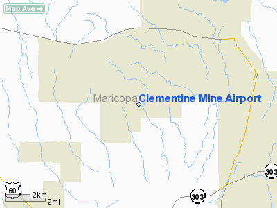
Location & QuickFacts
|
FAA Information
Effective: |
2005-10-27 |
|
Airport Identifier: |
AZ44 |
|
Longitude/Latitude: |
112-20-38.5880W/33-46-49.1270N
-112.344052/33.780313 (Estimated) |
|
Elevation: |
1530
ft / 466.34 m (Estimated) |
|
Land: |
0
acres |
|
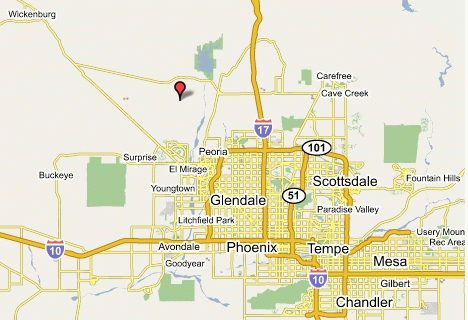
From nearest city: |
9 nautical miles NW of Sun City, AZ |
|
Location: |
Maricopa County, AZ |
|
Magnetic
Variation: |
13E (1985) |
Ownership:
Privately owned
Owner:
Robert Hicks
6441
E Mc Donald Dr Paradise Valley, AZ 85253
Phone number: 602-948-7823
Manager:
R.m.halagan
1902
N. 21st Place Phoenix, AZ 85006
Phone number: 602-244-1214
Airport Operations and Facilities
|
Airport Use: |
Private |
|
Wind indicator: |
Yes |
|
Segmented Circle: |
No |
|
Control Tower: |
No |
|
Attendance Schedule: |
UNATNDD |
|
Landing fee charge: |
No |
|
Sectional chart: |
Phoenix |
|
Region: |
AWP
- Western-Pacific |
|
Boundary ARTCC: |
ZAB
- Albuquerque |
|
Tie-in FSS: |
PRC
- Prescott |
|
FSS on Airport: |
No |
|
FSS Phone: |
928-778-7810 |
|
FSS Toll Free: |
1-800-WX-BRIEF |
Runway Information
Runway 12/30
|
Dimension: |
2400
x 50 ft / 731.5 x 15.2 m |
|
Surface: |
GRAVEL,
|
|
|
Runway 12 |
Runway 30 |
|
Traffic
Pattern: |
Left |
Left |
|
Radio Navigation Aids
|
ID |
Type |
Name |
Ch |
Freq |
Var |
Dist |
|
SDL |
NDB |
Scottsdale |
|
224.00 |
12E |
23.6 nm |
|
FFZ |
NDB |
Falcon Field |
|
281.00 |
12E |
36.1 nm |
|
CHD |
NDB |
Chandler |
|
407.00 |
12E |
40.9 nm |
|
LUF |
TACAN |
Luke |
077X |
|
13E |
14.7 nm |
|
PXR |
VORTAC |
Phoenix |
103X |
115.60 |
12E |
28.0 nm |
|
BXK |
VORTAC |
Buckeye |
043X |
110.60 |
14E |
31.1 nm |
|
IWA |
VORTAC |
Willie |
080X |
113.30 |
13E |
45.0 nm |
|
PHX |
VOT |
Phoenix Sky Harbor |
|
109.00 |
|
26.7 nm |
Remarks
-
LAND
300 DEG ONLY; RWY SLOPE IS UPHILL RAPIDLY; ALL TAKEOFFS DOWNHILL.
-
VFR; PVT USE ONLY.
Address: Maricopa
County, AZ
Tel:
602-244-1214