 |
|
|
|
|
|
Location & QuickFacts
|
FAA Information
Effective: |
2005-10-27 |
|
Airport Identifier: |
Z95 |
|
Longitude/Latitude: |
110-26-39.0000W/34-00-12.0000N
-110.444167/34.003333 (Estimated) |
|
Elevation: |
5037
ft / 1535.28 m (Estimated) |
|
Land: |
163
acres |
|
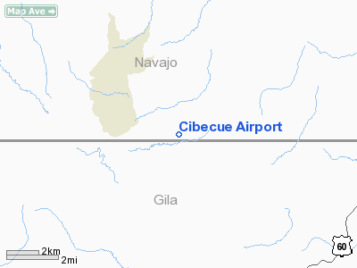
From nearest city: |
4
nautical miles SE of Cibecue, AZ |
|
Location: |
Navajo
County, AZ |
|
Magnetic
Variation: |
12E
(2000) |
Owner
& Manager
| Ownership: |
Publicly
owned |
| Owner: |
White
Mountain Apache Tribe |
| Address: |
P.o.
Box 700
Whiteriver, AZ 85941 |
| Phone number: |
520-338-4346 |
| Manager: |
Ken
Butler |
| Address: |
P.o.
Box 560
Whiteriver, AZ 85941 |
| Phone number: |
520-338-4346 |
Airport Operations and Facilities
|
Airport Use: |
Open
to public |
|
Segmented Circle: |
No |
|
Control Tower: |
No |
|
Attendance Schedule: |
UNATNDD |
|
Sectional chart: |
Phoenix |
|
Region: |
AWP
- Western-Pacific |
|
Boundary ARTCC: |
ZAB
- Albuquerque |
|
Responsible ARTCC: |
ZAB
- Albuquerque |
|
Tie-in FSS: |
PRC
- Prescott |
|
FSS Phone: |
928-778-7810 |
|
FSS Toll Free: |
1-800-WX-BRIEF |
|
NOTAMs Facility: |
PRC
(NOTAM-d service avaliable) |
|
Federal
Agreements: |
N |
Airport Communications
Runway Information
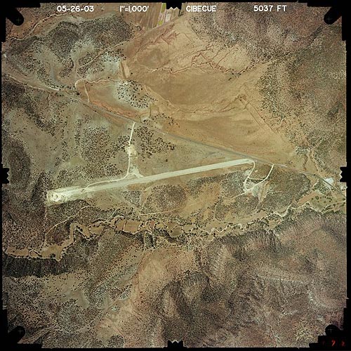
Runway 07/25
|
Dimension: |
4200
x 100 ft / 1280.2 x 30.5 m |
|
Surface: |
GRVL,
Fair Condition |
|
|
Runway 07 |
Runway 25 |
|
Traffic Pattern: |
Left |
Left |
|
Obstruction: |
|
15
ft road, 40.0 ft from runway |
|
Radio Navigation Aids
|
ID |
Type |
Name |
Ch |
Freq |
Var |
Dist |
|
SOW |
NDB |
Show
Low |
|
206.00 |
13E |
26.9
nm |
|
GAZ |
NDB |
Globe |
|
255.00 |
13E |
40.6
nm |
Remarks
-
PROVIDED
LANDING AREA IS OPERATED FOR PUBLIC USE, VFR OPNS ONLY AND SPONSOR
SHALL ENSURE OBSTRUCTION FREE ROUTES OF INGRESS AND EGRESS.
Based Aircraft
|
Aircraft based
on field: |
1 |
|
Single Engine Airplanes: |
1 |
Address: Navajo
County, AZ
Tel:
520-338-4346
Images and information placed above are from
http://www.airport-data.com/airport/Z95/
http://www.azdot.gov/aviation/airports/airports_list.asp?FAA=Z95
We thank them for the data!
| General Info
|
| Country |
United States
|
| State |
ARIZONA
|
| FAA ID |
Z95
|
| Latitude |
34-00-12.000N
|
| Longitude |
110-26-39.000W
|
| Elevation |
5037 feet
|
| Near City |
CIBECUE
|
We don't guarantee the information is fresh and accurate. The data may be wrong or outdated.
For more up-to-date information please refer to other sources.
|
|


