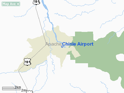
Location & QuickFacts
|
FAA Information
Effective: |
2005-10-27 |
|
Airport Identifier: |
04AZ |
|
Longitude/Latitude: |
109-33-02.3850W/36-09-15.0140N
-109.550663/36.154171 (Estimated) |
|
Elevation: |
5515
ft / 1680.97 m (Estimated) |
|
Land: |
20
acres |
|
From nearest city: |
0 nautical miles W of Chinle, AZ |
|
Location: |
Apache County, AZ |
|
Magnetic
Variation: |
13E (1985) |
Ownership:
Publicly owned
Owner:
The Navajo Tribe
Manager:
Paulson Chaco
Airport Operations
and Facilities
|
Airport
Use: |
Open to public |
|
Wind
indicator: |
Yes |
|
Segmented
Circle: |
No |
|
Control
Tower: |
No |
|
Attendance
Schedule: |
UNATNDD |
|
Landing
fee charge: |
No |
|
Sectional
chart: |
Denver |
|
Region: |
AWP - Western-Pacific |
|
Boundary
ARTCC: |
ZDV - Denver |
|
Tie-in
FSS: |
PRC - Prescott |
|
FSS
on Airport: |
No |
|
FSS
Phone: |
928-778-7810 |
|
FSS
Toll Free: |
1-800-WX-BRIEF |
|
Federal
Agreements: |
GY |
Airport Services
|
Airframe Repair: |
NONE |
|
Power Plant Repair: |
NONE |
|
Bottled Oxygen: |
NONE |
|
Bulk Oxygen: |
NONE |
Runway Information
Runway 17/35
|
Dimension: |
4200 x 60 ft / 1280.2 x 18.3 m |
|
Surface: |
DIRT, |
|
|
Runway 17 |
Runway 35 |
|
Traffic
Pattern: |
Right |
Left |
|
Runway
End Identifier: |
No |
No |
|
Centerline
Lights: |
No |
No |
|
Touchdown
Lights: |
No |
No |
|
Radio Navigation Aids
|
ID |
Type |
Name |
Ch |
Freq |
Var |
Dist |
|
AWR |
NDB |
Window Rock |
|
254.00 |
12E |
37.7 nm |
|
PBY |
NDB |
Peabody |
|
259.00 |
13E |
45.9 nm |
Remarks
-
VERY
SOFT WHEN WET. LOW SPOT AT SOUTH END OF RWY.
-
AIRSTRIP OCCASIONALLY
SMOOTHED BY GRADER
Based Aircraft
|
Aircraft
based on field: |
2 |
|
Single
Engine Airplanes: |
2 |
Operational Statistics
|
Aircraft
Operations: |
18/Week |
|
General
Aviation Local: |
88.9% |
|
General
Aviation Itinerant: |
11.1% |
Address: Apache County, AZ
Tel:
602-871-6498