 |
|
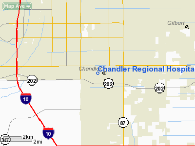
Chandler Municipal Airport |
Location & QuickFacts
|
FAA
Information Effective: |
2005-10-27 |
|
Airport Identifier: |
AZ76 |
|
Longitude/Latitude: |
111-52-22.5030W/33-17-53.1770N
-111.872918/33.298105 (Estimated) |
|
Elevation: |
1195
ft / 364.24 m (Estimated) |
|
Land: |
0
acres |
|
From nearest city: |
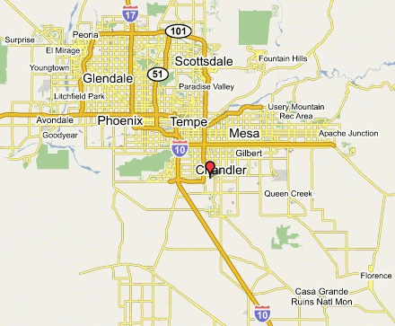
2 nautical miles SW of Chandler, AZ |
|
Location: |
Maricopa County, AZ |
|
Magnetic
Variation: |
13E (1985) |
Ownership:
Privately owned
Owner:
Chandler Regional Hospital
Manager:
Kaylor E. Shemberger, Pres.
Airport Operations and Facilities
|
Airport
Use: |
Private
MEDICAL. |
|
Wind indicator: |
Yes |
|
Segmented Circle: |
No |
|
Control Tower: |
No |
|
Attendance Schedule: |
ALL/ALL/ALL |
|
Lighting Schedule: |
PHONE REQ
FOR HELIPAD PERIMETER LIGHTS CALL 602-963-4561. |
|
Landing fee charge: |
No |
|
Sectional chart: |
Phoenix |
|
Region: |
AWP
- Western-Pacific |
|
Boundary ARTCC: |
ZAB
- Albuquerque |
|
Tie-in FSS: |
PRC
- Prescott |
|
FSS on Airport: |
No |
|
FSS Phone: |
928-778-7810 |
|
FSS Toll Free: |
1-800-WX-BRIEF |
Runway
Information
Helipad H1
|
Dimension: |
60 x 60 ft / 18.3 x 18.3 m |
|
Surface: |
ASPH, |
|
|
Runway H1 |
Runway |
|
Traffic
Pattern: |
Left |
Left |
|
Radio Navigation Aids
|
ID |
Type |
Name |
Ch |
Freq |
Var |
Dist |
|
CHD |
NDB |
Chandler |
|
407.00 |
12E |
3.8 nm |
|
FFZ |
NDB |
Falcon Field |
|
281.00 |
12E |
12.1 nm |
|
SDL |
NDB |
Scottsdale |
|
224.00 |
12E |
20.0 nm |
|
LUF |
TACAN |
Luke |
077X |
|
13E |
29.2 nm |
|
PXR |
VORTAC |
Phoenix |
103X |
115.60 |
12E |
9.5 nm |
|
IWA |
VORTAC |
Willie |
080X |
113.30 |
13E |
11.1 nm |
|
TFD |
VORTAC |
Stanfield |
095X |
114.80 |
12E |
24.8 nm |
|
GBN |
VORTAC |
Gila Bend |
113X |
116.60 |
14E |
45.3 nm |
|
BXK |
VORTAC |
Buckeye |
043X |
110.60 |
14E |
48.7 nm |
|
PHX |
VOT |
Phoenix Sky Harbor |
|
109.00 |
|
10.7 nm |
Remarks
Address: Maricopa County, AZ
Phone: 602-963-4561
Images and information placed above are from
http://www.airport-data.com/airport/AZ76/
http://www.lat-long.com/Arizona/Chandler-Regional-Hospital-Heliport_45330.html
We thank them for the data!
| General Info
|
| Country |
United States
|
| State |
ARIZONA
|
| FAA ID |
AZ76
|
| Latitude |
33-17-53.177N
|
| Longitude |
111-52-22.503W
|
| Elevation |
1195 feet
|
| Near City |
CHANDLER
|
We don't guarantee the information is fresh and accurate. The data may be wrong or outdated.
For more up-to-date information please refer to other sources.
|
|


