|
|
Casa Grande Municipal Airport |
| Casa Grande Municipal Airport |
 |
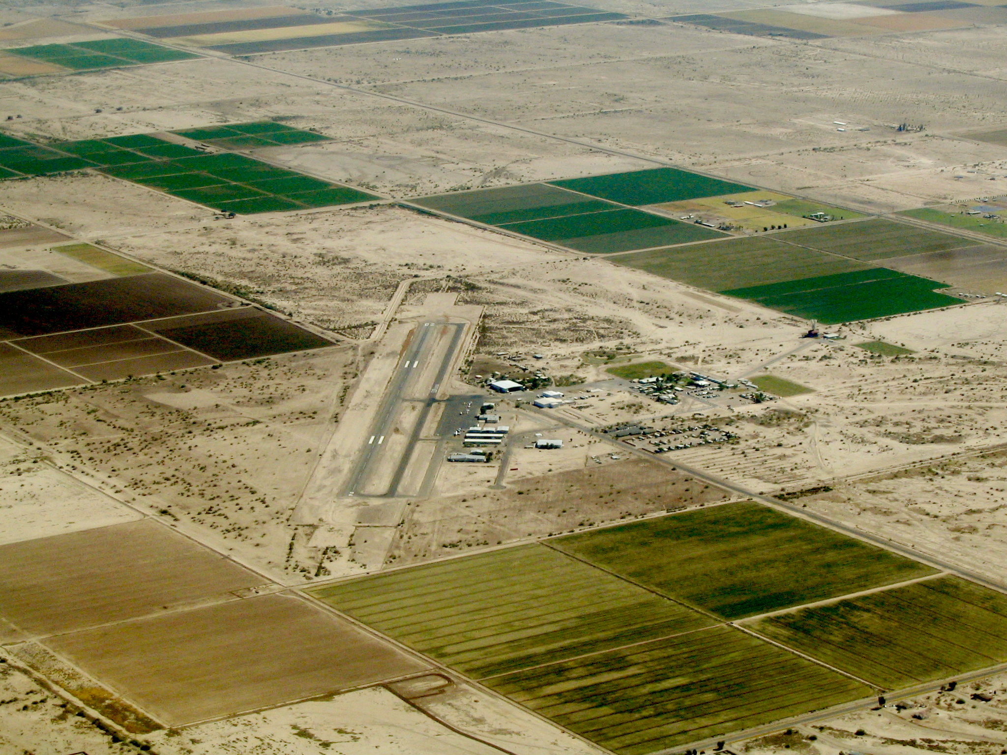
| Aerial view of airport from the west |
| IATA: CGZ – ICAO: KCGZ – FAA LID: CGZ |
| Summary |
| Airport type |
Public |
| Owner |
City of Casa Grande |
| Serves |
Casa Grande, Arizona |
| Elevation AMSL |
1,464 ft / 446 m |
| Coordinates |
32°57′18″N 111°46′01″W / 32.955°N 111.76694°W / 32.955; -111.76694 |
| Website |
CasaGrandeAZ.gov/... |
| Runways |
| Direction |
Length |
Surface |
| ft |
m |
| 5/23 |
5,200 |
1,585 |
Asphalt |
| Statistics (2009) |
| Aircraft operations |
119,680 |
| Based aircraft |
77 |
| Source: Federal Aviation Administration |
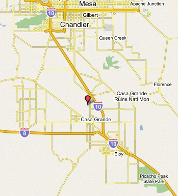
Casa Grande Municipal Airport (IATA: CGZ, ICAO: KCGZ, FAA LID: CGZ) is a city-owned public-use airport located five nautical miles (9 km) north of the central business district of Casa Grande, a city in Pinal County, Arizona, United States. The airport is included in the FAA's National Plan of Integrated Airport Systems for 2009–2013, which categorizes it as a general aviation facility. The airport is not served by any commercial airlines at this time.
Facilities and aircraft
Casa Grande Municipal Airport covers an area of 640 acres (259 ha) at an elevation of 1,464 feet (446 m) above mean sea level. It has one runway designated 5/23 with an asphalt surface measuring 5,200 by 100 feet (1,585 x 30 m).
For the 12-month period ending March 31, 2009, the airport had 119,680 aircraft operations, an average of 327 per day: 98% general aviation, 2% air taxi, and <1% military. At that time there were 77 aircraft based at this airport: 80% single-engine, 4% multi-engine, 3% helicopter and 13% ultralight.
The above content comes from Wikipedia and is published under free licenses – click here to read more.
The
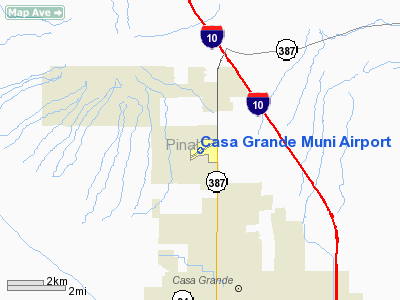
Casa Grande Municipal Airport is located north of the city of Casa
Grande, Arizona, south and west of Interstate 10 and west of Arizona Highway
387. The airport is owned and operated by the City of Casa Grande and occupies
approximately 300 acres.
The
existing facilities include a paved runway (05-23), three major taxiways,
apron and tiedown areas, hangers, a lighted wind sock, segmented circle,
and rotating beacon. Runway 05-23 has a Medium Intensity Runway Lighting
System (MIRL) with precision instrument markings for Runway 05 and basic
markings on Runway 23. Approach aids include a Visual approach Slope
Indicator (VASI), Runway End Identifier Lights (REILS), threshold lights,
and a Category I Instrument Landing system (ILS). Two published instrument
approaches into the Airport can be executed. The approaches to runway
5 consist of a VOR/GPS approach or an ILS/DME approach.
Communications/Navigation
CTAF/UNICOM:122.7
WX/AWOS-3:132.175 (520)836-3392
VOR:TFD 114.80
APCH/DEP: ABQ ARTCC 125.4/269.3
Airport: (520)426-3616
The
existing Runway 05-23 is 5,200 feet in length and 100 feet wide. Beginning
at the Runway 5 threshold, the runway slopes uphill from an elevation
of 1445 to an elevation of 1462 at the runway 23 threshold.
This location is
the high point of the runway
Pavement
The
Runway has an asphaltic concrete surface, comprised of a 5 inch thick
asphalt surface course over 8 inches of crushed base course. The existing
pavement is rated at 18,500 lb. Single wheel loading and 65,000 lb.
dual wheel loading.
Runway Protection Zones (RPZ)
 Other
important items relating to the runways at the Airport include the Runway
Protection Zones (RPZ), and the approach surfaces. The RPZ is defined
as an area off the runway end used to enhance the protection of people
and property on the ground. The RPZ is trapezoidal in shape and centered
about the extended runway centerline. The existing Runway 5 RPZ lies
within airport property boundaries and the Runway 23 RPZ extends beyond
airport property. However aviation easements protect the areas beyond
the property limits. Arizona
Highway 387 lies within the runway 23 RPZ. Other
important items relating to the runways at the Airport include the Runway
Protection Zones (RPZ), and the approach surfaces. The RPZ is defined
as an area off the runway end used to enhance the protection of people
and property on the ground. The RPZ is trapezoidal in shape and centered
about the extended runway centerline. The existing Runway 5 RPZ lies
within airport property boundaries and the Runway 23 RPZ extends beyond
airport property. However aviation easements protect the areas beyond
the property limits. Arizona
Highway 387 lies within the runway 23 RPZ.
Approaches
At
the Casa Grande Airport, a 50:1 precision instrument approach surface
is the primary approach to Runway 5. The approach minimums are published
at 285' height above touchdown (HAT) with a �
mile visibility. The best approach minimums available for a Category
* (CAT I) Instrument Landing System (ILS) are 200' HAT and �
mile visibility.
The current approach for Runway 5 has several obstructions such as trees,
shrubs and fences.
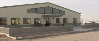
Hangars
The
City of Casa Grande maintains and rents out 52 T-hangars, 18 shade-hangars,
50 tie-downs, a commercial hangar, and a flight school building. In
addition, the City has leased land out to four private hangars.
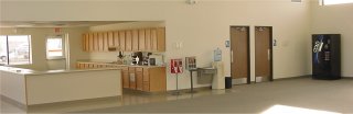
The
terminal building was built in 2001 with 4,800 square feet. It contains
offices, restrooms, showers, a pilot briefing and flight planning area,
conference room and a fuel service desk.
Access
 Pinal
Avenue/State Highway 387 provides access to the airport. An access road
leads directly to the terminal building and the FBO facility. Pinal
Avenue/State Highway 387 provides access to the airport. An access road
leads directly to the terminal building and the FBO facility.
There are 60 auto parking spots available to terminal users, FBO patrons,
and occupants of the shade hangars.
Airport
Meteorological Data
Casa
Grande has an AWOS-3 system to provide local weather information.
It can be accessed
on 132.175 or by calling (520)836-3392.
Location
& QuickFacts
| FAA Information Effective: |
2005-10-27 |
| Airport Identifier: |
CGZ |
| Longitude/Latitude: |
111-46-00.6000W/32-57-17.6000N
-111.766833/32.954889 (Estimated) |
| Elevation: |
1464
ft / 446.23 m (Surveyed) |
| Land: |
640
acres |
| From nearest city: |
4
nautical miles N of Casa Grande, AZ |
| Location: |
Pinal
County, AZ |
| Magnetic Variation: |
12E
(2000) |
Owner
& Manager
| Ownership: |
Publicly
owned |
| Owner: |
City
Of Casa Grande |
| Address: |
City
Hall, 510 E. Florence Blvd
Casa Grande, AZ 85222 |
| Phone number: |
520-421-8625 |
| Manager: |
A.j.
Blaha |
| Address: |
City
Of Casa Grande, 510 E. Florence Blvd
Casa Grande, AZ 85222 |
| Phone number: |
520-421-8625 |
Airport
Operations and Facilities
| Airport Use: |
Open
to public |
| Wind indicator: |
Yes |
| Segmented Circle: |
Yes |
| Control Tower: |
No |
| Attendance Schedule: |
ALL/ALL/0730-1730 |
| Lighting Schedule: |
DUSK-DAWN
ACTVT MALSR RY 05 - CTAF. |
| Beacon Color: |
Clear-Green
(lighted land airport) |
| Landing fee charge: |
No |
| Sectional chart: |
Phoenix |
| Region: |
AWP
- Western-Pacific |
| Traffic Pattern Alt: |
1038
ft |
| Boundary ARTCC: |
ZAB
- Albuquerque |
| Tie-in FSS: |
PRC
- Prescott |
| FSS on Airport: |
No |
| FSS Phone: |
928-778-7810 |
| FSS Toll Free: |
1-800-WX-BRIEF |
| NOTAMs Facility: |
CGZ
(NOTAM-d service avaliable) |
| Federal Agreements: |
NGPY |
Airport
Communications
| CTAF: |
122.700 |
| Unicom: |
122.700
|
Airport
Services
| Fuel available: |
100LLA |
| Airframe Repair: |
MAJOR |
| Power Plant Repair: |
MAJOR |
| Bottled Oxygen: |
NONE |
| Bulk Oxygen: |
NONE |
Runway
Information
Runway
05/23
| Dimension: |
5200
x 100 ft / 1585.0 x 30.5 m |
| Surface: |
ASPH,
Good Condition |
| Weight Limit: |
Single
wheel: 18500 lbs.
Dual wheel: 65000 lbs. |
| Edge Lights: |
Medium |
| |
Runway
05 |
Runway
23 |
| Longitude: |
111-46-26.9497W |
111-45-34.1498W |
| Latitude: |
32-57-04.7376N |
32-57-30.5264N |
| Elevation: |
1447.00
ft |
1464.00
ft |
| Alignment: |
60 |
127 |
| ILS Type: |
ILS |
|
| Traffic Pattern: |
Left |
Right |
| Markings: |
Precision
instrument, Fair Condition |
Basic,
Fair Condition |
| Crossing Height: |
41.00
ft |
38.00
ft |
| VASI: |
2-box
on right side |
2-box
on left side |
| Visual Glide Angle: |
3.00� |
3.00� |
| Approach lights: |
MALSR |
|
| Runway End Identifier: |
No |
No |
| Centerline Lights: |
No |
No |
| Touchdown Lights: |
No |
No |
| Obstruction: |
10
ft road, 200.0 ft from runway, 110 ft left of centerline
10 FT ROAD 0 FT FM RY END 130 FT L. |
10
ft road, 200.0 ft from runway, 125 ft right of centerline
10 FT ROAD 0 FT FM RY END 100 FT R. |
|
Radio
Navigation Aids
| ID |
Type |
Name |
Ch |
Freq |
Var |
Dist |
| CHD |
NDB |
Chandler |
|
407.00 |
12E |
18.8
nm |
| FFZ |
NDB |
Falcon
Field |
|
281.00 |
12E |
30.5
nm |
| SDL |
NDB |
Scottsdale |
|
224.00 |
12E |
41.1
nm |
| AVQ |
NDB |
Marana |
|
245.00 |
12E |
42.9
nm |
| LUF |
TACAN |
Luke |
077X |
|
13E |
46.7
nm |
| TFD |
VORTAC |
Stanfield |
095X |
114.80 |
12E |
8.3
nm |
| IWA |
VORTAC |
Willie |
080X |
113.30 |
13E |
21.7
nm |
| PXR |
VORTAC |
Phoenix |
103X |
115.60 |
12E |
30.5
nm |
| GBN |
VORTAC |
Gila
Bend |
113X |
116.60 |
14E |
45.8
nm |
| PHX |
VOT |
Phoenix
Sky Harbor |
|
109.00 |
|
31.3
nm |
Remarks
- ARPT
FQTLY USED FOR PRACTICE INST APCHS BY TSNT ACFT.
- SVC
ROAD WITHIN PRIMARY SFC.
- HOLDLINES
ON ALL TWYS CONNECTING TO THE RY ARE SET AT 280FT FM RY CL
- ACFT
TAXIING ON TWY B BE ALERT TO PASSING ACFT HOLDING ON THE CONNECTING
TWYS.
Address: Pinal County, AZ
Tel:
520-421-8625
URL: http://www.ci.casa-grande.az.us/airport/airport.php
Images and information placed above are from
http://www.airport-data.com/airport/CGZ/
http://www.lat-long.com/Arizona/Casa-Grande-Municipal-Airport_45323.html
http://www.ci.casa-grande.az.us/airport/airport.php
We thank them for the data!
| General Info
|
| Country |
United States
|
| State |
ARIZONA
|
| FAA ID |
CGZ
|
| Latitude |
32-57-17.600N
|
| Longitude |
111-46-00.600W
|
| Elevation |
1464 feet
|
| Near City |
CASA GRANDE
|
We don't guarantee the information is fresh and accurate. The data may be wrong or outdated.
For more up-to-date information please refer to other sources.
|
|