Location
& QuickFacts
| FAA Information Effective: |
2005-10-27 |
| Airport Identifier: |
AZ19 |
| Longitude/Latitude: |
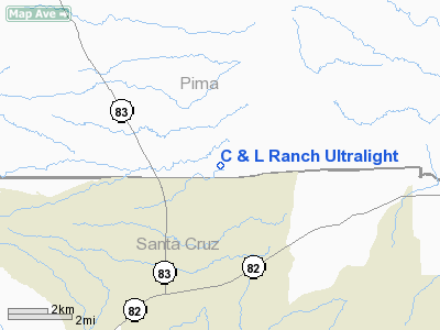
110-37-35.0000W/31-44-16.0000N
-110.626389/31.737778 (Estimated) |
| Elevation: |
4600
ft / 1402.08 m (Estimated) |
| Land: |
10
acres |
| From nearest city: |
5
nautical miles NE of Sonoita, AZ |
| Location: |
Pima
County, AZ |
| Magnetic Variation: |
12E
(1990) |
Owner
& Manager
| Ownership: |
Privately
owned |
| Owner: |
Louis
Boisvert |
| Address: |
1834
S Sleepy Hallow Ave
Tuscon, AZ 85710 |
| Phone number: |
602-885-5770 |
| Manager: |
Louis
Boisvert |
| Address: |
1834
S Sleepy Hallow Ave
Tuscon, AZ 85710 |
| Phone number: |
602-885-5770 |
Airport
Operations and Facilities
|
Airport Use: |
Private |
| Wind indicator: |
Yes |
| Segmented Circle: |
No |
| Control Tower: |
No |
| Attendance Schedule: |
UNATNDD |
| Sectional chart: |
Phoenix |
| Region: |
AWP
- Western-Pacific |
| Boundary ARTCC: |
ZAB
- Albuquerque |
| Tie-in FSS: |
PRC
- Prescott |
| FSS on Airport: |
No |
| FSS Phone: |
928-778-7810 |
| FSS Toll Free: |
1-800-WX-BRIEF |
Runway
Information
Runway
02/20
|
Dimension: |
750
x 250 ft / 228.6 x 76.2 m |
| Surface: |
TURF,
|
| |
Runway
02 |
Runway
20 |
| Traffic Pattern: |
Left |
Left |
|
Radio
Navigation Aids
| ID |
Type |
Name |
Ch |
Freq |
Var |
Dist |
| DAO |
NDB |
Dragoo |
|
410.00 |
13E |
17.1
nm |
| ENZ |
NDB |
Nogales |
|
394.00 |
12E |
22.1
nm |
| NOG |
NDB |
Nogales |
|
265.00 |
13E |
36.3
nm |
| RYN |
NDB |
Ryan |
|
338.00 |
12E |
36.4
nm |
| RBJ |
NDB |
Robles |
|
220.00 |
12E |
42.6
nm |
| ARH |
TACAN |
Fort
Huachuca |
053X |
|
12E |
17.3
nm |
| DMA |
TACAN |
Davis
Monthan |
123X |
|
12E |
28.5
nm |
| FHU |
VOR |
Libby |
|
113.60 |
13E |
16.5
nm |
| OLS |
VOR/DME |
Nogales |
019X |
108.20 |
12E |
22.5
nm |
| TUS |
VORTAC |
Tucson |
107X |
116.00 |
12E |
26.0
nm |
| CIE |
VORTAC |
Cochise |
105X |
115.80 |
13E |
47.7
nm |
Remarks
- VFR;
PRIVATE USE; OPNS REMAIN CLEAR OF R-2303B.
Address: Pima County, AZ
Tel:
602-885-5770
Images and information placed above are from
http://www.airport-data.com/airport/AZ19/
We thank them for the data!
| General Info
|
| Country |
United States
|
| State |
ARIZONA
|
| FAA ID |
AZ19
|
| Latitude |
31-44-16.000N
|
| Longitude |
110-37-35.000W
|
| Elevation |
4600 feet
|
| Near City |
SONOITA
|
We don't guarantee the information is fresh and accurate. The data may be wrong or outdated.
For more up-to-date information please refer to other sources.