 |
|
|
|
|
|
Location
& QuickFacts
| FAA Information Effective: |
2005-10-27 |
| Airport Identifier: |
40AZ |
| Longitude/Latitude: |
112-07-44.5200W/33-04-44.1780N
-112.129033/33.078938 (Estimated) |
| Elevation: |
1240
ft / 377.95 m (Estimated) |
| Land: |
0
acres |
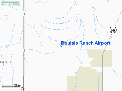
| From nearest city: |
3
nautical miles W of Maricopa, AZ |
| Location: |
Pinal
County, AZ |
| Magnetic Variation: |
13E
(1985) |
Owner
& Manager
| Ownership: |
Privately
owned |
| Owner: |
Stageline
Ranches Inc |
| Address: |
5346
N 91st Ave
Glendale, AZ 85305 |
| Phone number: |
602-247-8222 |
| Manager: |
Richard
A. Boulais |
| Address: |
5346
N 91st Ave
Glendale, AZ 85305 |
| Phone number: |
602-247-8222 |
Airport
Operations and Facilities
| Airport Use: |
Private |
| Wind indicator: |
No |
| Segmented Circle: |
No |
| Control Tower: |
No |
| Attendance Schedule: |
UNATNDD |
| Landing fee charge: |
No |
| Sectional chart: |
Phoenix |
| Region: |
AWP
- Western-Pacific |
| Boundary ARTCC: |
ZAB
- Albuquerque |
| Tie-in FSS: |
PRC
- Prescott |
| FSS on Airport: |
No |
| FSS Phone: |
928-778-7810 |
| FSS Toll Free: |
1-800-WX-BRIEF |
Airport
Services
| Airframe Repair: |
NONE |
| Power Plant Repair: |
NONE |
Runway
Information
Runway
08/26
| Dimension: |
2000
x 75 ft / 609.6 x 22.9 m
<1000' OVRN ON E END RWY 08/26. |
| Surface: |
DIRT,
|
| |
Runway
08 |
Runway
26 |
| Traffic Pattern: |
Left |
Left |
|
Radio
Navigation Aids
| ID |
Type |
Name |
Ch |
Freq |
Var |
Dist |
| CHD |
NDB |
Chandler |
|
407.00 |
12E |
19.7
nm |
| FFZ |
NDB |
Falcon
Field |
|
281.00 |
12E |
30.4
nm |
| SDL |
NDB |
Scottsdale |
|
224.00 |
12E |
34.9
nm |
| LUF |
TACAN |
Luke |
077X |
|
13E |
30.3
nm |
| TFD |
VORTAC |
Stanfield |
095X |
114.80 |
12E |
16.1
nm |
| PXR |
VORTAC |
Phoenix |
103X |
115.60 |
12E |
22.7
nm |
| IWA |
VORTAC |
Willie |
080X |
113.30 |
13E |
27.5
nm |
| GBN |
VORTAC |
Gila
Bend |
113X |
116.60 |
14E |
28.5
nm |
| BXK |
VORTAC |
Buckeye |
043X |
110.60 |
14E |
41.6
nm |
| PHX |
VOT |
Phoenix
Sky Harbor |
|
109.00 |
|
22.3
nm |
Remarks
Address: Pinal County, AZ
Tel:
602-247-8222
Images and information placed above are from
http://www.airport-data.com/airport/40AZ/
We thank them for the data!
| General Info
|
| Country |
United States
|
| State |
ARIZONA
|
| FAA ID |
40AZ
|
| Latitude |
33-04-44.178N
|
| Longitude |
112-07-44.520W
|
| Elevation |
1240 feet
|
| Near City |
MARICOPA
|
We don't guarantee the information is fresh and accurate. The data may be wrong or outdated.
For more up-to-date information please refer to other sources.
|
|


