 |
|
Black Canyon City Medical Center Heliport |
|
|
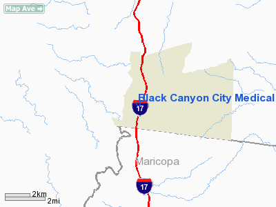
Location
& QuickFacts
| FAA Information Effective: |
2005-10-27 |
| Airport Identifier: |
AZ68 |
| Longitude/Latitude: |
112-08-45.5730W/34-03-50.1200N
-112.145992/34.063922 (Estimated) |
| Elevation: |
2040
ft / 621.79 m (Estimated) |
| Land: |
0
acres |
| From nearest city: |
0
nautical miles N of Black Canyon City, AZ |
| Location: |
Yavapai
County, AZ |
| Magnetic Variation: |
13E
(1985) |
Owner
& Manager
| Ownership: |
Privately
owned |
| Owner: |
Black
Canyon Cty Com Assn Inc |
| Address: |
Po
Box 33
Black Canyon City, AZ 85324 |
| Phone number: |
602-374-9913 |
| Manager: |
President |
| Address: |
Po
Box 33
Black Canyon City, AZ 85324 |
| Phone number: |
602-374-5473 |
Airport
Operations and Facilities
| Airport Use: |
Private
MEDICAL. |
| Wind indicator: |
Yes |
| Segmented Circle: |
No |
| Control Tower: |
No |
| Attendance Schedule: |
UNATNDD |
| Landing fee charge: |
No |
| Sectional chart: |
Phoenix |
| Region: |
AWP
- Western-Pacific |
| Boundary ARTCC: |
ZAB
- Albuquerque |
| Tie-in FSS: |
PRC
- Prescott |
| FSS on Airport: |
No |
| FSS Phone: |
928-778-7810 |
| FSS Toll Free: |
1-800-WX-BRIEF |
Runway
Information
Helipad
H1
| Dimension: |
40
x 40 ft / 12.2 x 12.2 m |
| Surface: |
CONC,
|
| |
Runway
H1 |
Runway
|
| Traffic Pattern: |
Left |
Left |
|
Radio
Navigation Aids
| ID |
Type |
Name |
Ch |
Freq |
Var |
Dist |
| SDL |
NDB |
Scottsdale |
|
224.00 |
12E |
28.7
nm |
| FFZ |
NDB |
Falcon
Field |
|
281.00 |
12E |
41.7
nm |
| LUF |
TACAN |
Luke |
077X |
|
13E |
33.7
nm |
| PXR |
VORTAC |
Phoenix |
103X |
115.60 |
12E |
38.9
nm |
| DRK |
VORTAC |
Drake |
088X |
114.10 |
14E |
41.8
nm |
| BXK |
VORTAC |
Buckeye |
043X |
110.60 |
14E |
50.0
nm |
| PRC |
VOT |
Prescott |
|
110.00 |
|
37.9
nm |
| PHX |
VOT |
Phoenix
Sky Harbor |
|
109.00 |
|
38.4
nm |
Remarks
Address: Yavapai County, AZ
Tel:
602-374-5473
Images and information placed above are from
http://www.airport-data.com/airport/AZ68/
We thank them for the data!
| General Info
|
| Country |
United States
|
| State |
ARIZONA
|
| FAA ID |
AZ68
|
| Latitude |
34-03-50.120N
|
| Longitude |
112-08-45.573W
|
| Elevation |
2040 feet
|
| Near City |
BLACK CANYON CITY
|
We don't guarantee the information is fresh and accurate. The data may be wrong or outdated.
For more up-to-date information please refer to other sources.
|
|


