 |
|
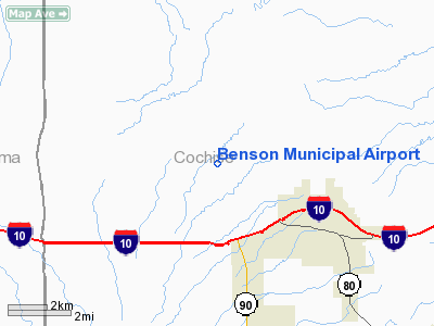
| Benson Municipal Airport |
| IATA: none – ICAO: none – FAA LID: E95 |
| Summary |
| Airport type |
Public |
| Owner |
City of Benson |
| Serves |
Benson, Arizona |
| Elevation AMSL |
3,829 ft / 1,167 m |
| Coordinates |
31°59′59″N 110°21′28″W / 31.99972°N 110.35778°W / 31.99972; -110.35778 |
| Website |
http://www.swernaviation.com/ |
| Runways |
| Direction |
Length |
Surface |
| ft |
m |
| 10/28 |
4,000 |
1,807 |
Asphalt |
| Statistics (2008) |
| Aircraft operations |
10000 |
| Based aircraft |
40 |
| Source: Federal Aviation Administration |
Benson Municipal Airport, Arizona (E95) The airport is located about 3 miles NW of the city of Benson, Arizona, and 30 miles East or Tucson International Airport (TUS) The airport was opened in November 1999. Runways
Runways: 10 & 28
Runway length: 4000 feet
Runway width: 75 feet
Frequencies
UNICOM freq.: 122.8
AWOS freq.: 118.475
Facilities and aircraft
100LL & Jet-A Fuel
Attended 24 x 7
Courtesy Cars
Maintenance
Pilot Lounge (with free WiFi)
Aircraft Rental
Flight Training
Full service FBO: SouthWestern Aviation, LLC
Pilot Supplies
Tie-downs and Hangars (From $25/month!).
The above content comes from Wikipedia and is published under free licenses – click here to read more.
Location
& QuickFacts
| FAA Information Effective: |
2005-10-27 |
| Airport Identifier: |
E95 |
| Longitude/Latitude: |
110-21-26.0000W/31-59-59.0000N
-110.357222/31.999722 (Estimated) |
| Elevation: |
3829
ft / 1167.08 m (Estimated) |
| Land: |
0
acres |
| From nearest city: |
3
nautical miles NW of Benson, AZ |
| Location: |
Cochise
County, AZ |
| Magnetic Variation: |
12E
(1995) |
Owner
& Manager
| Ownership: |
Publicly
owned |
| Owner: |
City
Of Benson |
| Address: |
160
South Huachuca
Benson, AZ 85602 |
| Phone number: |
520-586-2245 |
| Manager: |
Boyd
Kraemer |
| Address: |
160
South Huachuca
Benson, AZ 85602 |
| Phone number: |
520-586-8834 |
Airport
Operations and Facilities
| Airport Use: |
Open
to public |
| Wind indicator: |
Yes |
| Segmented Circle: |
Yes |
| Control Tower: |
No |
| Attendance Schedule: |
ALL/ALL/ALL |
| Lighting Schedule: |
DUSK-DAWN
ACTVT MIRL RY 10/28 PAPI RYS 10 & 28 - 122.8. |
| Beacon Color: |
Clear-Green
(lighted land airport) |
| Sectional chart: |
Phoenix |
| Region: |
AWP
- Western-Pacific |
| Boundary ARTCC: |
ZAB
- Albuquerque |
| Tie-in FSS: |
PRC
- Prescott |
| FSS Phone: |
928-778-7810 |
| FSS Toll Free: |
1-800-WX-BRIEF |
| NOTAMs Facility: |
PRC |
| Federal Agreements: |
NGY |
Airport
Communications
| CTAF: |
122.800 |
| Unicom: |
122.800
|
Airport
Services
Runway
Information
Runway
10/28
| Dimension: |
4000
x 75 ft / 1219.2 x 22.9 m |
| Surface: |
ASPH,
|
| Weight Limit: |
Single
wheel: 12500 lbs. |
| Edge Lights: |
Medium |
| |
Runway
10 |
Runway
28 |
| Traffic Pattern: |
Left |
Left |
| Markings: |
Basic,
Good Condition |
Basic,
Good Condition |
| Crossing Height: |
40.00
ft |
40.00
ft |
| VASI: |
2-light
PAPI on left side |
2-light
PAPI on left side |
| Visual Glide Angle: |
3.00� |
3.00� |
| Runway End Identifier: |
Yes |
Yes |
|
Radio
Navigation Aids
| ID |
Type |
Name |
Ch |
Freq |
Var |
Dist |
| DAO |
NDB |
Dragoo |
|
410.00 |
13E |
24.9
nm |
| RYN |
NDB |
Ryan |
|
338.00 |
12E |
41.8
nm |
| ENZ |
NDB |
Nogales |
|
394.00 |
12E |
42.8
nm |
| ARH |
TACAN |
Fort
Huachuca |
053X |
|
12E |
24.9
nm |
| DMA |
TACAN |
Davis
Monthan |
123X |
|
12E |
28.4
nm |
| FHU |
VOR |
Libby |
|
113.60 |
13E |
24.6
nm |
| OLS |
VOR/DME |
Nogales |
019X |
108.20 |
12E |
43.2
nm |
| TUS |
VORTAC |
Tucson |
107X |
116.00 |
12E |
29.0
nm |
| CIE |
VORTAC |
Cochise |
105X |
115.80 |
13E |
30.6
nm |
| DUG |
VORTAC |
Douglas |
025X |
108.80 |
13E |
49.9
nm |
Remarks
Address: Cochise County, AZ
Tel:
520-586-8834
Images and information placed above are from
http://www.airport-data.com/airport/E95/
We thank them for the data!
| General Info
|
| Country |
United States
|
| State |
ARIZONA
|
| FAA ID |
E95
|
| Latitude |
31-59-59.000N
|
| Longitude |
110-21-26.000W
|
| Elevation |
3829 feet
|
| Near City |
BENSON
|
We don't guarantee the information is fresh and accurate. The data may be wrong or outdated.
For more up-to-date information please refer to other sources.
|
|


