 |
|
| Bagdad Airport |
| IATA: BGT – ICAO: none – FAA LID: E51 |
| Summary |
| Airport type |
Public |
| Owner |
Yavapai County |
| Serves |
Bagdad, Arizona |
| Elevation AMSL |
4,183 ft / 1,275 m |
| Coordinates |
34°35′45″N 113°10′13″W / 34.59583°N 113.17028°W / 34.59583; -113.17028 |
| Runways |
| Direction |
Length |
Surface |
| ft |
m |
| 5/23 |
4,575 |
1,394 |
Asphalt |
| Statistics (2007) |
| Aircraft operations |
1,000 |
| Source: Federal Aviation Administration |
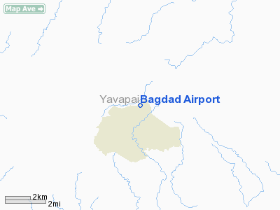
Bagdad Airport (IATA: BGT, FAA LID: E51) is a county-owned public-use airport located two nautical miles (4 km) northeast of the central business district of Bagdad, in Yavapai County, Arizona, United States.
Facilities and aircraft
Bagdad Airport covers an area of 91 acres (37 ha) at an elevation of 4,183 feet (1,275 m) above mean sea level. It has one runway designated 5/23 with a 4,575 by 60 ft (1,394 x 18 m) asphalt surface. For the 12-month period ending May 3, 2007, the airport had 1,000 aircraft operations, an average of 83 per month, all of which were general aviation.
The above content comes from Wikipedia and is published under free licenses – click here to read more.
Location
& QuickFacts
| FAA Information Effective: |
2005-10-27 |
| Airport Identifier: |
E51 |
| Longitude/Latitude: |
113-10-12.7020W/34-35-45.0700N
-113.170195/34.595853 (Estimated) |
| Elevation: |
4183
ft / 1274.98 m (Surveyed) |
| Land: |
91
acres |
| From nearest city: |
2
nautical miles NE of Bagdad, AZ |
| Location: |
Yavapai
County, AZ |
| Magnetic Variation: |
13E
(1985) |
Owner
& Manager
| Ownership: |
Publicly
owned |
| Owner: |
Yavapai
County
CONTACT MR. GAY HENDON, GRANTS ADMINSTRATOR. |
| Address: |
1100
Commerce St
Prescott, AZ 86301 |
| Phone number: |
928-771-3183 |
| Manager: |
Richard
Straub |
| Address: |
1100
Commerce St, 1100 Commerce St
Prescott, AZ 86301 |
| Phone number: |
928-771-3183
NIGHTS CALL BOB MANIFEE, 928-663-2521. |
Airport
Operations and Facilities
| Airport Use: |
Open
to public |
| Wind indicator: |
Yes |
| Segmented Circle: |
No |
| Control Tower: |
No |
| Attendance Schedule: |
UNATNDD |
| Lighting Schedule: |
DUSK-DAWN
ROTG BCN OTS INDEFLY. |
| Beacon Color: |
Clear-Green
(lighted land airport) |
| Landing fee charge: |
No |
| Sectional chart: |
Phoenix |
| Region: |
AWP
- Western-Pacific |
| Boundary ARTCC: |
ZAB
- Albuquerque |
| Tie-in FSS: |
PRC
- Prescott |
| FSS on Airport: |
No |
| FSS Phone: |
928-778-7810 |
| FSS Toll Free: |
1-800-WX-BRIEF |
| NOTAMs Facility: |
PRC
(NOTAM-d service avaliable) |
| Federal Agreements: |
NGY |
Airport
Communications
Airport
Services
| Airframe Repair: |
MAJOR |
| Power Plant Repair: |
MAJOR |
| Bottled Oxygen: |
NONE |
| Bulk Oxygen: |
NONE |
Runway
Information Runway
05/23
| Dimension: |
4575
x 60 ft / 1394.5 x 18.3 m |
| Surface: |
ASPH,
Good Condition |
| Weight Limit: |
Single
wheel: 4000 lbs. |
| |
Runway
05 |
Runway
23 |
| Elevation: |
4136.00
ft |
0.00
ft |
| Traffic Pattern: |
Left |
Left |
| Markings: |
Basic,
Poor Condition
& RY 23 MARKINGS FADED. |
Basic,
Poor Condition |
| Runway End Identifier: |
No |
No |
| Centerline Lights: |
No |
No |
| Touchdown Lights: |
No |
No |
| Obstruction: |
,
50:1 slope to clear |
85
ft gnd, 3000.0 ft from runway, 250 ft left of centerline,
32:1 slope to clear
RY 23 APCH END 3 FT BUSHES 72 FT FM EOR AND 10 FT RIGHT
OF RWY CENTER. |
|
Radio
Navigation Aids
| ID |
Type |
Name |
Ch |
Freq |
Var |
Dist |
| DRK |
VORTAC |
Drake |
088X |
114.10 |
14E |
34.7
nm |
| PRC |
VOT |
Prescott |
|
110.00 |
|
37.2
nm |
Remarks
- BE
ALERT DEER ON RY.
- UNUSUAL
AIR CURRENTS INVOF APRT; ESPECIALLY APCH END RY 23.
- MTNS
E; NE; NW PROJECT ABV PART 77 CONICAL SFDC.
- ROW
OF BUSHES 6-10 FT HIGH ALONG SE SIDE OF RY 05/23.
- 7
FT FUEL TANK 500 FT SW OF RY 23 AND 129 FT RIGHT OF RY CNTRLN.
Address: Yavapai County, AZ
Phone: 928-771-3183
Images and information placed above are from
http://www.airport-data.com/airport/E51/
We thank them for the data!
| General Info
|
| Country |
United States
|
| State |
ARIZONA
|
| FAA ID |
E51
|
| Latitude |
34-35-45.070N
|
| Longitude |
113-10-12.702W
|
| Elevation |
4183 feet
|
| Near City |
BAGDAD
|
We don't guarantee the information is fresh and accurate. The data may be wrong or outdated.
For more up-to-date information please refer to other sources.
|
|


