 |
|
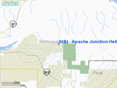
At&t - Apache Junction Heliport |
|
|
Location
& QuickFacts
| FAA Information Effective: |
2005-10-27 |
| Airport Identifier: |
63AZ |
| Longitude/Latitude: |
111-38-28.4930W/33-29-39.1640N
-111.641248/33.494212 (Estimated) |
| Elevation: |
2527
ft / 770.23 m (Estimated) |
| Land: |
0
acres |
| From nearest city: |
9
nautical miles NE of Mesa, AZ |
| Location: |
Maricopa
County, AZ |
| Magnetic Variation: |
13E
(1985) |
Owner
& Manager
| Ownership: |
Privately
owned |
| Owner: |
At&t
Co |
| Address: |
3950
N Usery Pass Rd
Mesa, AZ 85207 |
| Phone number: |
602-271-3693 |
| Manager: |
Pete
Funk |
| Address: |
3950
N Usery Pass Rd
Mesa, AZ 85207 |
| Phone number: |
602-271-3693 |
Airport
Operations and Facilities
| Airport Use: |
Private |
| Wind indicator: |
Yes |
| Segmented Circle: |
No |
| Control Tower: |
No |
| Attendance Schedule: |
ALL/MON-FRI/0800-1600 |
| Lighting Schedule: |
PHONE
REQ
FOR HELIPAD LIGHTS CALL 602-271-3693. |
| Landing fee charge: |
No |
| Sectional chart: |
Phoenix |
| Region: |
AWP
- Western-Pacific |
| Boundary ARTCC: |
ZAB
- Albuquerque |
| Tie-in FSS: |
PRC
- Prescott |
| FSS on Airport: |
No |
| FSS Phone: |
928-778-7810 |
| FSS Toll Free: |
1-800-WX-BRIEF |
Runway
Information Helipad
H1
| Dimension: |
60
x 45 ft / 18.3 x 13.7 m |
| Surface: |
ASPH,
|
| Edge Lights: |
High |
| |
Runway
H1 |
Runway
|
| Traffic Pattern: |
Left |
Left |
|
Radio
Navigation Aids
| ID |
Type |
Name |
Ch |
Freq |
Var |
Dist |
| FFZ |
NDB |
Falcon
Field |
|
281.00 |
12E |
5.0
nm |
| SDL |
NDB |
Scottsdale |
|
224.00 |
12E |
15.6
nm |
| CHD |
NDB |
Chandler |
|
407.00 |
12E |
16.0
nm |
| GAZ |
NDB |
Globe |
|
255.00 |
13E |
49.6
nm |
| LUF |
TACAN |
Luke |
077X |
|
13E |
37.1
nm |
| IWA |
VORTAC |
Willie |
080X |
113.30 |
13E |
11.5
nm |
| PXR |
VORTAC |
Phoenix |
103X |
115.60 |
12E |
16.9
nm |
| TFD |
VORTAC |
Stanfield |
095X |
114.80 |
12E |
39.0
nm |
| PHX |
VOT |
Phoenix
Sky Harbor |
|
109.00 |
|
18.7
nm |
Remarks
Address: Maricopa County, AZ
Phone: 602-271-3693
Images and information placed above are from
http://www.airport-data.com/airport/63AZ/
We thank them for the data!
| General Info
|
| Country |
United States
|
| State |
ARIZONA
|
| FAA ID |
63AZ
|
| Latitude |
33-29-39.164N
|
| Longitude |
111-38-28.493W
|
| Elevation |
2527 feet
|
| Near City |
MESA
|
We don't guarantee the information is fresh and accurate. The data may be wrong or outdated.
For more up-to-date information please refer to other sources.
|
|


